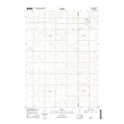
2015 Map of Dallas
USGS Topo · Published 2015About this map
Dallas serves as the primary settlement on this South Dakota landscape, positioned near the border of Tripp Co and Gregory Co. This 2015 survey illustrates a rural environment defined by a rigid section grid typical of the Great Plains, where north-south and east-west roads delineate agricultural tracts. Local history is anchored by the Hillview Cem, located just south of the town center, while natural drainage is provided by the winding path of Bull Cr. The map captures the enduring layout of this small community and its surrounding ranchlands well into the modern era.
Find a feature on this map
3 named features on this map. Tap any name to fly to it.
Don’t see what you’re looking for? This feature index may not catch every label — zoom into the map to look around manually.
Map Details
Editions of this 2015 Dallas Map
This is the sole edition of this map. No revisions or reprints were ever made.
Other maps of this area

1955 · Mitchell
USGS Topo · 1:250,000

1959 · Mitchell
USGS Topo · 1:250,000

1964 · Dallas SW
USGS Topo · 1:24,000

1964 · Gregory
USGS Topo · 1:24,000

1964 · Dallas
USGS Topo · 1:24,000

1964 · Paxton
USGS Topo · 1:24,000

1964 · Dallas NW
USGS Topo · 1:24,000
1964 · Carlock
USGS Topo · 1:24,000

1971 · Colome
USGS Topo · 1:24,000

1971 · Dixon SW
USGS Topo · 1:24,000