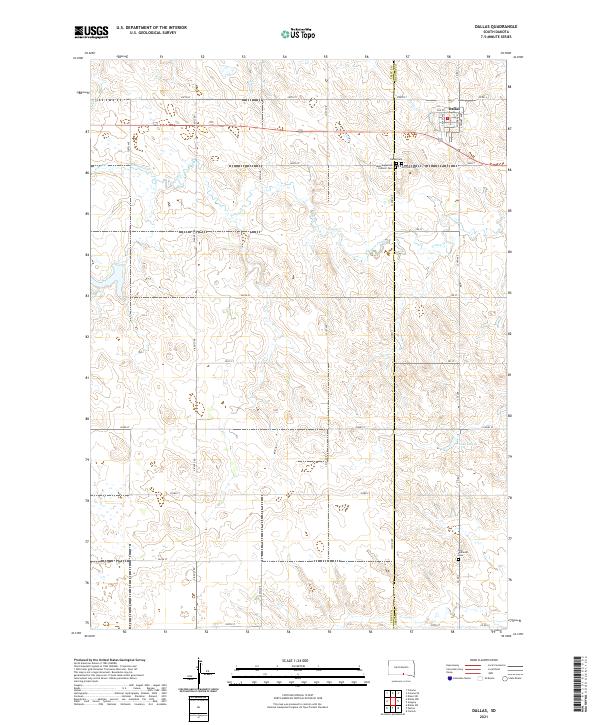
2021 Map of Dallas
USGS Topo · Published 2021About this map
Dallas sits on the eastern edge of the South Dakota plains, positioned just across the Tripp Co Gregory Co boundary. This high-plains landscape is defined by the winding course of Ponca Creek and the headwaters of Bull Cr, which carve gentle draws into the surrounding agricultural tablelands. The town's grid is small but distinct, featuring local thoroughfares like Casady Ave and Main St that once served as the commercial heart for area ranchers.
Find a feature on this map
44 named features on this map. Tap any name to fly to it.
Don’t see what you’re looking for? This feature index may not catch every label — zoom into the map to look around manually.
Map Details
Editions of this 2021 Dallas Map
This is the sole edition of this map. No revisions or reprints were ever made.
Other maps of this area

1955 · Mitchell
USGS Topo · 1:250,000

1959 · Mitchell
USGS Topo · 1:250,000

1964 · Dallas SW
USGS Topo · 1:24,000

1964 · Gregory
USGS Topo · 1:24,000

1964 · Dallas
USGS Topo · 1:24,000

1964 · Paxton
USGS Topo · 1:24,000

1964 · Dallas NW
USGS Topo · 1:24,000
1964 · Carlock
USGS Topo · 1:24,000

1971 · Colome
USGS Topo · 1:24,000

1971 · Dixon SW
USGS Topo · 1:24,000