
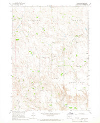
1964 Map of Dallas
USGS Topo · Published 1965About this map
Dallas serves as the primary hub in this mid-1960s landscape, situated where the Chicago and North Western railroad cuts across the northern edge of Gregory County. The township is characterized by a high density of rural schoolhouses, including Saathoff Sch, Barker Sch, and McKinzie Sch, which underscore the organized, section-based settlement patterns of the South Dakota prairie. The meandering path of Ponca Creek flows through the northern reaches, while Roosevelt Lake and Lake Dalton provide distinct water landmarks among the rolling terrain.
Find a feature on this map
20 named features on this map. Tap any name to fly to it.
Don’t see what you’re looking for? This feature index may not catch every label — zoom into the map to look around manually.
Map Details
Editions of this 1964 Dallas Map
This is the sole edition of this map. No revisions or reprints were ever made.
Other maps of this area

1955 · Mitchell
USGS Topo · 1:250,000

1959 · Mitchell
USGS Topo · 1:250,000

1964 · Dallas SW
USGS Topo · 1:24,000

1964 · Gregory
USGS Topo · 1:24,000

1964 · Paxton
USGS Topo · 1:24,000

1964 · Dallas NW
USGS Topo · 1:24,000
1964 · Carlock
USGS Topo · 1:24,000

1971 · Colome
USGS Topo · 1:24,000

1971 · Dixon SW
USGS Topo · 1:24,000

1971 · Colome SE
USGS Topo · 1:24,000