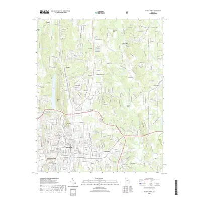
2020 Map of Dalton North
USGS Topo · Published 2020About this map
The Whitfield County Courthouse stands as a central landmark in the city of Dalton, anchoring a landscape where North Georgia's industrial growth meets the foothills of the Blue Ridge. This modern survey details the northern expansion of the city toward Varnell and Pleasant Grove, showing a dense network of suburban development intertwined with older rural legacies like Hiag Mill and the Fairground Sch. To the west, the steep rise of Hamilton Mtn and the boundaries of the Chattahoochee National Forest provide a sharp topographic contrast to the developed valley floors.
Find a feature on this map
324 named features on this map. Tap any name to fly to it.
Don’t see what you’re looking for? This feature index may not catch every label — zoom into the map to look around manually.
Map Details
Editions of this 2020 Dalton North Map
This is the sole edition of this map. No revisions or reprints were ever made.
Other maps of this area

1886 · Dalton
USGS Topo · 1:125,000

1886 · Ringgold
USGS Topo · 1:125,000

1892 · Ringgold
USGS Topo · 1:125,000

1892 · Dalton
USGS Topo · 1:125,000

1897 · Dalton
USGS Topo · 1:125,000
1935 · Tiger Creek
USGS Topo · 1:24,000

1935 · Villanow
USGS Topo · 1:24,000

1935 · Ringgold
USGS Topo · 1:24,000

1935 · Tunnel Hill
USGS Topo · 1:24,000

1938 · Chatsworth
USGS Topo · 1:48,000