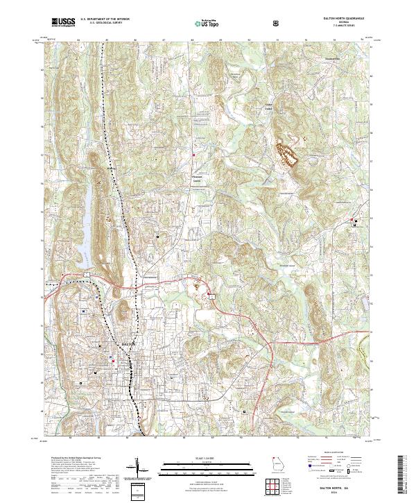
2024 Map of Dalton North
USGS Topo · Published 2024About this map
Dalton serves as the focal point of this North Georgia survey, where the urban grid of the city meets the rising terrain of the Ridge-and-Valley province. The city's civic core is centered at the Whitfield County Courthouse and Ft Hill, with older residential and commercial areas bounded by W Walnut Ave and the North Byp. Outside the city center, the landscape transitions into a mix of suburban development and rural heritage, marked by numerous small settlements like Waring and Pleasant Grove. Genealogists will find a high concentration of burial sites across the quadrangle, including the Old Presbyterian Cem, West Hill Cem, and Fairground Cem. Natural drainage is defined by the winding course of Coahulla Creek and Mill Creek, while the western edge of the map includes portions of the Chattahoochee National Forest.
Find a feature on this map
47 named features on this map. Tap any name to fly to it.
Don’t see what you’re looking for? This feature index may not catch every label — zoom into the map to look around manually.
Map Details
Editions of this 2024 Dalton North Map
This is the sole edition of this map. No revisions or reprints were ever made.
Other maps of this area

1886 · Dalton
USGS Topo · 1:125,000

1886 · Ringgold
USGS Topo · 1:125,000

1892 · Ringgold
USGS Topo · 1:125,000

1892 · Dalton
USGS Topo · 1:125,000

1897 · Dalton
USGS Topo · 1:125,000
1935 · Tiger Creek
USGS Topo · 1:24,000

1935 · Villanow
USGS Topo · 1:24,000

1935 · Ringgold
USGS Topo · 1:24,000

1935 · Tunnel Hill
USGS Topo · 1:24,000

1938 · Chatsworth
USGS Topo · 1:48,000