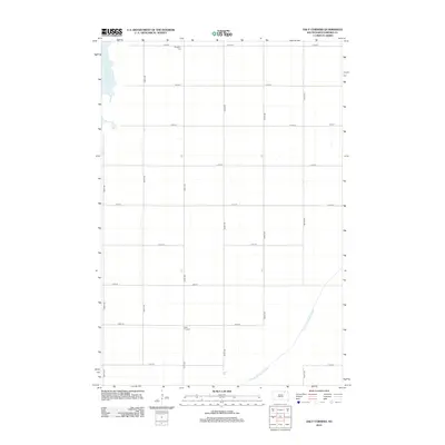
2012 Map of Daly Corners
USGS Topo · Published 2012About this map
Houghton Cem stands near the northern boundary of this Brown County landscape, a vital point for those tracing family history in the area around Daly Corners. The terrain is strictly partitioned by a grid of rural roads, including 399th Ave and 401st Ave, reflecting the systematic land division typical of the Dakotas. Water management is a central theme of this 2012 survey, with the Columbia Road Reservoir bordering the northwest and the engineered path of the Crow Creek Drainage Ditch cutting diagonally across the southeastern corner. This drainage network, including the various section roads like 113th St and 121st St, illustrates the long-standing efforts to stabilize and utilize this agricultural prairie for consistent production.
Find a feature on this map
19 named features on this map. Tap any name to fly to it.
Don’t see what you’re looking for? This feature index may not catch every label — zoom into the map to look around manually.
Map Details
Editions of this 2012 Daly Corners Map
This is the sole edition of this map. No revisions or reprints were ever made.
Other maps of this area

1894 · Hecla
USGS Topo · 1:62,500

1894 · Columbia
USGS Topo · 1:62,500

1894 · Savo
USGS Topo · 1:62,500

1896 · Columbia
USGS Topo · 1:125,000

1952 · Huffton
USGS Topo · 1:24,000

1952 · Columbia
USGS Topo · 1:24,000

1952 · Columbia NE
USGS Topo · 1:24,000

1952 · Putney
USGS Topo · 1:24,000

1953 · Hecla SE
USGS Topo · 1:24,000

1953 · Houghton
USGS Topo · 1:24,000