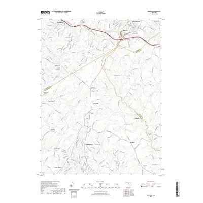
2019 Map of Damascus
USGS Topo · Published 2019About this map
Damascus sits at a multi-county crossroads where Frederick, Carroll, Howard, and Montgomery counties converge. This 2019 survey illustrates a landscape defined by historic ridge-top settlements and established transportation corridors like the Old National Pike. The area is notably dense with community institutions, including the Montgomery United Methodist Church Cem and Providence United Methodist Church Cem, which serve as vital landmarks for local family history. To the north, Mount Airy and Ridgeville anchor the Carroll County border, while the headwaters of the S Br Patapsco River, Patuxent River, and Great Seneca Cr begin their descent from these heights. The map captures the suburban character of Kings Valley and Cedar Heights alongside more rural enclaves such as Mullinix and Purdum, providing a comprehensive look at the region's modern layout while preserving the names of its earliest churchyards and settlements.
Find a feature on this map
188 named features on this map. Tap any name to fly to it.
Don’t see what you’re looking for? This feature index may not catch every label — zoom into the map to look around manually.
Map Details
Editions of this 2019 Damascus Map
This is the sole edition of this map. No revisions or reprints were ever made.
Other maps of this area

1893 · Frederick
USGS Topo · 1:125,000

1894 · Frederick
USGS Topo · 1:125,000

1908 · Rockville
USGS Topo · 1:62,500

1908 · Seneca
USGS Topo · 1:62,500

1908 · Ijamsville
USGS Topo · 1:62,500

1909 · Mount Airy
USGS Topo · 1:62,500

1909 · Ijamsville
USGS Topo · 1:62,500

1923 · Rockville
USGS Topo · 1:62,500

1942 · Frederick
USGS Topo · 1:62,500

1944 · Walkersville
USGS Topo · 1:31,680