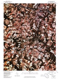
1981 Map of Damascus
USGS Topo · Published 1986About this map
Damascus serves as a central hub in this orthophotograph produced from 1981 infrared aerial imagery, showing a landscape defined by a mix of maturing residential clusters and well-established agricultural fields. In the northern reaches, Mount Airy straddles the boundary as a significant transit and trade point, while the southern edge includes the residential layout of Cedar Heights. This specific survey, produced in cooperation with the Soil Conservation Service, uses rectified photoimagery to reveal the precise textures of the Maryland Piedmont. The hydrology of the region is dominated by the Patuxent River snaking through dense woodland corridors, alongside the headwaters of Bennett Creek and Great Seneca Creek. These waterways provide a clear view of the natural drainage patterns that have historically shaped local property lines and farming practices in this part of Montgomery County.
Find a feature on this map
6 named features on this map. Tap any name to fly to it.
Don’t see what you’re looking for? This feature index may not catch every label — zoom into the map to look around manually.
Map Details
Editions of this 1981 Damascus Map
This is the sole edition of this map. No revisions or reprints were ever made.
Other maps of this area

1893 · Frederick
USGS Topo · 1:125,000

1894 · Frederick
USGS Topo · 1:125,000

1908 · Rockville
USGS Topo · 1:62,500

1908 · Seneca
USGS Topo · 1:62,500

1908 · Ijamsville
USGS Topo · 1:62,500

1909 · Mount Airy
USGS Topo · 1:62,500

1909 · Ijamsville
USGS Topo · 1:62,500

1923 · Rockville
USGS Topo · 1:62,500

1942 · Frederick
USGS Topo · 1:62,500

1944 · Walkersville
USGS Topo · 1:31,680