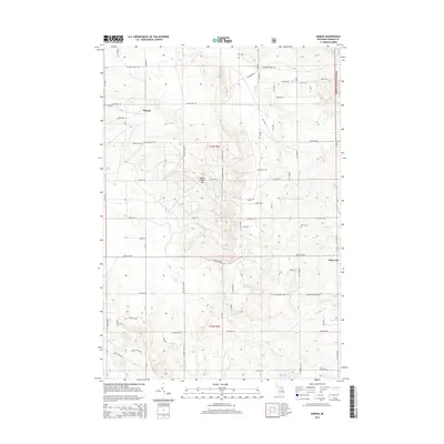
2014 Map of Damon
USGS Topo · Published 2014About this map
The settlement of Damon sits at the intersection of Roll Rd and McGregor Rd, serving as a central point in this Ogemaw County landscape. To the southeast, the larger community of Rose City borders the Huron National Forest, which covers the eastern margin of the sheet. The terrain is defined by a dense network of forest trails and rural routes like Stoney Ridge Rd and Gilford Ranch Trl, reflecting a region shaped by timber and recreation. Local history is anchored by several burial sites, including Damon Cem and Tucker Cem. Numerous small waterways such as Bixby Cr and Brooks Cr drain the area, while Townline Lake and Wallin Lake provide distinct landmarks in the southwest. A notable geographic feature, Wagon Wheel Hill, rises between Oyster Rd and Heath Rd, illustrating the undulating topography of the Michigan interior.
Find a feature on this map
70 named features on this map. Tap any name to fly to it.
Don’t see what you’re looking for? This feature index may not catch every label — zoom into the map to look around manually.
Map Details
Editions of this 2014 Damon Map
This is the sole edition of this map. No revisions or reprints were ever made.
Other maps of this area

1954 · Traverse City
USGS Topo · 1:250,000

1958 · Traverse City
USGS Topo · 1:250,000

1963 · Luzerne
USGS Topo · 1:24,000

1965 · Damon
USGS Topo · 1:24,000

1965 · St. Helen NE
USGS Topo · 1:24,000

1965 · West Branch
USGS Topo · 1:24,000

1965 · Ogemaw Springs
USGS Topo · 1:24,000

1965 · Selkirk
USGS Topo · 1:24,000

1965 · Rose City
USGS Topo · 1:24,000

1972 · Mack Lake
USGS Topo · 1:24,000