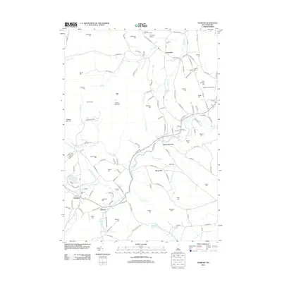
2012 Map of Danbury
USGS Topo · Published 2012About this map
Danbury and the smaller hamlets of South Alexandria and Elmwood anchor this survey of the New Hampshire interior during the early 2010s. The landscape is defined by its many summits, including Forbes Mountain, The Pinnacle, and Pillsbury Mountain, which overlook a network of winding waterways such as the Smith River and Wild Meadow Brook. Notable local institutions like the Saint Pauls School Camp near School Pond and the Cardigan Mountain Orchard near the Simmons Ledges reflect the area's mix of educational, agricultural, and recreational heritage. Genealogists will find value in the precise locations of the Riverside Cem, Crawford Cem, and Burns Hill Cem. Transportation remains vital to the region, evidenced by the Newfound Valley Airport and a dense system of local roads including Town Pound Rd and Fowler River Rd that navigate the varied terrain of Hemp Hill and Gordon Hill.
Find a feature on this map
141 named features on this map. Tap any name to fly to it.
Don’t see what you’re looking for? This feature index may not catch every label — zoom into the map to look around manually.
Map Details
Editions of this 2012 Danbury Map
This is the sole edition of this map. No revisions or reprints were ever made.
Other maps of this area

1925 · Holderness
USGS Topo · 1:62,500

1927 · Penacook
USGS Topo · 1:62,500

1927 · Holderness
USGS Topo · 1:62,500

1927 · Cardigan
USGS Topo · 1:62,500

1928 · Mount Kearsarge
USGS Topo · 1:62,500

1930 · Cardigan
USGS Topo · 1:62,500

1931 · Mount Kearsarge
USGS Topo · 1:62,500

1949 · Portland
USGS Topo · 1:250,000

1956 · Cardigan
USGS Topo · 1:62,500

1956 · Penacook
USGS Topo · 1:62,500