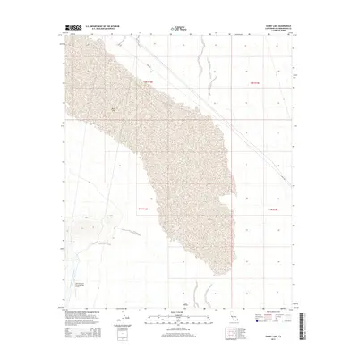
2015 Map of Danby Lake
USGS Topo · Published 2015About this map
Danby Lake dominates this San Bernardino County landscape, appearing as an expansive dry lake bed in the California desert. The terrain is defined by the flat expanse of Ward Valley and the massive infrastructure of the Colorado River Aqueduct, which cuts through the southwest corner of the map. This engineering marvel, crucial for regional water transport, is accompanied by the Iron Mountain Pumping Plant Airport, reflecting the logistical needs of maintaining water systems in isolated desert environments. The area is sparsely developed, with Cadiz Rd providing one of the few managed transit corridors through the arid basin. The map reveals the intricate natural drainage patterns that flow toward the central lake bed, illustrating a landscape shaped by intermittent water and severe heat.
Find a feature on this map
9 named features on this map. Tap any name to fly to it.
Don’t see what you’re looking for? This feature index may not catch every label — zoom into the map to look around manually.
Map Details
Editions of this 2015 Danby Lake Map
This is the sole edition of this map. No revisions or reprints were ever made.
Other maps of this area

1942 · Amboy
USGS Topo · 1:250,000

1943 · Amboy
USGS Topo · 1:250,000

1943 · Turtle Mts.
USGS Topo · 1:62,500

1943 · Iron Mountains
USGS Topo · 1:62,500

1954 · Needles
USGS Topo · 1:250,000

1954 · Turtle Mountains
USGS Topo · 1:62,500

1954 · Rice
USGS Topo · 1:62,500

1956 · Needles
USGS Topo · 1:250,000

1956 · Milligan
USGS Topo · 1:62,500

1956 · Iron Mountains
USGS Topo · 1:62,500