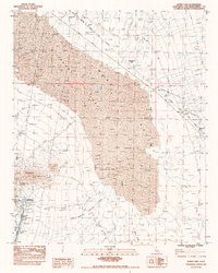
1983 Map of Danby Lake
USGS Topo · Published 1983About this map
The Iron Mountain Pumping Plant and the engineering of the Colorado River Aqueduct dominate this corner of the Mojave Desert. In the early 1980s, this landscape was defined by industrial infrastructure, including a Siphon, a Spillway Gate, and a private Air Strip. To the north, the vast floor of Dry Lake is marked by a history of resource extraction, evidenced by an Abandoned Salt Pond and a larger complex of Abandoned Salt Ponds. The Atchison Topeka and Santa Fe railroad cuts across the arid terrain, passing near a historical Salt Marsh (Site). The map details the complex drainage and flood control measures of the era, such as a Wasteway Area and numerous Dikes constructed to manage runoff from the Iron Mountains.
Find a feature on this map
23 named features on this map. Tap any name to fly to it.
Don’t see what you’re looking for? This feature index may not catch every label — zoom into the map to look around manually.
Map Details
Editions of this 1983 Danby Lake Map
This is the sole edition of this map. No revisions or reprints were ever made.
Other maps of this area

1942 · Amboy
USGS Topo · 1:250,000

1943 · Amboy
USGS Topo · 1:250,000

1943 · Turtle Mts.
USGS Topo · 1:62,500

1943 · Iron Mountains
USGS Topo · 1:62,500

1954 · Needles
USGS Topo · 1:250,000

1954 · Turtle Mountains
USGS Topo · 1:62,500

1954 · Rice
USGS Topo · 1:62,500

1956 · Needles
USGS Topo · 1:250,000

1956 · Milligan
USGS Topo · 1:62,500

1956 · Iron Mountains
USGS Topo · 1:62,500