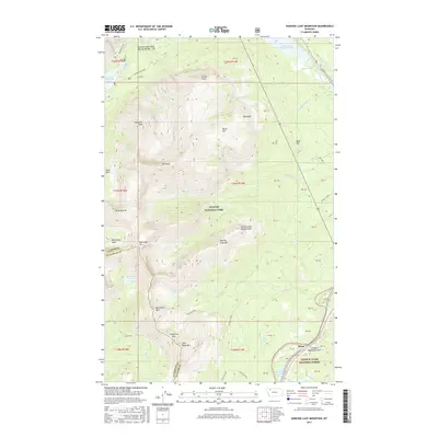
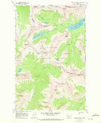
2017 Map of Dancing Lady Mountain
USGS Topo · Published 2017About this map
Glacier National Park and the Lewis & Clark National Forest meet in this 2017 survey, where high-altitude peaks and significant water features define the boundary between Glacier and Flathead counties. The landscape is marked by prominent summits such as Dancing Lady Mountain, Bison Mountain, and Stands Alone Woman Peak. Waterways like the Two Medicine River flow from Lower Two Medicine Lake and Pray Lake, while several natural landmarks provide focal points for exploration, including Running Eagle Falls Natural Bridge and Appistoki Falls. Transportation through these mountain ranges is limited to routes like the Two Medicine Road and passes such as Theodore Roosevelt Pass and Firebrand Pass, highlighting the remote and protected nature of the wilderness area. Near the eastern edge, the small settlement of Bison sits along the Looking Glass Hill Road, serving as a rare point of human habitation in this alpine environment.
Find a feature on this map
61 named features on this map. Tap any name to fly to it.
Don’t see what you’re looking for? This feature index may not catch every label — zoom into the map to look around manually.
Map Details
Editions of this 2017 Dancing Lady Mountain Map
This is the sole edition of this map. No revisions or reprints were ever made.
Other maps of this area

1901 · Browning
USGS Topo · 1:125,000

1903 · Browning
USGS Topo · 1:125,000

1913 · Marias Pass
USGS Topo · 1:125,000

1960 · Cut Bank
USGS Topo · 1:250,000

1963 · Cut Bank
USGS Topo · 1:250,000

1964 · Cut Bank
USGS Topo · 1:250,000
1968 · Blacktail
USGS Topo · 1:24,000
1968 · Cut Bank Pass
USGS Topo · 1:24,000
1968 · Kiowa
USGS Topo · 1:24,000
1968 · Mount Rockwell
USGS Topo · 1:24,000