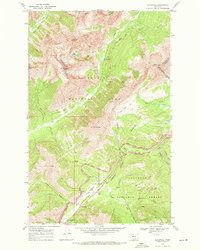
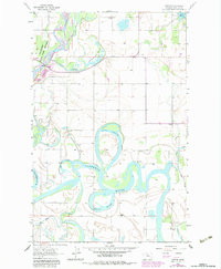
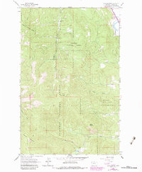
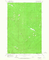
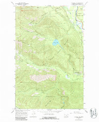
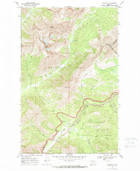
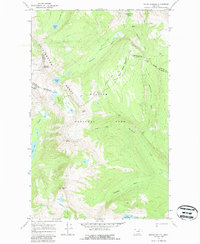
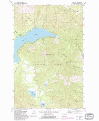
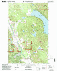
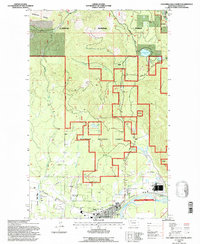
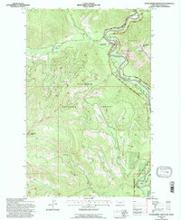
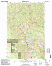
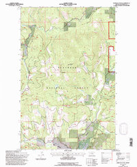
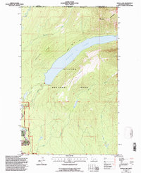
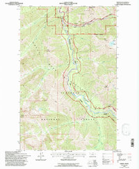
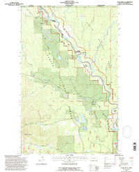
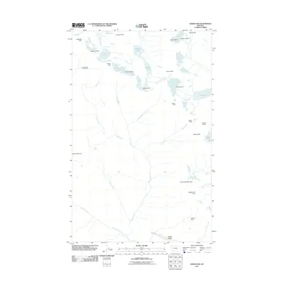
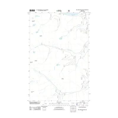
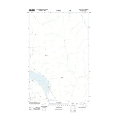
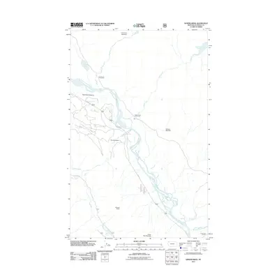
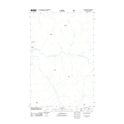
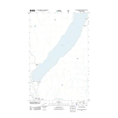
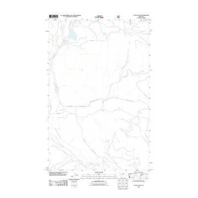
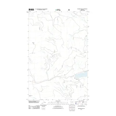
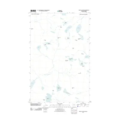
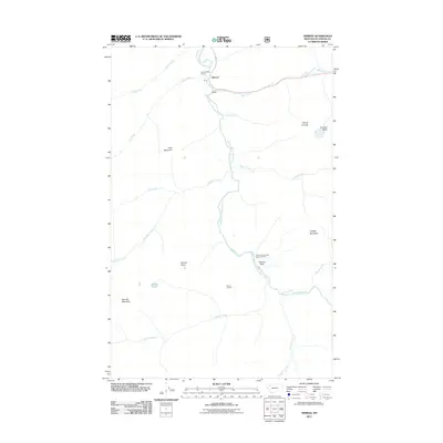
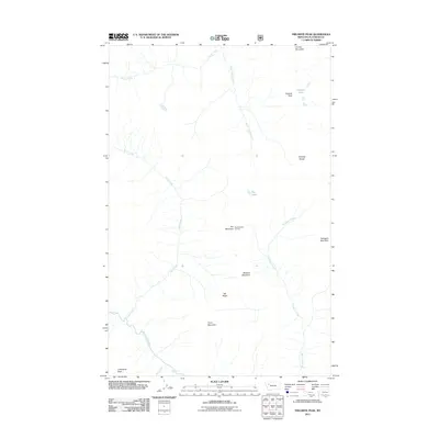
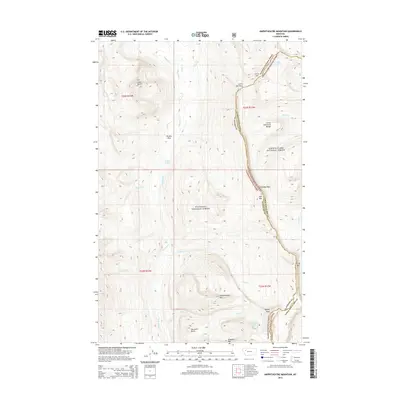
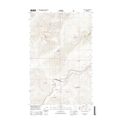
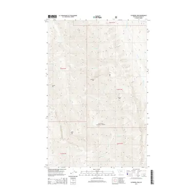
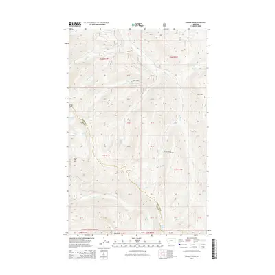
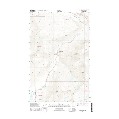
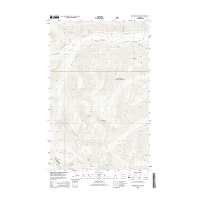
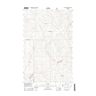
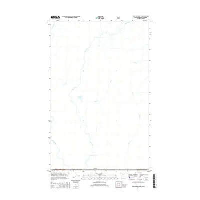
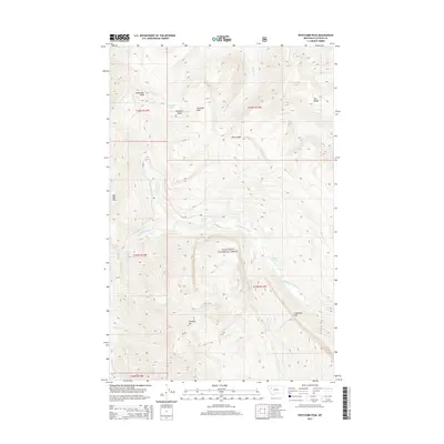
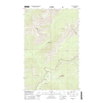
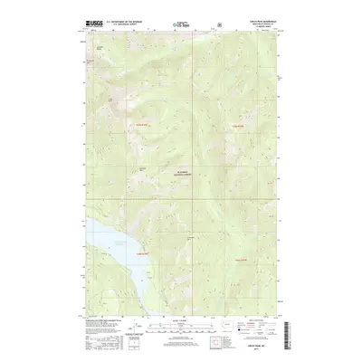
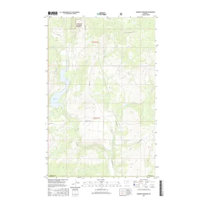
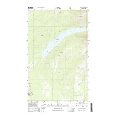
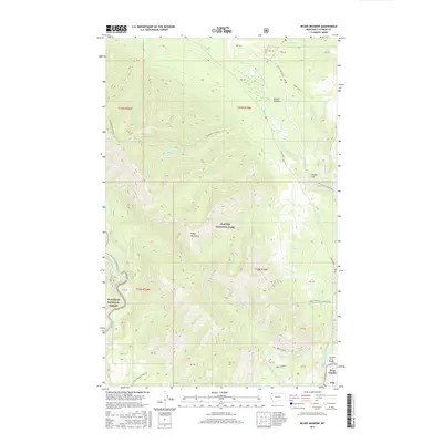
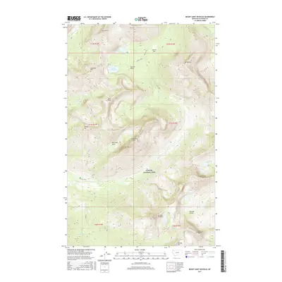
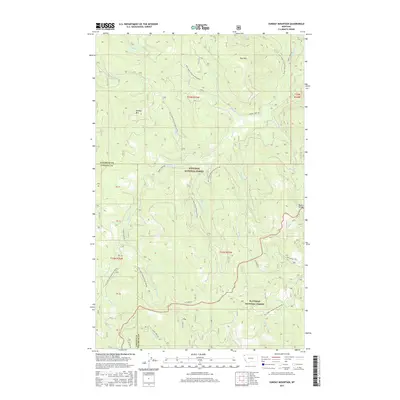
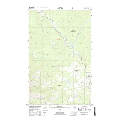
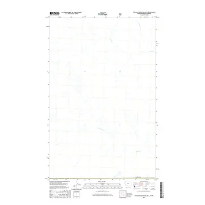
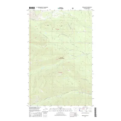
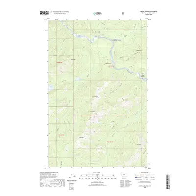
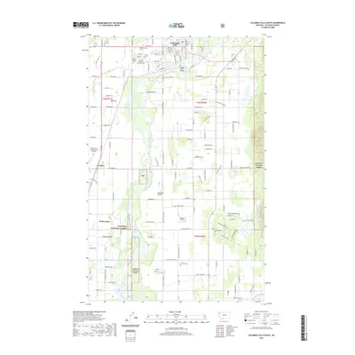
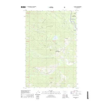
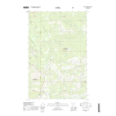
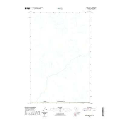
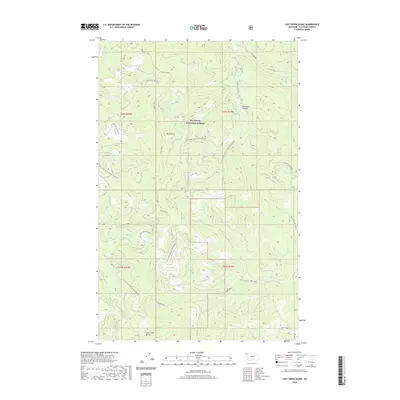
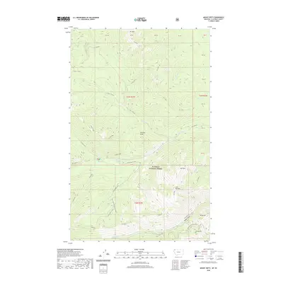
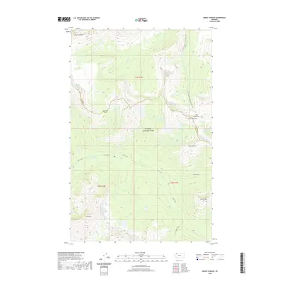
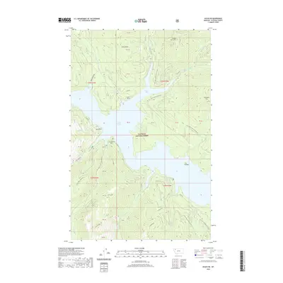
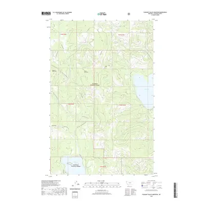
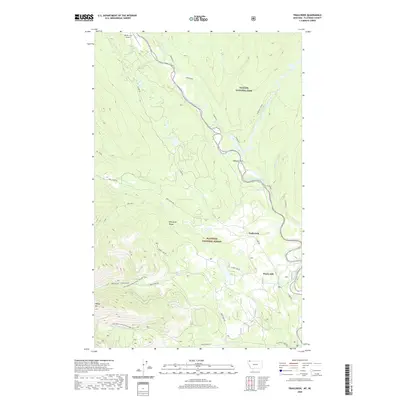
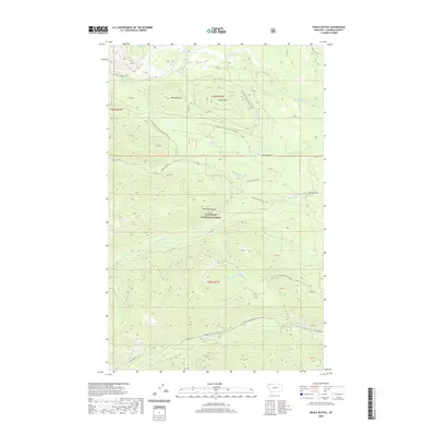
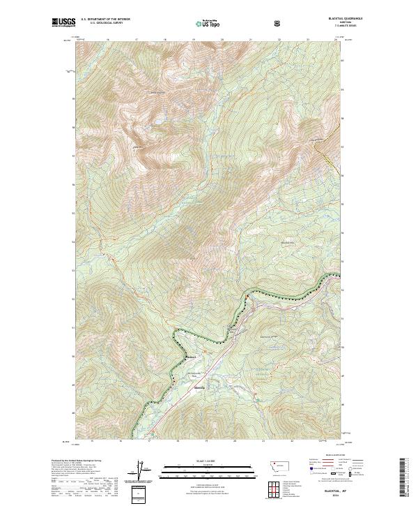
1968 Map of Blacktail
USGS Topo · Published 1971About this map
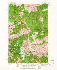
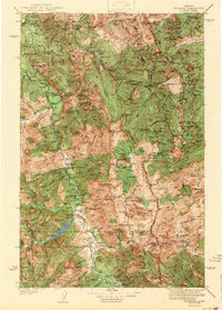
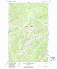
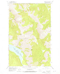
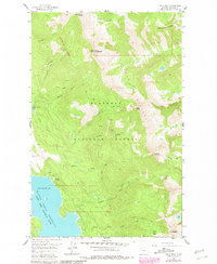
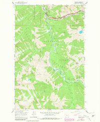
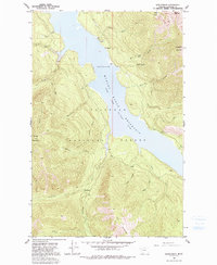
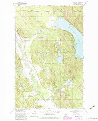
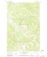
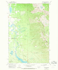
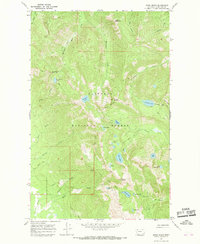
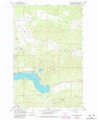
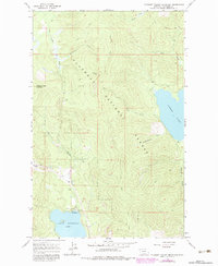
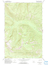
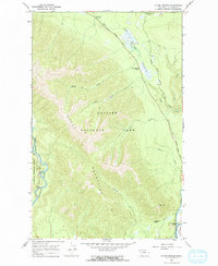
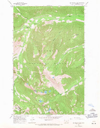
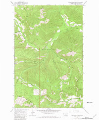
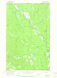
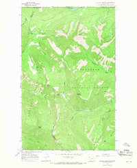
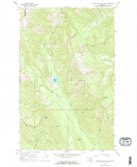
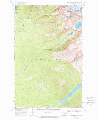
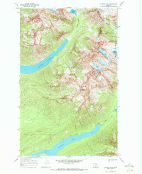
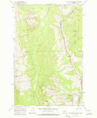
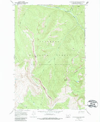
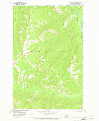
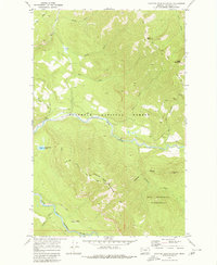
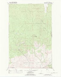
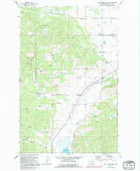
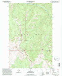
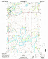
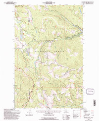
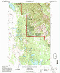
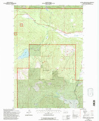
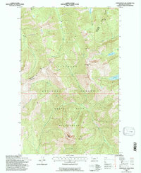
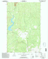
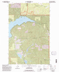
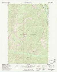
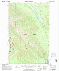
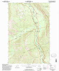
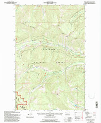
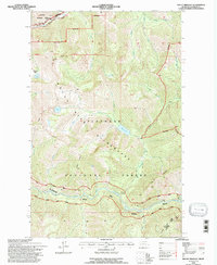
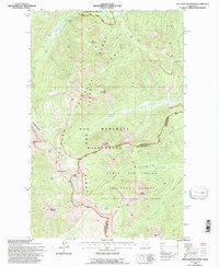
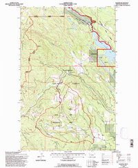
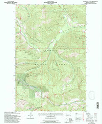
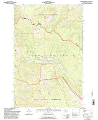
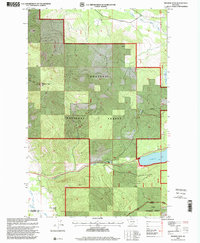
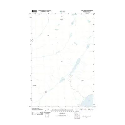
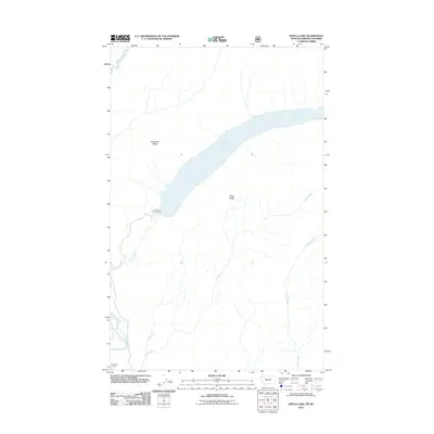
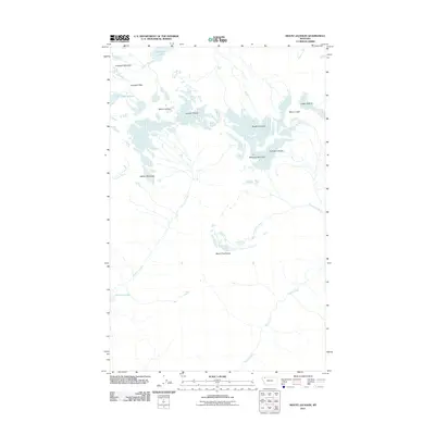
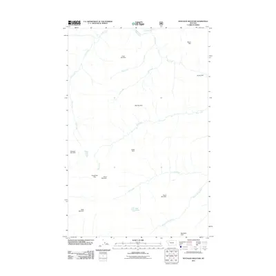
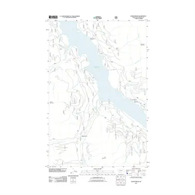
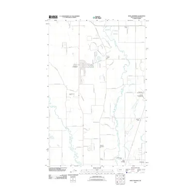
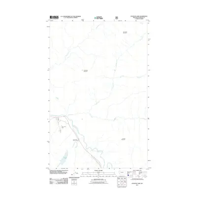
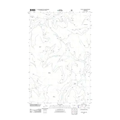
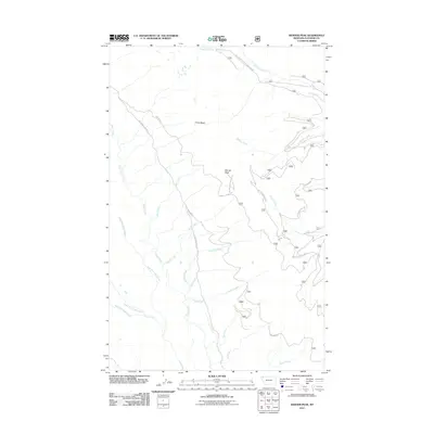
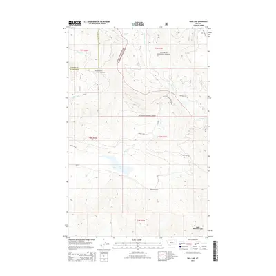
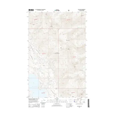
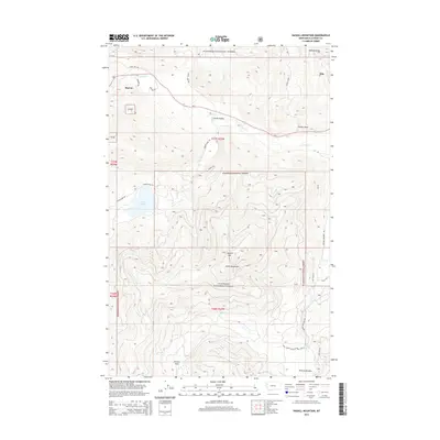
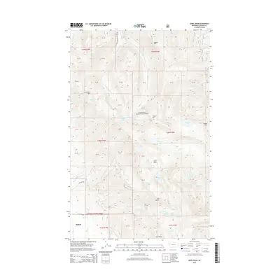
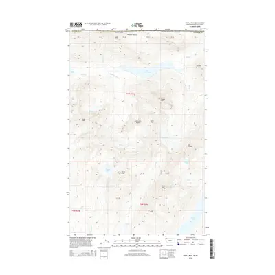
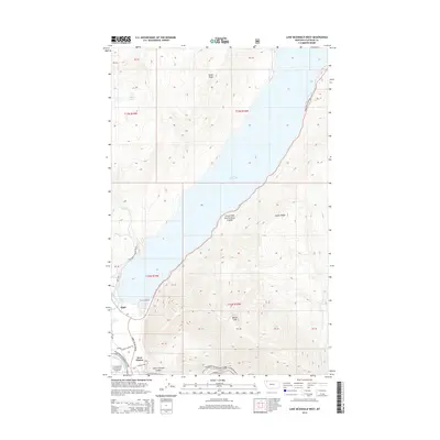
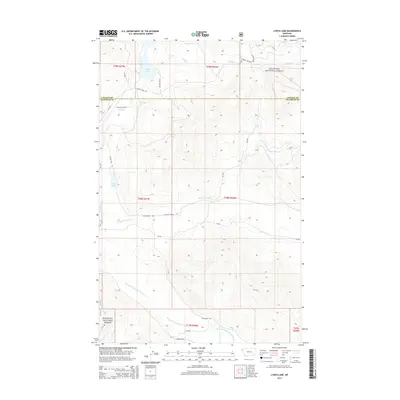
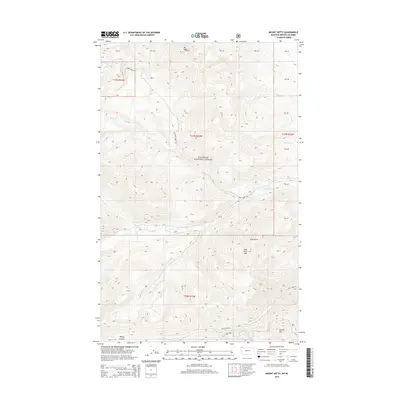
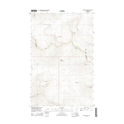
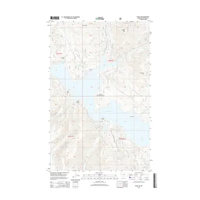
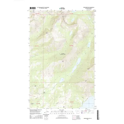
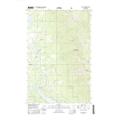
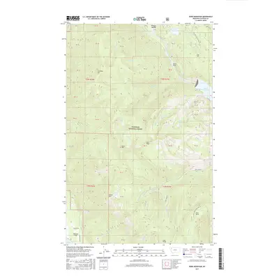
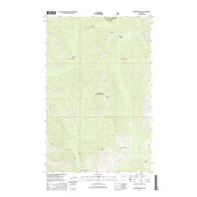
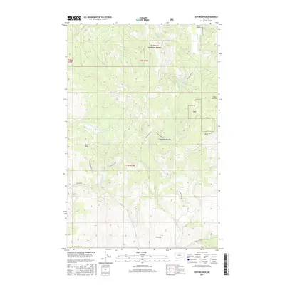
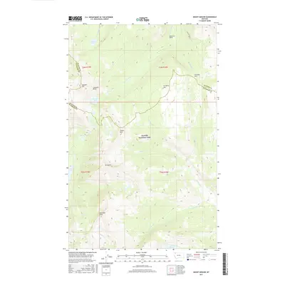
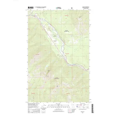
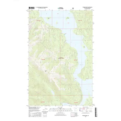
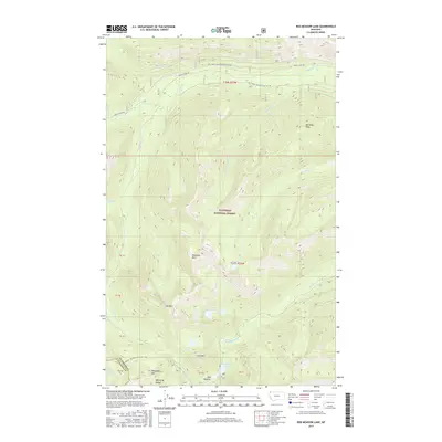
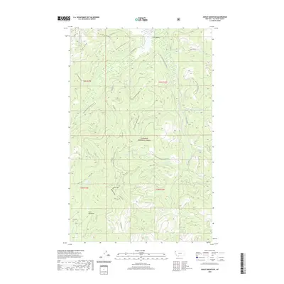
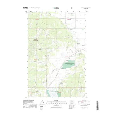
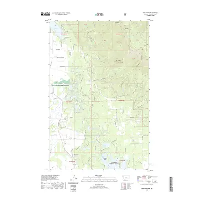
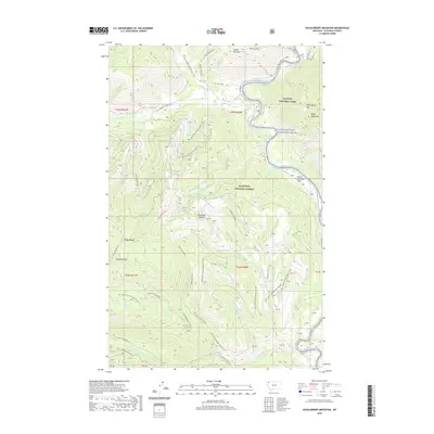
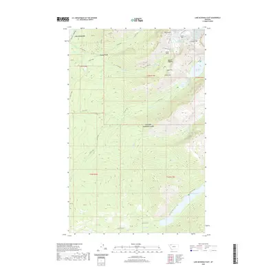
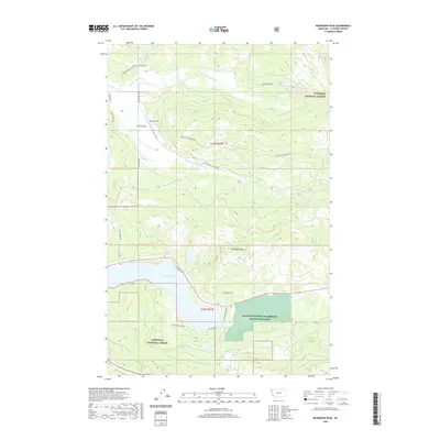
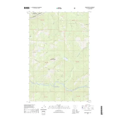
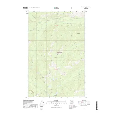
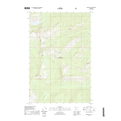
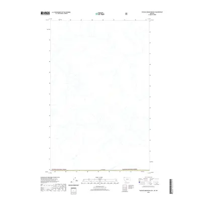
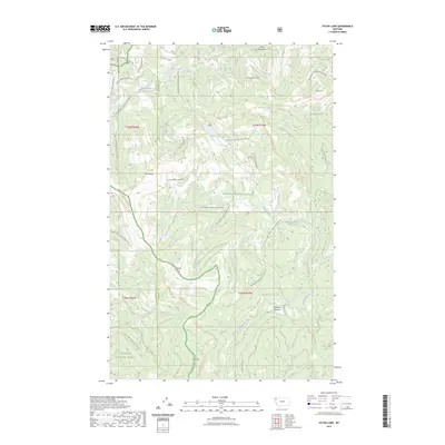
Glacier National Park and Flathead National Forest meet along the high spine of the Continental Divide in this late 1960s topographic study. The landscape is defined by the critical transportation corridor of the Theodore Roosevelt Stevens John Pass, where the Burlington Northern railroad winds through the canyon alongside Bear Creek. Evidence of the harsh alpine environment and the infrastructure required to manage it is visible in the series of snowsheds protecting the tracks and the presence of the Fielding Patrol Cabin and Fielding Guard Sta. To the north, the terrain rises toward Brave Dog Mountain and Sheep Mountain, while to the south, the Giefer Twentyfive Mile Creek Trail leads into the dense forest. This map documents a period when these mountain passes remained vital links for transcontinental rail traffic, even as they served as gateways for wilderness recreation.
Find a feature on this map
39 named features on this map. Tap any name to fly to it.
Don’t see what you’re looking for? This feature index may not catch every label — zoom into the map to look around manually.
Map Details
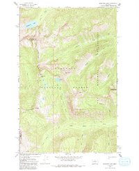
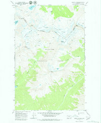
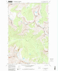
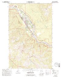
Editions of this 1968 Blacktail Map
2 editions found
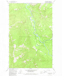
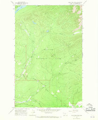
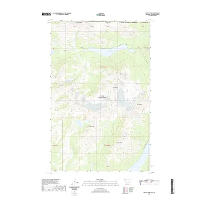
Historical Maps of Blacktail Through Time
652 maps found
1906 Kinta Lakes
Flathead County, MT
1913 Marias Pass
Flathead County, MT
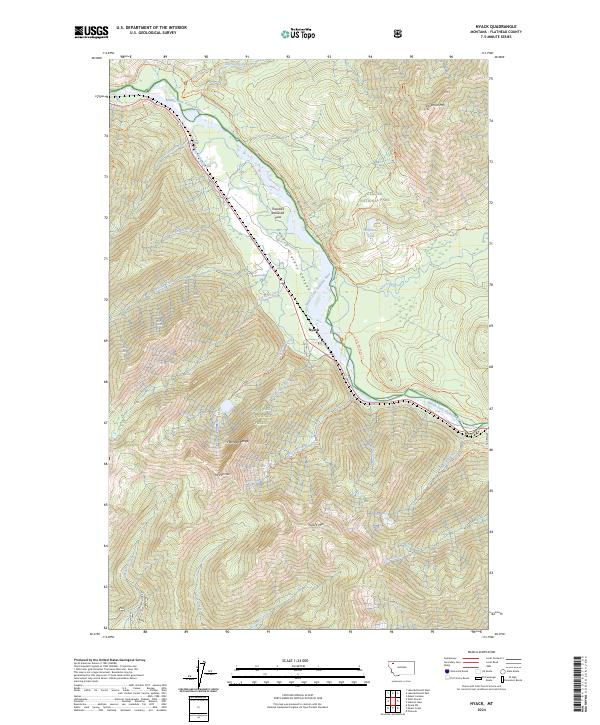
1914 Nyack
Flathead County, MT
1936 Silvertip
Flathead County, MT

1938 Kintla Lakes
Flathead County, MT
1942 Silvertip
Flathead County, MT
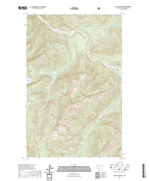
1958 Capitol Mountain
Flathead County, MT
1958 Circus Peak
Flathead County, MT
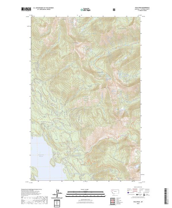
1958 Felix Peak
Flathead County, MT
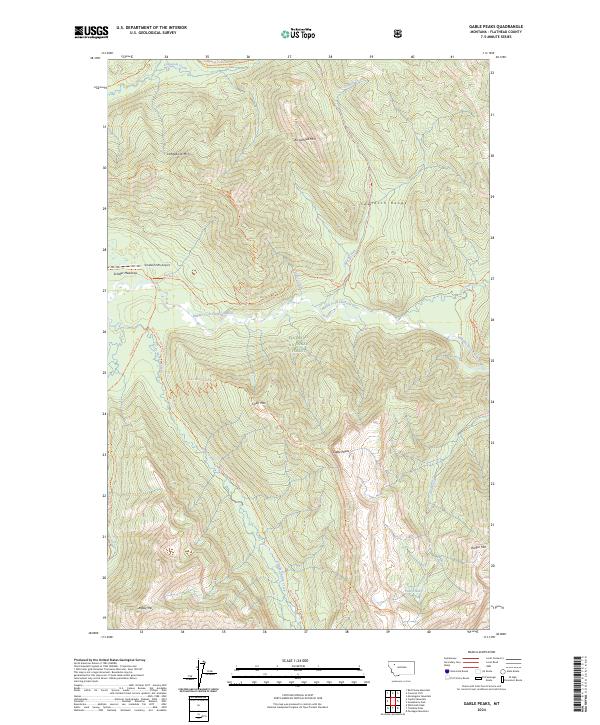
1958 Gable Peaks
Flathead County, MT
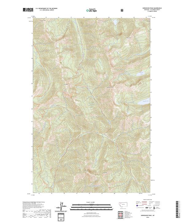
1958 Horseshoe Peak
Flathead County, MT
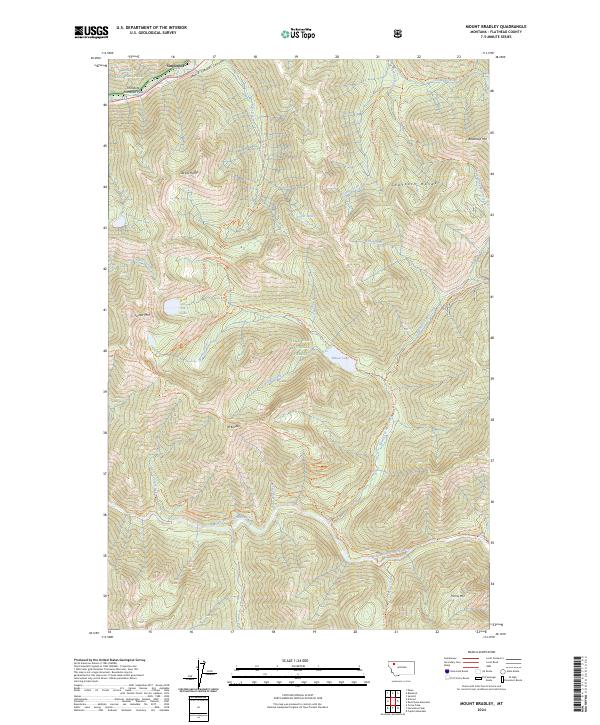
1958 Mount Bradley
Flathead County, MT
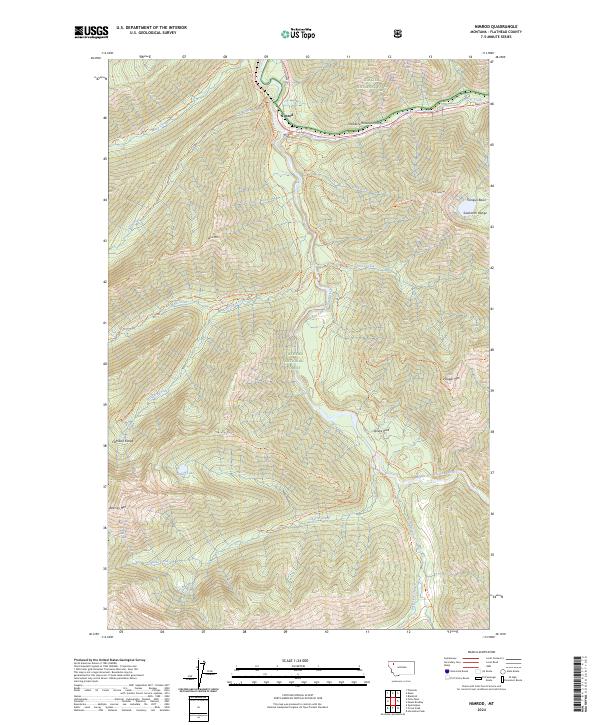
1958 Nimrod
Flathead County, MT
1958 Quintonkon
Flathead County, MT
1958 Red Plume Mountain
Flathead County, MT
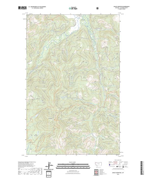
1962 Ashley Mountain
Flathead County, MT
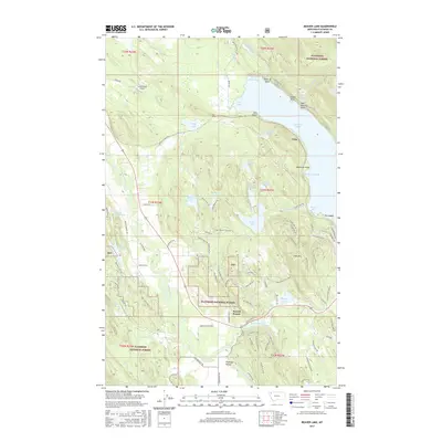
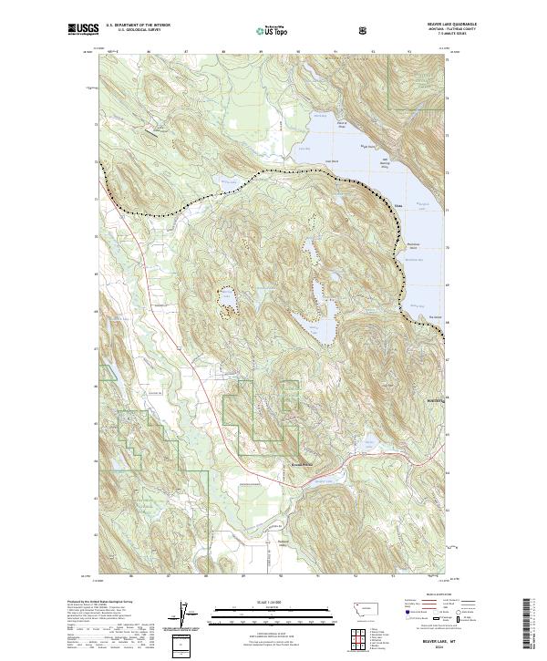
1962 Beaver Lake
Flathead County, MT
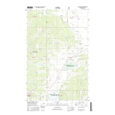
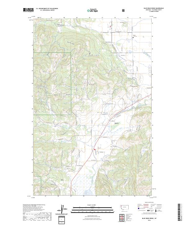
1962 Blue Grass Ridge
Flathead County, MT
1962 Columbia Falls North
Flathead County, MT
1962 Columbia Falls South
Flathead County, MT
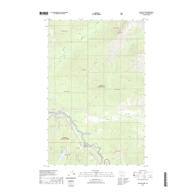
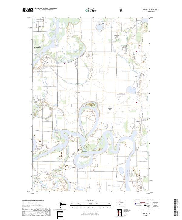
1962 Creston
Flathead County, MT
1962 Doris Mountain
Flathead County, MT
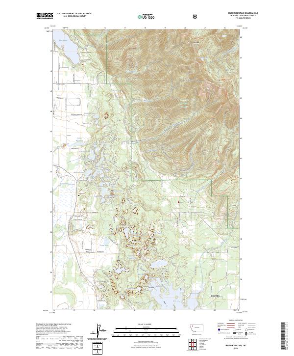
1962 Hash Mountain
Flathead County, MT
1962 Johnson Peak
Flathead County, MT
1962 Lion Mountain
Flathead County, MT
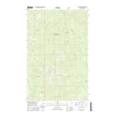
1962 Lost Creek Divide
Flathead County, MT
1962 Rose Crossing
Flathead County, MT
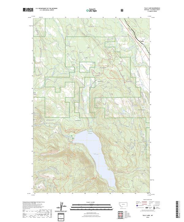
1962 Tally Lake
Flathead County, MT
1963 Dunsire Point
Flathead County, MT
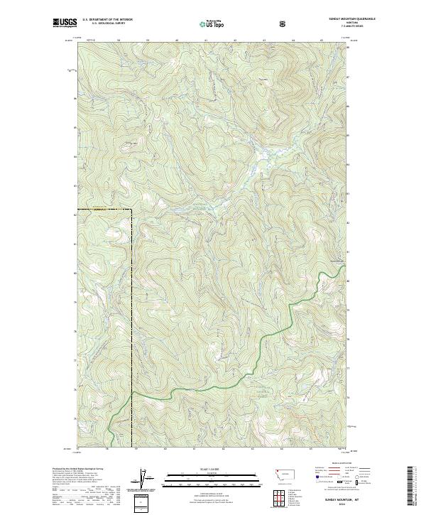
1963 Sunday Mountain
Flathead County, MT
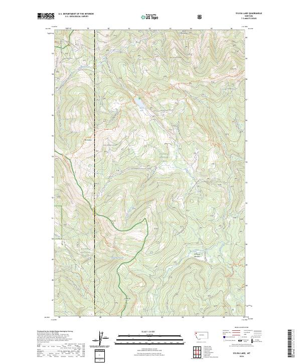
1963 Sylvia Lake
Flathead County, MT
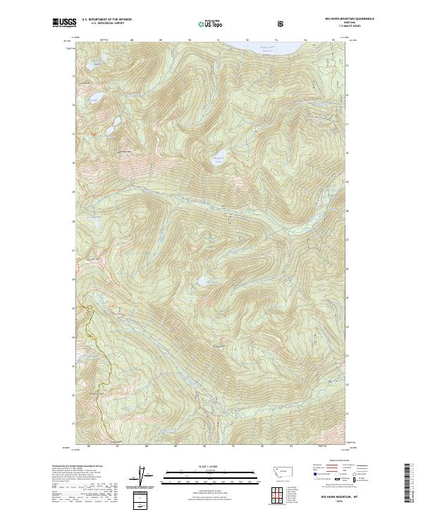
1964 Big Hawk Mountain
Flathead County, MT
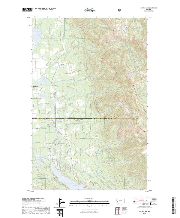
1964 Crater Lake
Flathead County, MT
1964 Dahl Lake
Flathead County, MT
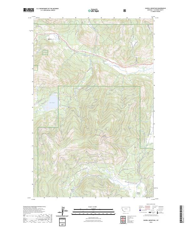
1964 Haskill Mountain
Flathead County, MT
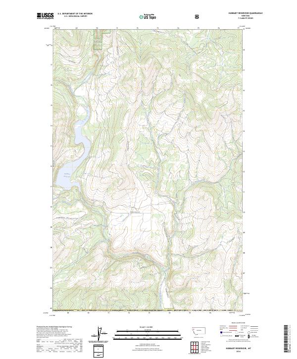
1964 Hubbart Reservoir
Flathead County, MT
1964 Jewel Basin
Flathead County, MT
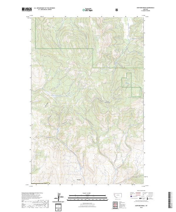
1964 Kofford Ridge
Flathead County, MT
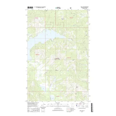
1964 Lone Lake
Flathead County, MT
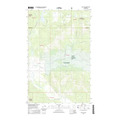
1964 Lynch Lake
Flathead County, MT
1964 Mc Gregor Peak
Flathead County, MT
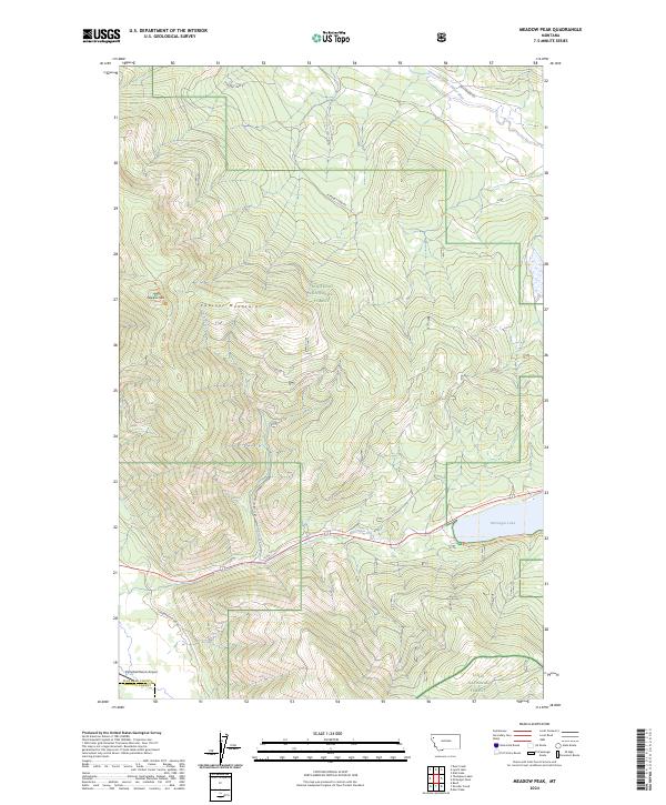
1964 Meadow Peak
Flathead County, MT
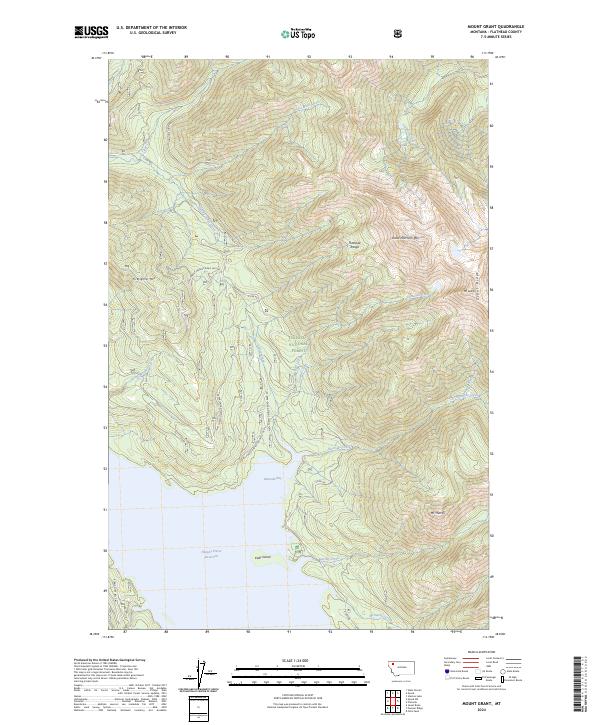
1964 Mount Grant
Flathead County, MT
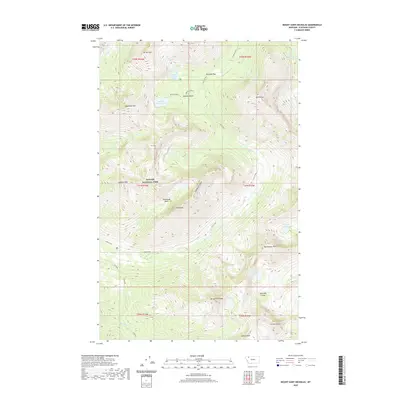
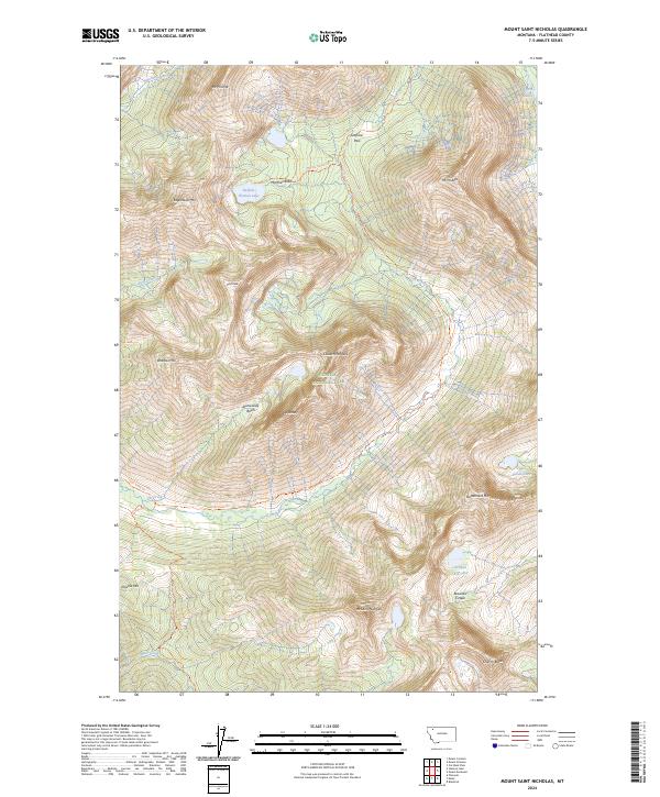
1964 Mount Saint Nicholas
Flathead County, MT
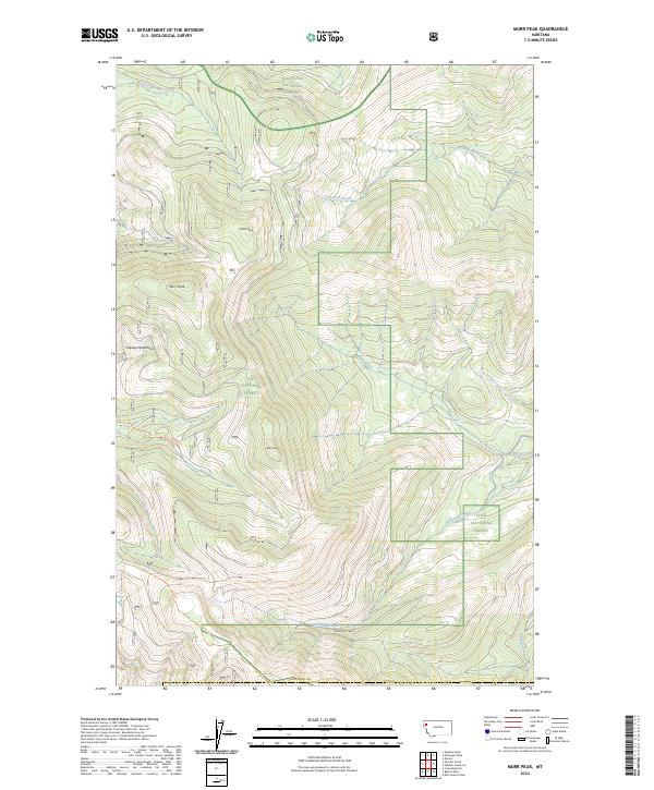
1964 Murr Peak
Flathead County, MT
1964 Nyack
Flathead County, MT
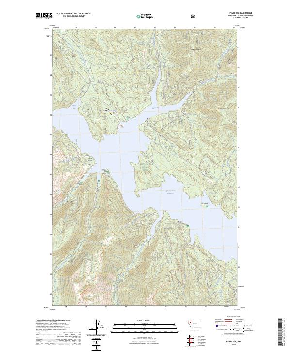
1964 Nyack SW
Flathead County, MT
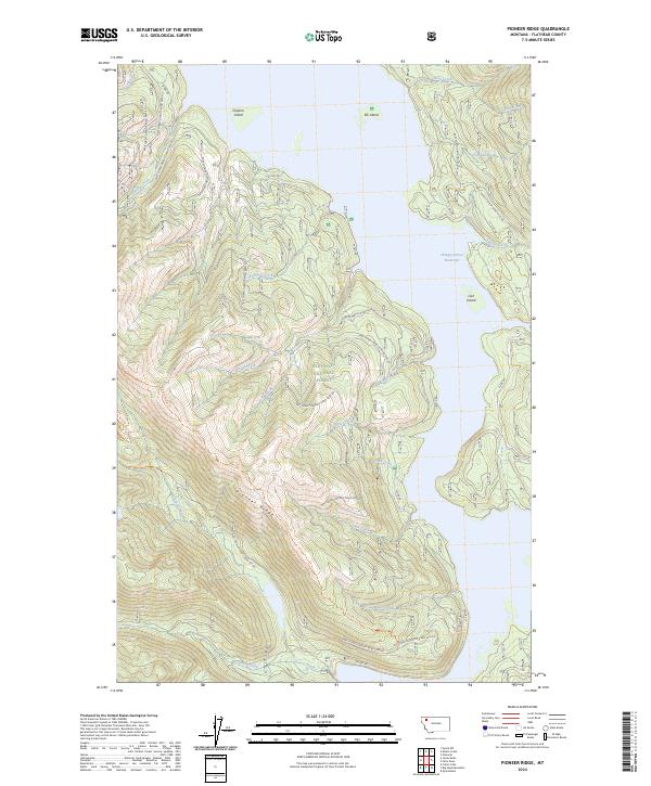
1964 Pioneer Ridge
Flathead County, MT
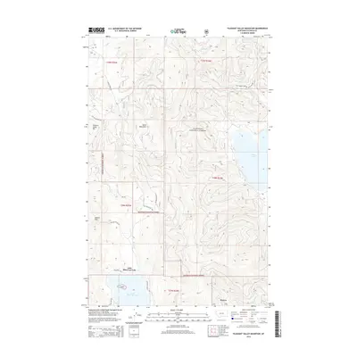
1964 Pleasant Valley Mountain
Flathead County, MT
1964 Shroder Creek
Flathead County, MT
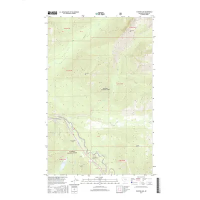
1964 Stanton Lake
Flathead County, MT
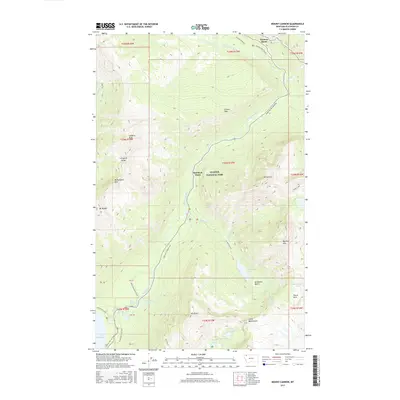
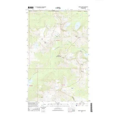
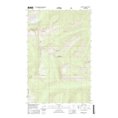
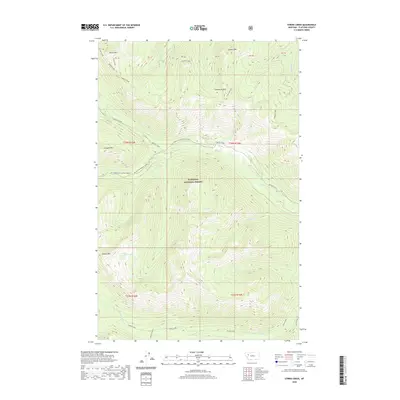
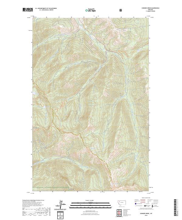
1965 Connor Creek
Flathead County, MT
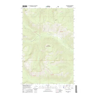
1965 String Creek
Flathead County, MT
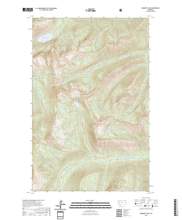
1965 Sunburst Lake
Flathead County, MT
1965 Tin Creek
Flathead County, MT
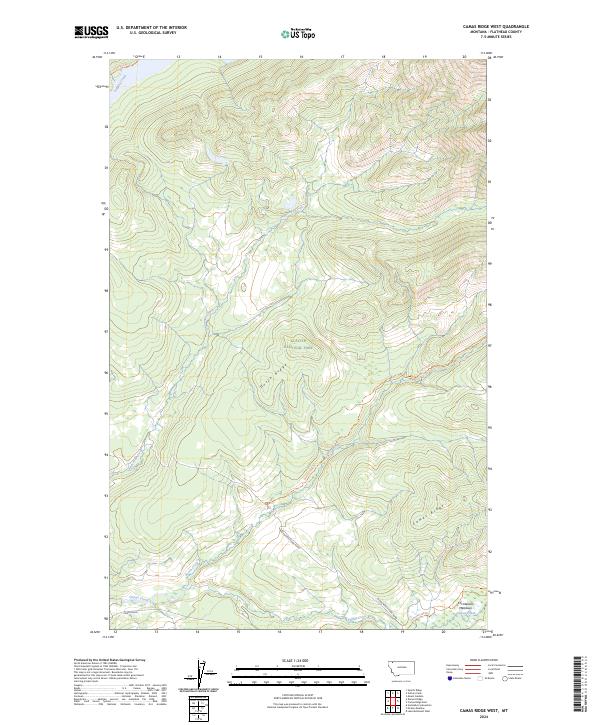
1966 Camas Ridge West
Flathead County, MT
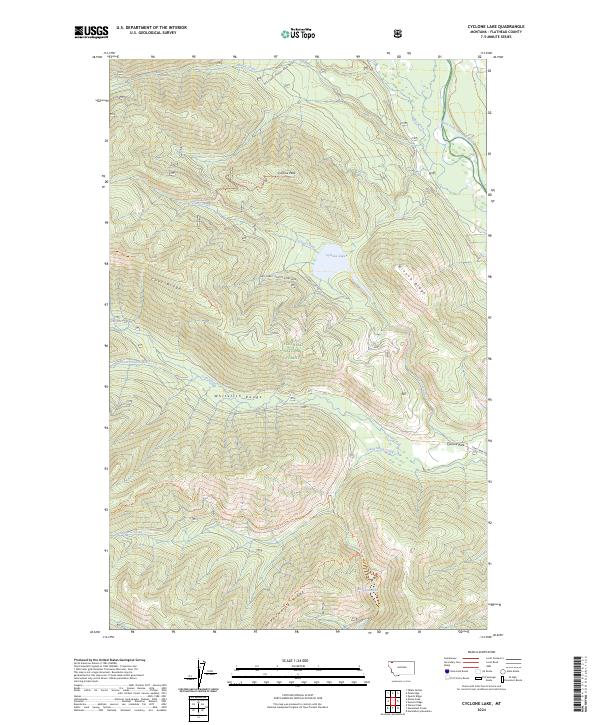
1966 Cyclone Lake
Flathead County, MT
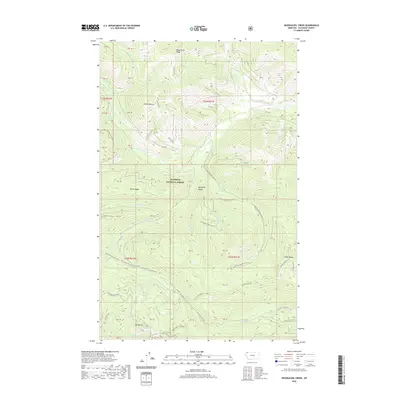
1966 Demers Ridge
Flathead County, MT
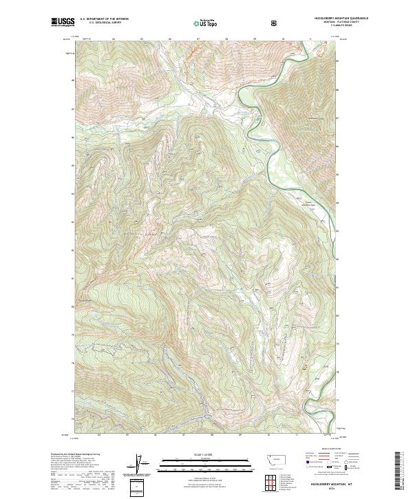
1966 Huckleberry Mountain
Flathead County, MT
1966 Kintla Lake
Flathead County, MT
1966 Mc Gee Meadow
Flathead County, MT
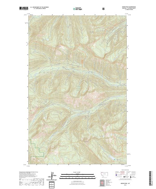
1966 Moose Peak
Flathead County, MT
1966 Mount Hefty
Flathead County, MT
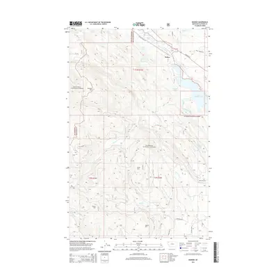
1966 Radnor
Flathead County, MT
1966 Red Meadow Lake
Flathead County, MT
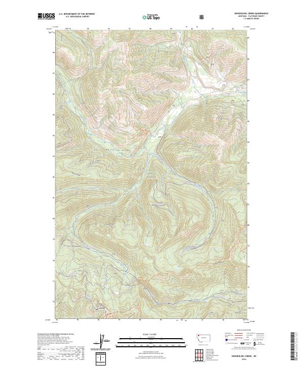
1966 Skookoleel Creek
Flathead County, MT
1966 Trailcreek
Flathead County, MT
1966 Tuchuck Mountain
Flathead County, MT
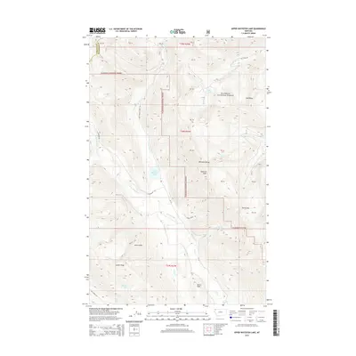
1966 Upper Whitefish Lake
Flathead County, MT
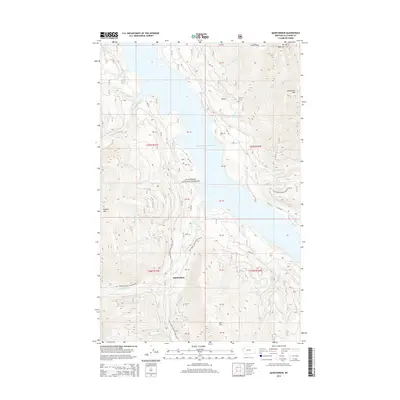
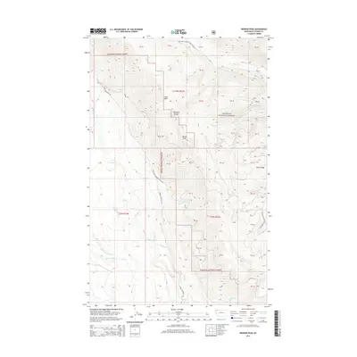
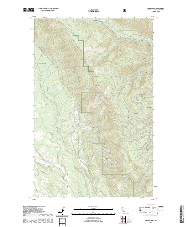
1966 Werner Peak
Flathead County, MT
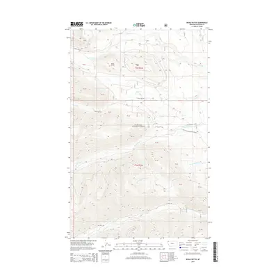
1966 Whale Buttes
Flathead County, MT
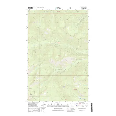
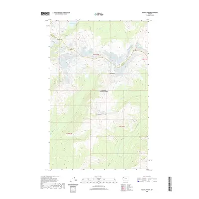
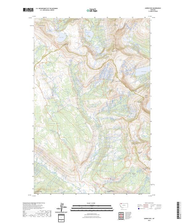
1968 Ahern Pass
Flathead County, MT
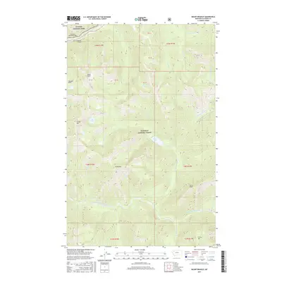
1968 Blacktail
Flathead County, MT
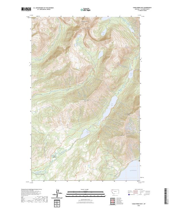
1968 Camas Ridge East
Flathead County, MT
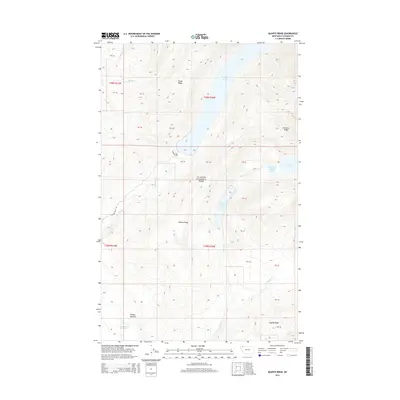
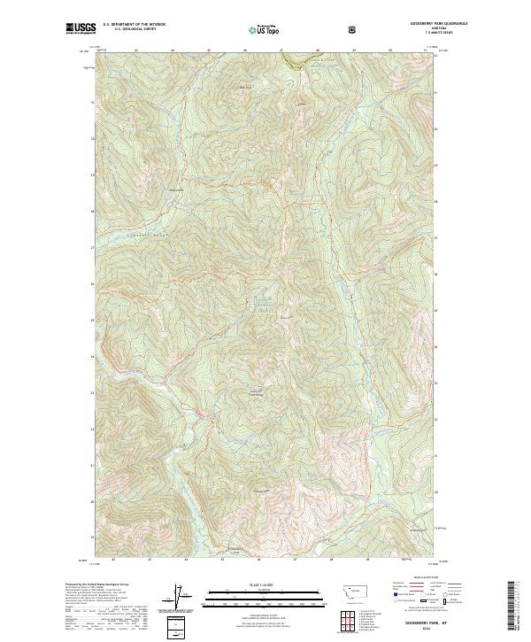
1968 Gooseberry Park
Flathead County, MT
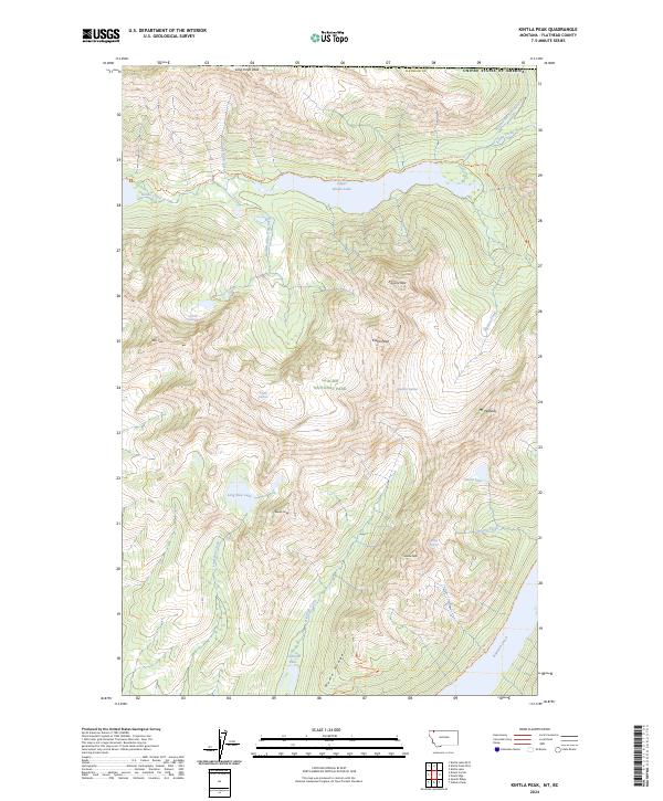
1968 Kintla Peak
Flathead County, MT
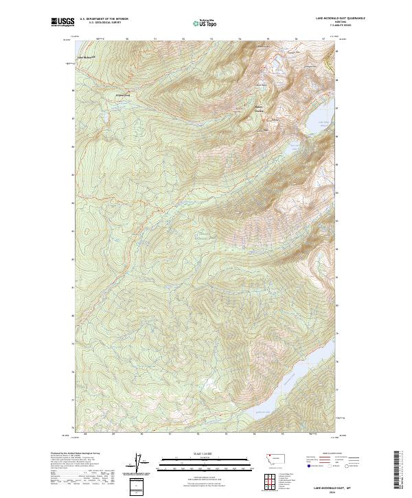
1968 Lake Mc Donald East
Flathead County, MT
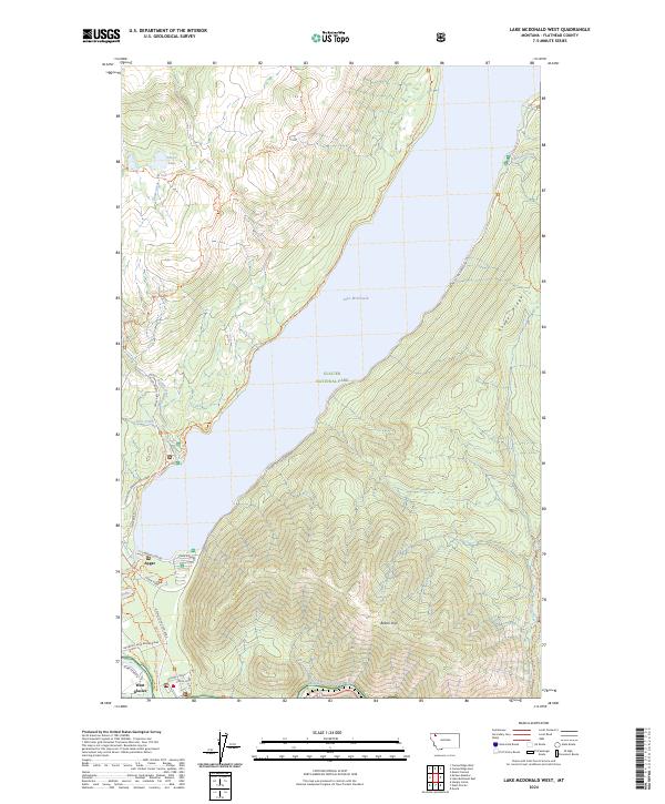
1968 Lake Mc Donald West
Flathead County, MT
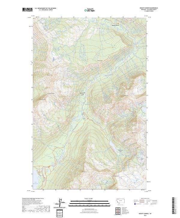
1968 Mount Cannon
Flathead County, MT
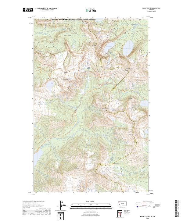
1968 Mount Carter
Flathead County, MT
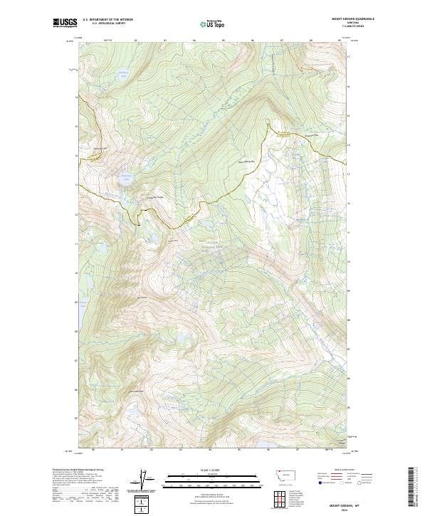
1968 Mount Geduhn
Flathead County, MT
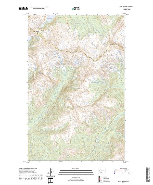
1968 Mount Jackson
Flathead County, MT
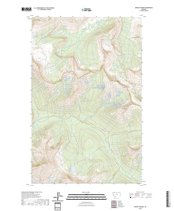
1968 Mount Stimson
Flathead County, MT
1968 Quartz Ridge
Flathead County, MT
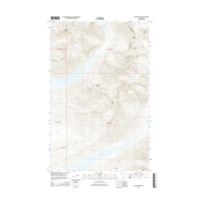
1968 Vulture Peak
Flathead County, MT
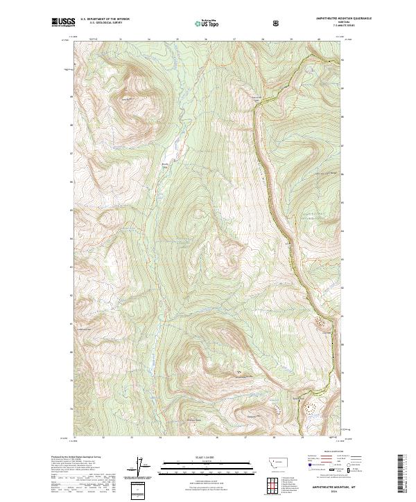
1970 Amphitheatre Mountain
Flathead County, MT
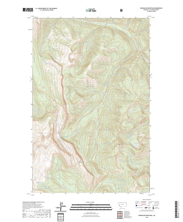
1970 Bungalow Mountain
Flathead County, MT
1970 Cathedral Peak
Flathead County, MT
1970 Marmot Mountain
Flathead County, MT
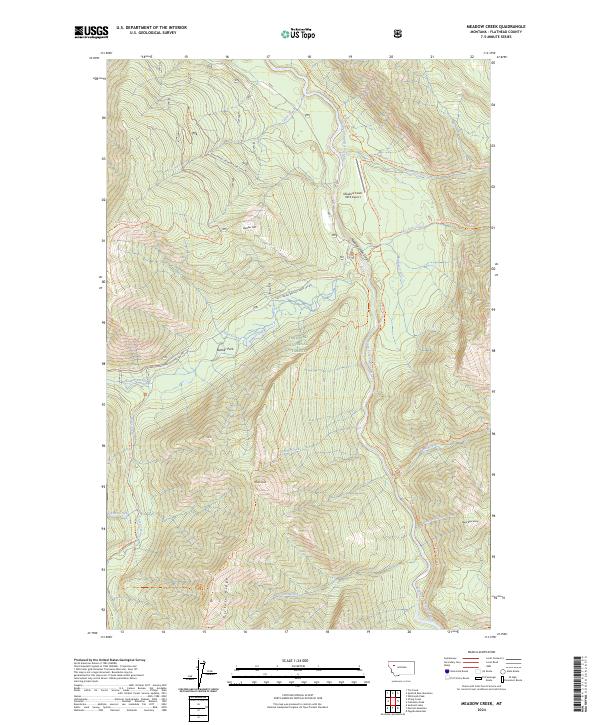
1970 Meadow Creek
Flathead County, MT
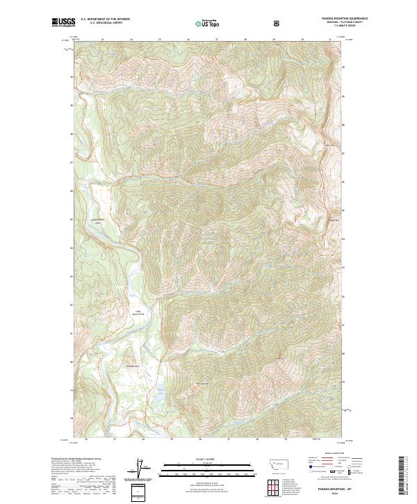
1970 Pagoda Mountain
Flathead County, MT
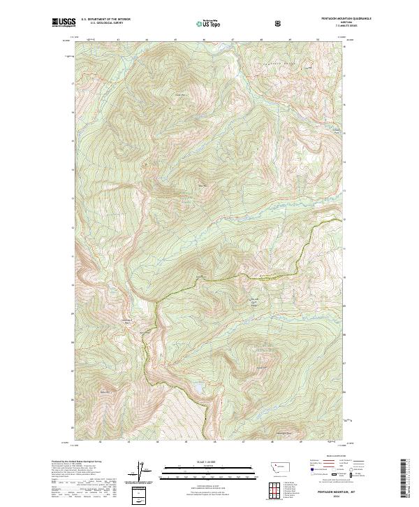
1970 Pentagon Mountain
Flathead County, MT
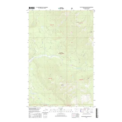
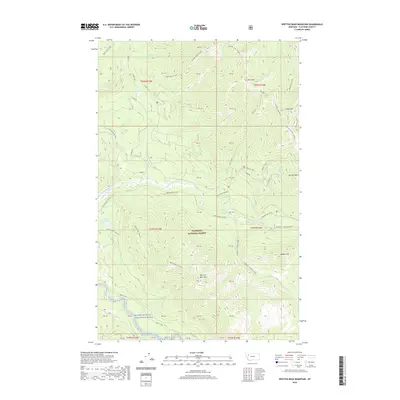
1970 Spotted Bear Mountain
Flathead County, MT
1970 Trilobite Peak
Flathead County, MT
1970 Whitcomb Peak
Flathead County, MT

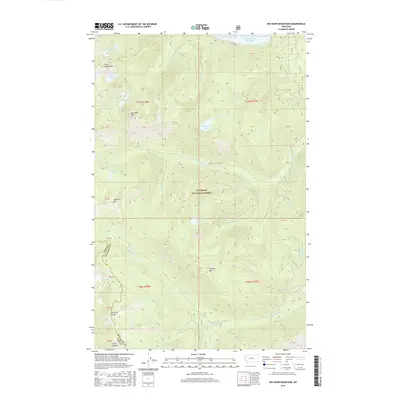
1981 Hungry Horse Reservoir
Flathead County, MT

1981 Whitefish Range
Flathead County, MT
1982 Rose Crossing
Flathead County, MT
1987 Kofford Ridge
Flathead County, MT
1988 Swan Peak
Flathead County, MT
1989 Hubbart Reservoir
Flathead County, MT
1989 Murr Peak
Flathead County, MT

1990 Lost Creek Divide
Flathead County, MT
1991 Blue Grass Ridge
Flathead County, MT
1991 Creston
Flathead County, MT
1991 Doris Mountain
Flathead County, MT
1991 Hash Mountain
Flathead County, MT
1991 Lone Lake
Flathead County, MT
1991 Lynch Lake
Flathead County, MT
1994 Amphitheatre Mountain
Flathead County, MT
1994 Ashley Mountain
Flathead County, MT
1994 Beaver Lake
Flathead County, MT
1994 Big Hawk Mountain
Flathead County, MT
1994 Blacktail
Flathead County, MT
1994 Blue Grass Ridge
Flathead County, MT
1994 Bungalow Mountain
Flathead County, MT
1994 Capitol Mountain
Flathead County, MT
1994 Cathedral Peak
Flathead County, MT
1994 Circus Peak
Flathead County, MT
1994 Columbia Falls North
Flathead County, MT
1994 Columbia Falls South
Flathead County, MT
1994 Connor Creek
Flathead County, MT
1994 Crater Lake
Flathead County, MT
1994 Creston
Flathead County, MT
1994 Cyclone Lake
Flathead County, MT
1994 Demers Ridge
Flathead County, MT
1994 Doris Mountain
Flathead County, MT
1994 Dunsire Point
Flathead County, MT
1994 Felix Peak
Flathead County, MT
1994 Gable Peaks
Flathead County, MT
1994 Gooseberry Park
Flathead County, MT
1994 Hash Mountain
Flathead County, MT
1994 Haskill Mountain
Flathead County, MT
1994 Horseshoe Peak
Flathead County, MT
1994 Hubbart Reservoir
Flathead County, MT
1994 Huckleberry Mountain
Flathead County, MT
1994 Jewel Basin
Flathead County, MT
1994 Johnson Peak
Flathead County, MT
1994 Kintla Lake
Flathead County, MT
1994 Kofford Ridge
Flathead County, MT
1994 Lake Mc Donald East
Flathead County, MT
1994 Lake Mc Donald West
Flathead County, MT
1994 Lion Mountain
Flathead County, MT
1994 Lone Lake
Flathead County, MT
1994 Marmot Mountain
Flathead County, MT
1994 Mc Gee Meadow
Flathead County, MT
1994 Meadow Creek
Flathead County, MT
1994 Moose Peak
Flathead County, MT
1994 Mount Bradley
Flathead County, MT
1994 Mount Grant
Flathead County, MT
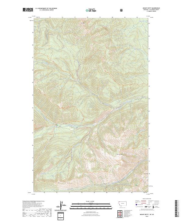
1994 Mount Hefty
Flathead County, MT
1994 Nimrod
Flathead County, MT
1994 Nyack
Flathead County, MT
1994 Nyack SW
Flathead County, MT
1994 Pagoda Mountain
Flathead County, MT
1994 Pentagon Mountain
Flathead County, MT
1994 Pioneer Ridge
Flathead County, MT
1994 Pleasant Valley Mountain
Flathead County, MT
1994 Quintonkon
Flathead County, MT
1994 Radnor
Flathead County, MT
1994 Red Meadow Lake
Flathead County, MT
1994 Red Plume Mountain
Flathead County, MT
1994 Rose Crossing
Flathead County, MT
1994 Skookoleel Creek
Flathead County, MT
1994 Spotted Bear Mountain
Flathead County, MT
1994 Stanton Lake
Flathead County, MT
1994 String Creek
Flathead County, MT
1994 Sunburst Lake
Flathead County, MT
1994 Sylvia Lake
Flathead County, MT
1994 Tally Lake
Flathead County, MT
1994 Tin Creek
Flathead County, MT
1994 Trailcreek
Flathead County, MT

1994 Tuchuck Mountain
Flathead County, MT
1994 Upper Whitefish Lake
Flathead County, MT
1994 Werner Peak
Flathead County, MT
1994 Whale Buttes
Flathead County, MT
1994 Whitcomb Peak
Flathead County, MT
1997 Dahl Lake
Flathead County, MT
1997 Lynch Lake
Flathead County, MT
1997 Mc Gregor Peak
Flathead County, MT
1997 Meadow Peak
Flathead County, MT
1997 Sunday Mountain
Flathead County, MT
1999 Murr Peak
Flathead County, MT
1999 Shroder Creek
Flathead County, MT
2011 Ahern Pass
Flathead County, MT
2011 Amphitheatre Mountain
Flathead County, MT
2011 Ashley Mountain
Flathead County, MT
2011 Beaver Lake
Flathead County, MT
2011 Big Hawk Mountain
Flathead County, MT
2011 Blacktail
Flathead County, MT
2011 Blue Grass Ridge
Flathead County, MT
2011 Bungalow Mountain
Flathead County, MT
2011 Camas Ridge East
Flathead County, MT
2011 Camas Ridge West
Flathead County, MT
2011 Capitol Mountain
Flathead County, MT
2011 Cathedral Peak
Flathead County, MT
2011 Circus Peak
Flathead County, MT
2011 Columbia Falls North
Flathead County, MT
2011 Columbia Falls South
Flathead County, MT
2011 Connor Creek
Flathead County, MT
2011 Crater Lake
Flathead County, MT
2011 Creston
Flathead County, MT
2011 Cyclone Lake
Flathead County, MT
2011 Dahl Lake
Flathead County, MT
2011 Demers Ridge
Flathead County, MT
2011 Doris Mountain
Flathead County, MT
2011 Dunsire Point
Flathead County, MT
2011 Felix Peak
Flathead County, MT
2011 Gable Peaks
Flathead County, MT
2011 Gooseberry Park
Flathead County, MT
2011 Hash Mountain
Flathead County, MT
2011 Haskill Mountain
Flathead County, MT

2011 Horseshoe Peak
Flathead County, MT
2011 Hubbart Reservoir
Flathead County, MT
2011 Huckleberry Mountain
Flathead County, MT
2011 Jewel Basin
Flathead County, MT
2011 Johnson Peak
Flathead County, MT
2011 Kintla Lake
Flathead County, MT
2011 Kintla Peak
Flathead County, MT
2011 Kofford Ridge
Flathead County, MT
2011 Lake McDonald East
Flathead County, MT
2011 Lake McDonald West
Flathead County, MT
2011 Lion Mountain
Flathead County, MT
2011 Lone Lake
Flathead County, MT
2011 Lost Creek Divide
Flathead County, MT
2011 Lynch Lake
Flathead County, MT
2011 Marmot Mountain
Flathead County, MT
2011 McGee Meadow
Flathead County, MT
2011 McGregor Peak
Flathead County, MT

2011 Meadow Creek
Flathead County, MT
2011 Meadow Peak
Flathead County, MT
2011 Moose Peak
Flathead County, MT
2011 Mount Bradley
Flathead County, MT
2011 Mount Cannon
Flathead County, MT
2011 Mount Carter
Flathead County, MT
2011 Mount Geduhn
Flathead County, MT
2011 Mount Grant
Flathead County, MT
2011 Mount Hefty
Flathead County, MT
2011 Mount Jackson
Flathead County, MT
2011 Mount Saint Nicholas
Flathead County, MT
2011 Mount Stimson
Flathead County, MT
2011 Murr Peak
Flathead County, MT
2011 Nimrod
Flathead County, MT
2011 Nyack
Flathead County, MT
2011 Nyack SW
Flathead County, MT
2011 Pagoda Mountain
Flathead County, MT
2011 Pentagon Mountain
Flathead County, MT
2011 Pioneer Ridge
Flathead County, MT
2011 Pleasant Valley Mountain
Flathead County, MT
2011 Quartz Ridge
Flathead County, MT
2011 Quintonkon
Flathead County, MT
2011 Radnor
Flathead County, MT
2011 Red Meadow Lake
Flathead County, MT
2011 Red Plume Mountain
Flathead County, MT
2011 Rose Crossing
Flathead County, MT
2011 Shroder Creek
Flathead County, MT
2011 Skookoleel Creek
Flathead County, MT
2011 Spotted Bear Mountain
Flathead County, MT
2011 Stanton Lake
Flathead County, MT
2011 String Creek
Flathead County, MT
2011 Sunburst Lake
Flathead County, MT
2011 Sunday Mountain
Flathead County, MT
2011 Sylvia Lake
Flathead County, MT
2011 Tally Lake
Flathead County, MT
2011 Tin Creek
Flathead County, MT
2011 Trailcreek
Flathead County, MT
2011 Trilobite Peak
Flathead County, MT
2011 Tuchuck Mountain
Flathead County, MT
2011 Upper Whitefish Lake
Flathead County, MT
2011 Vulture Peak
Flathead County, MT
2011 Werner Peak
Flathead County, MT
2011 Whale Buttes
Flathead County, MT
2011 Whitcomb Peak
Flathead County, MT
2014 Ahern Pass
Flathead County, MT
2014 Amphitheatre Mountain
Flathead County, MT
2014 Ashley Mountain
Flathead County, MT
2014 Beaver Lake
Flathead County, MT
2014 Big Hawk Mountain
Flathead County, MT
2014 Blacktail
Flathead County, MT

2014 Blue Grass Ridge
Flathead County, MT
2014 Bungalow Mountain
Flathead County, MT

2014 Camas Ridge East
Flathead County, MT
2014 Camas Ridge West
Flathead County, MT
2014 Capitol Mountain
Flathead County, MT
2014 Cathedral Peak
Flathead County, MT
2014 Circus Peak
Flathead County, MT
2014 Columbia Falls North
Flathead County, MT
2014 Columbia Falls South
Flathead County, MT
2014 Connor Creek
Flathead County, MT
2014 Crater Lake
Flathead County, MT
2014 Creston
Flathead County, MT
2014 Cyclone Lake
Flathead County, MT
2014 Dahl Lake
Flathead County, MT
2014 Demers Ridge
Flathead County, MT
2014 Doris Mountain
Flathead County, MT
2014 Dunsire Point
Flathead County, MT
2014 Felix Peak
Flathead County, MT
2014 Gable Peaks
Flathead County, MT
2014 Gooseberry Park
Flathead County, MT
2014 Hash Mountain
Flathead County, MT
2014 Haskill Mountain
Flathead County, MT
2014 Horseshoe Peak
Flathead County, MT
2014 Hubbart Reservoir
Flathead County, MT
2014 Huckleberry Mountain
Flathead County, MT
2014 Jewel Basin
Flathead County, MT
2014 Johnson Peak
Flathead County, MT
2014 Kintla Lake
Flathead County, MT
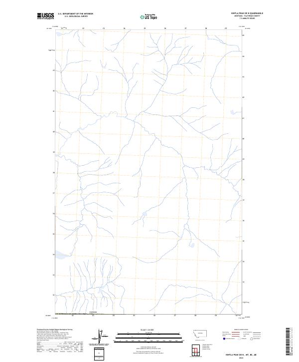
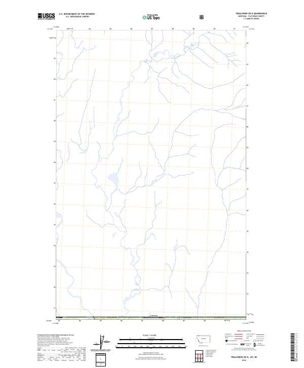
2014 Kintla Lake OE N
Flathead County, MT
2014 Kintla Peak
Flathead County, MT
2014 Kintla Peak OE N
Flathead County, MT
2014 Kofford Ridge
Flathead County, MT
2014 Lake McDonald East
Flathead County, MT
2014 Lake McDonald West
Flathead County, MT
2014 Lion Mountain
Flathead County, MT
2014 Lone Lake
Flathead County, MT
2014 Lost Creek Divide
Flathead County, MT
2014 Lynch Lake
Flathead County, MT
2014 Marmot Mountain
Flathead County, MT
2014 McGee Meadow
Flathead County, MT
2014 McGregor Peak
Flathead County, MT
2014 Meadow Creek
Flathead County, MT
2014 Meadow Peak
Flathead County, MT
2014 Moose Peak
Flathead County, MT
2014 Mount Bradley
Flathead County, MT
2014 Mount Cannon
Flathead County, MT
2014 Mount Carter
Flathead County, MT
2014 Mount Geduhn
Flathead County, MT
2014 Mount Grant
Flathead County, MT
2014 Mount Hefty
Flathead County, MT
2014 Mount Hefty OE N
Flathead County, MT
2014 Mount Jackson
Flathead County, MT
2014 Mount Saint Nicholas
Flathead County, MT
2014 Mount Stimson
Flathead County, MT
2014 Murr Peak
Flathead County, MT
2014 Nimrod
Flathead County, MT
2014 Nyack
Flathead County, MT
2014 Nyack SW
Flathead County, MT
2014 Pagoda Mountain
Flathead County, MT
2014 Pentagon Mountain
Flathead County, MT
2014 Pioneer Ridge
Flathead County, MT
2014 Pleasant Valley Mountain
Flathead County, MT
2014 Quartz Ridge
Flathead County, MT
2014 Quintonkon
Flathead County, MT
2014 Radnor
Flathead County, MT
2014 Red Meadow Lake
Flathead County, MT

2014 Red Plume Mountain
Flathead County, MT
2014 Rose Crossing
Flathead County, MT
2014 Shroder Creek
Flathead County, MT
2014 Skookoleel Creek
Flathead County, MT
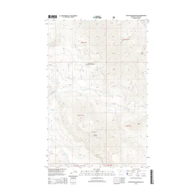
2014 Spotted Bear Mountain
Flathead County, MT
2014 Stanton Lake
Flathead County, MT
2014 String Creek
Flathead County, MT
2014 Sunburst Lake
Flathead County, MT
2014 Sunday Mountain
Flathead County, MT
2014 Sylvia Lake
Flathead County, MT
2014 Tally Lake
Flathead County, MT

2014 Tin Creek
Flathead County, MT
2014 Trailcreek
Flathead County, MT
2014 Trailcreek OE N
Flathead County, MT
2014 Trilobite Peak
Flathead County, MT
2014 Tuchuck Mountain
Flathead County, MT
2014 Tuchuck Mountain OE N
Flathead County, MT
2014 Upper Whitefish Lake
Flathead County, MT
2014 Vulture Peak
Flathead County, MT
2014 Werner Peak
Flathead County, MT
2014 Whale Buttes
Flathead County, MT
2014 Whitcomb Peak
Flathead County, MT
2017 Ahern Pass
Flathead County, MT
2017 Amphitheatre Mountain
Flathead County, MT
2017 Ashley Mountain
Flathead County, MT
2017 Beaver Lake
Flathead County, MT
2017 Big Hawk Mountain
Flathead County, MT
2017 Blacktail
Flathead County, MT
2017 Blue Grass Ridge
Flathead County, MT

2017 Bungalow Mountain
Flathead County, MT
2017 Camas Ridge East
Flathead County, MT
2017 Camas Ridge West
Flathead County, MT
2017 Capitol Mountain
Flathead County, MT
2017 Cathedral Peak
Flathead County, MT
2017 Circus Peak
Flathead County, MT
2017 Columbia Falls North
Flathead County, MT
2017 Columbia Falls South
Flathead County, MT
2017 Connor Creek
Flathead County, MT
2017 Crater Lake
Flathead County, MT
2017 Creston
Flathead County, MT
2017 Cyclone Lake
Flathead County, MT
2017 Dahl Lake
Flathead County, MT

2017 Demers Ridge
Flathead County, MT
2017 Doris Mountain
Flathead County, MT
2017 Dunsire Point
Flathead County, MT
2017 Felix Peak
Flathead County, MT
2017 Gable Peaks
Flathead County, MT
2017 Gooseberry Park
Flathead County, MT
2017 Hash Mountain
Flathead County, MT
2017 Haskill Mountain
Flathead County, MT
2017 Horseshoe Peak
Flathead County, MT
2017 Hubbart Reservoir
Flathead County, MT
2017 Huckleberry Mountain
Flathead County, MT
2017 Jewel Basin
Flathead County, MT
2017 Johnson Peak
Flathead County, MT
2017 Kintla Lake
Flathead County, MT
2017 Kintla Lake OE N
Flathead County, MT
2017 Kintla Peak
Flathead County, MT
2017 Kintla Peak OE N
Flathead County, MT
2017 Kofford Ridge
Flathead County, MT
2017 Lake McDonald East
Flathead County, MT
2017 Lake McDonald West
Flathead County, MT
2017 Lion Mountain
Flathead County, MT
2017 Lone Lake
Flathead County, MT
2017 Lost Creek Divide
Flathead County, MT
2017 Lynch Lake
Flathead County, MT
2017 Marmot Mountain
Flathead County, MT
2017 McGee Meadow
Flathead County, MT
2017 McGregor Peak
Flathead County, MT
2017 Meadow Creek
Flathead County, MT
2017 Meadow Peak
Flathead County, MT
2017 Moose Peak
Flathead County, MT
2017 Mount Bradley
Flathead County, MT
2017 Mount Cannon
Flathead County, MT
2017 Mount Carter
Flathead County, MT
2017 Mount Geduhn
Flathead County, MT

2017 Mount Grant
Flathead County, MT
2017 Mount Hefty
Flathead County, MT
2017 Mount Hefty OE N
Flathead County, MT
2017 Mount Jackson
Flathead County, MT
2017 Mount Saint Nicholas
Flathead County, MT
2017 Mount Stimson
Flathead County, MT
2017 Murr Peak
Flathead County, MT
2017 Nimrod
Flathead County, MT
2017 Nyack
Flathead County, MT
2017 Nyack SW
Flathead County, MT
2017 Pagoda Mountain
Flathead County, MT
2017 Pentagon Mountain
Flathead County, MT
2017 Pioneer Ridge
Flathead County, MT
2017 Pleasant Valley Mountain
Flathead County, MT
2017 Quartz Ridge
Flathead County, MT
2017 Quintonkon
Flathead County, MT

2017 Radnor
Flathead County, MT
2017 Red Meadow Lake
Flathead County, MT
2017 Red Plume Mountain
Flathead County, MT
2017 Rose Crossing
Flathead County, MT

2017 Shroder Creek
Flathead County, MT
2017 Skookoleel Creek
Flathead County, MT
2017 Spotted Bear Mountain
Flathead County, MT
2017 Stanton Lake
Flathead County, MT
2017 String Creek
Flathead County, MT
2017 Sunburst Lake
Flathead County, MT
2017 Sunday Mountain
Flathead County, MT
2017 Sylvia Lake
Flathead County, MT
2017 Tally Lake
Flathead County, MT
2017 Tin Creek
Flathead County, MT
2017 Trailcreek
Flathead County, MT
2017 Trailcreek OE N
Flathead County, MT
2017 Trilobite Peak
Flathead County, MT
2017 Tuchuck Mountain
Flathead County, MT
2017 Tuchuck Mountain OE N
Flathead County, MT
2017 Upper Whitefish Lake
Flathead County, MT
2017 Vulture Peak
Flathead County, MT
2017 Werner Peak
Flathead County, MT
2017 Whale Buttes
Flathead County, MT
2017 Whitcomb Peak
Flathead County, MT
2020 Ahern Pass
Flathead County, MT
2020 Amphitheatre Mountain
Flathead County, MT
2020 Ashley Mountain
Flathead County, MT
2020 Beaver Lake
Flathead County, MT
2020 Big Hawk Mountain
Flathead County, MT
2020 Blacktail
Flathead County, MT
2020 Blue Grass Ridge
Flathead County, MT
2020 Bungalow Mountain
Flathead County, MT
2020 Camas Ridge East
Flathead County, MT
2020 Camas Ridge West
Flathead County, MT
2020 Capitol Mountain
Flathead County, MT
2020 Cathedral Peak
Flathead County, MT
2020 Circus Peak
Flathead County, MT
2020 Columbia Falls North
Flathead County, MT
2020 Columbia Falls South
Flathead County, MT
2020 Connor Creek
Flathead County, MT
2020 Crater Lake
Flathead County, MT
2020 Creston
Flathead County, MT
2020 Cyclone Lake
Flathead County, MT
2020 Dahl Lake
Flathead County, MT
2020 Demers Ridge
Flathead County, MT
2020 Doris Mountain
Flathead County, MT
2020 Dunsire Point
Flathead County, MT
2020 Felix Peak
Flathead County, MT
2020 Gable Peaks
Flathead County, MT
2020 Gooseberry Park
Flathead County, MT
2020 Hash Mountain
Flathead County, MT
2020 Haskill Mountain
Flathead County, MT
2020 Horseshoe Peak
Flathead County, MT
2020 Hubbart Reservoir
Flathead County, MT
2020 Huckleberry Mountain
Flathead County, MT
2020 Jewel Basin
Flathead County, MT
2020 Johnson Peak
Flathead County, MT
2020 Kintla Lake
Flathead County, MT
2020 Kintla Lake OE N
Flathead County, MT
2020 Kintla Peak
Flathead County, MT
2020 Kintla Peak OE N
Flathead County, MT
2020 Kofford Ridge
Flathead County, MT
2020 Lake McDonald East
Flathead County, MT
2020 Lake McDonald West
Flathead County, MT
2020 Lion Mountain
Flathead County, MT
2020 Lone Lake
Flathead County, MT
2020 Lost Creek Divide
Flathead County, MT
2020 Lynch Lake
Flathead County, MT
2020 Marmot Mountain
Flathead County, MT
2020 McGee Meadow
Flathead County, MT
2020 McGregor Peak
Flathead County, MT
2020 Meadow Creek
Flathead County, MT
2020 Meadow Peak
Flathead County, MT
2020 Moose Peak
Flathead County, MT
2020 Mount Bradley
Flathead County, MT
2020 Mount Cannon
Flathead County, MT

2020 Mount Carter
Flathead County, MT
2020 Mount Geduhn
Flathead County, MT
2020 Mount Grant
Flathead County, MT
2020 Mount Hefty
Flathead County, MT
2020 Mount Hefty OE N
Flathead County, MT
2020 Mount Jackson
Flathead County, MT
2020 Mount Saint Nicholas
Flathead County, MT
2020 Mount Stimson
Flathead County, MT
2020 Murr Peak
Flathead County, MT
2020 Nimrod
Flathead County, MT
2020 Nyack
Flathead County, MT
2020 Nyack SW
Flathead County, MT
2020 Pagoda Mountain
Flathead County, MT
2020 Pentagon Mountain
Flathead County, MT
2020 Pioneer Ridge
Flathead County, MT
2020 Pleasant Valley Mountain
Flathead County, MT
2020 Quartz Ridge
Flathead County, MT
2020 Quintonkon
Flathead County, MT
2020 Radnor
Flathead County, MT
2020 Red Meadow Lake
Flathead County, MT
2020 Red Plume Mountain
Flathead County, MT
2020 Rose Crossing
Flathead County, MT
2020 Shroder Creek
Flathead County, MT
2020 Skookoleel Creek
Flathead County, MT
2020 Spotted Bear Mountain
Flathead County, MT
2020 Stanton Lake
Flathead County, MT
2020 String Creek
Flathead County, MT
2020 Sunburst Lake
Flathead County, MT
2020 Sunday Mountain
Flathead County, MT

2020 Sylvia Lake
Flathead County, MT
2020 Tally Lake
Flathead County, MT
2020 Tin Creek
Flathead County, MT
2020 Trailcreek
Flathead County, MT
2020 Trailcreek OE N
Flathead County, MT
2020 Trilobite Peak
Flathead County, MT
2020 Tuchuck Mountain
Flathead County, MT
2020 Tuchuck Mountain OE N
Flathead County, MT
2020 Upper Whitefish Lake
Flathead County, MT
2020 Vulture Peak
Flathead County, MT
2020 Werner Peak
Flathead County, MT
2020 Whale Buttes
Flathead County, MT
2020 Whitcomb Peak
Flathead County, MT
2023 Dahl Lake
Flathead County, MT
2023 Jewel Basin
Flathead County, MT
2023 Sylvia Lake
Flathead County, MT
2024 Ahern Pass
Flathead County, MT
2024 Amphitheatre Mountain
Flathead County, MT
2024 Ashley Mountain
Flathead County, MT
2024 Beaver Lake
Flathead County, MT
2024 Big Hawk Mountain
Flathead County, MT
2024 Blacktail
Flathead County, MT
2024 Blue Grass Ridge
Flathead County, MT
2024 Bungalow Mountain
Flathead County, MT
2024 Camas Ridge East
Flathead County, MT
2024 Camas Ridge West
Flathead County, MT
2024 Capitol Mountain
Flathead County, MT
2024 Cathedral Peak
Flathead County, MT
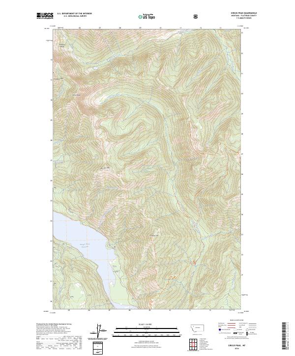
2024 Circus Peak
Flathead County, MT
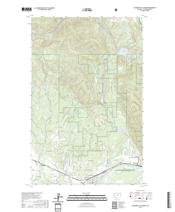
2024 Columbia Falls North
Flathead County, MT
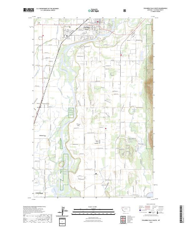
2024 Columbia Falls South
Flathead County, MT
2024 Connor Creek
Flathead County, MT
2024 Crater Lake
Flathead County, MT
2024 Creston
Flathead County, MT
2024 Cyclone Lake
Flathead County, MT
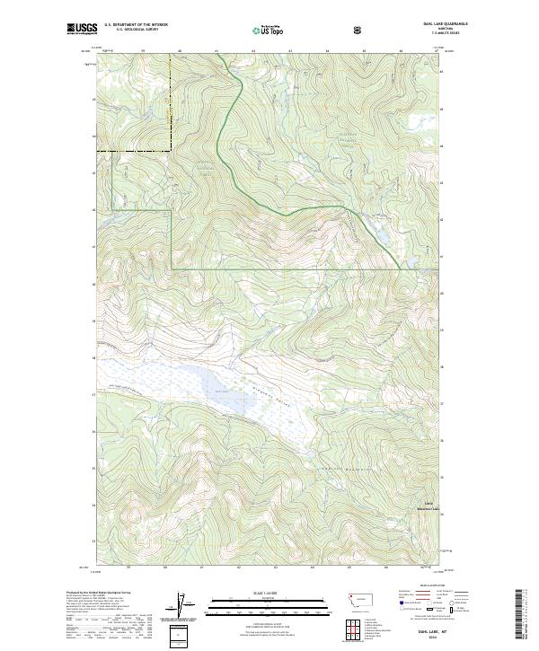
2024 Dahl Lake
Flathead County, MT
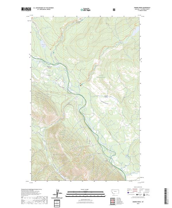
2024 Demers Ridge
Flathead County, MT
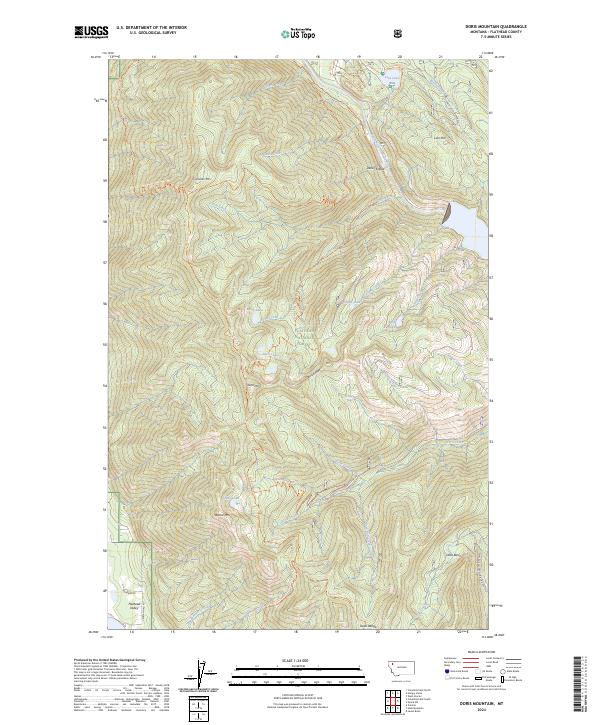
2024 Doris Mountain
Flathead County, MT
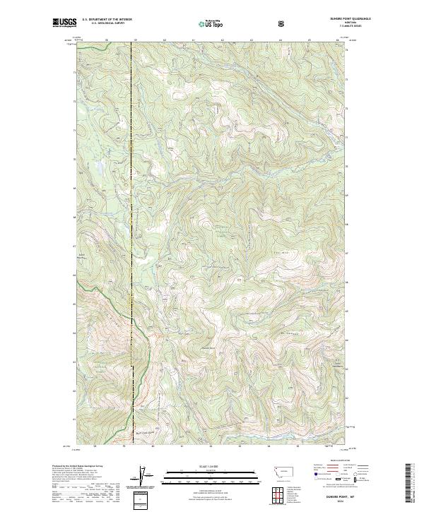
2024 Dunsire Point
Flathead County, MT
2024 Felix Peak
Flathead County, MT
2024 Gable Peaks
Flathead County, MT
2024 Gooseberry Park
Flathead County, MT
2024 Hash Mountain
Flathead County, MT
2024 Haskill Mountain
Flathead County, MT
2024 Horseshoe Peak
Flathead County, MT
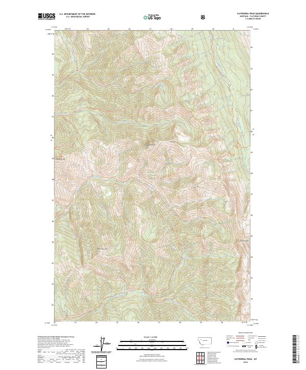
2024 Hubbart Reservoir
Flathead County, MT
2024 Huckleberry Mountain
Flathead County, MT
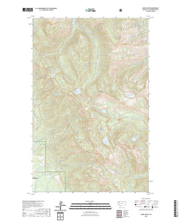
2024 Jewel Basin
Flathead County, MT
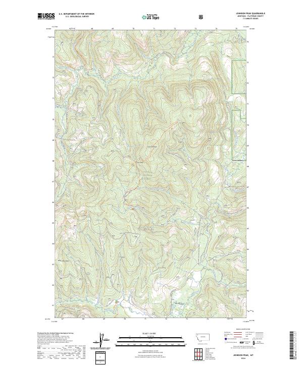
2024 Johnson Peak
Flathead County, MT
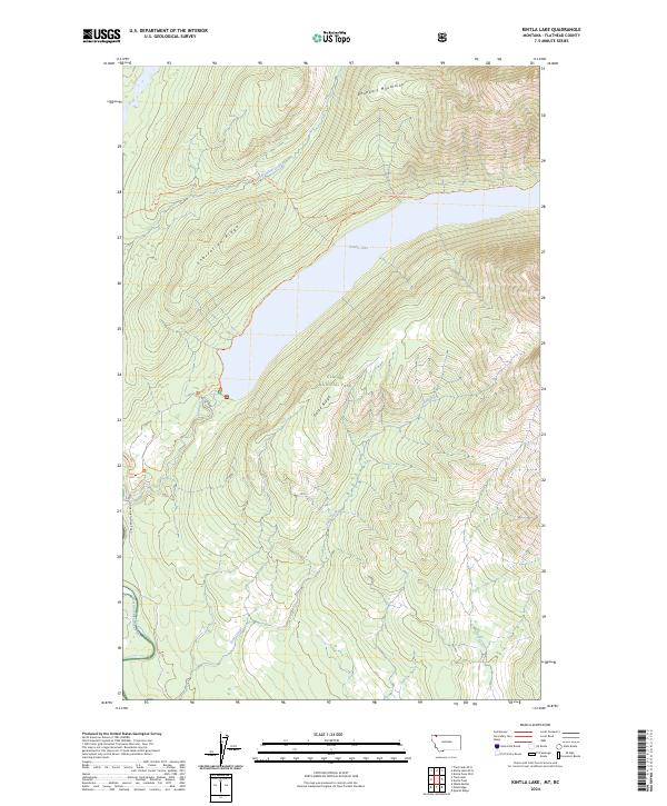
2024 Kintla Lake
Flathead County, MT
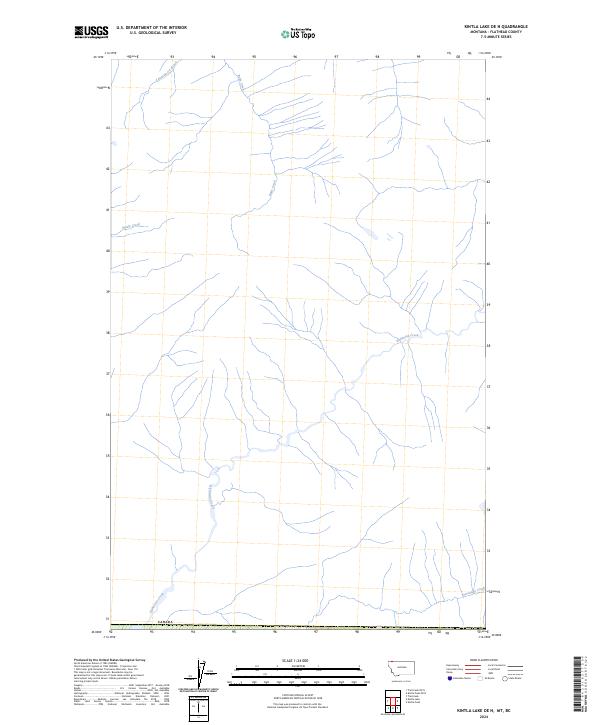
2024 Kintla Lake OE N
Flathead County, MT
2024 Kintla Peak
Flathead County, MT
2024 Kintla Peak OE N
Flathead County, MT
2024 Kofford Ridge
Flathead County, MT
2024 Lake McDonald East
Flathead County, MT
2024 Lake McDonald West
Flathead County, MT
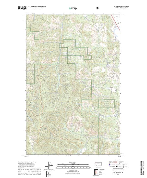
2024 Lion Mountain
Flathead County, MT
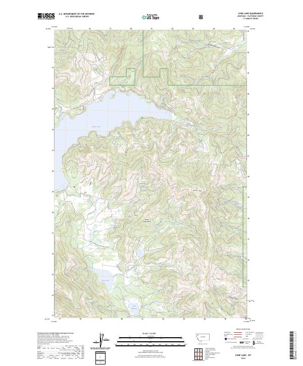
2024 Lone Lake
Flathead County, MT
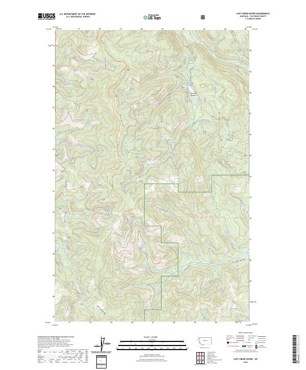
2024 Lost Creek Divide
Flathead County, MT
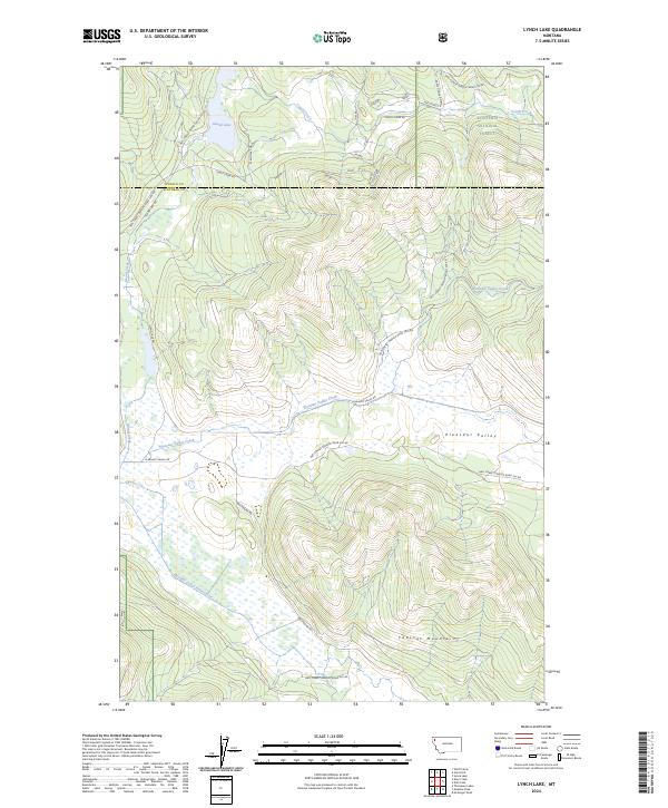
2024 Lynch Lake
Flathead County, MT
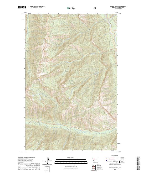
2024 Marmot Mountain
Flathead County, MT
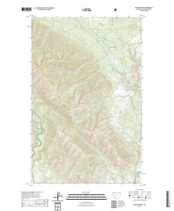
2024 McGee Meadow
Flathead County, MT
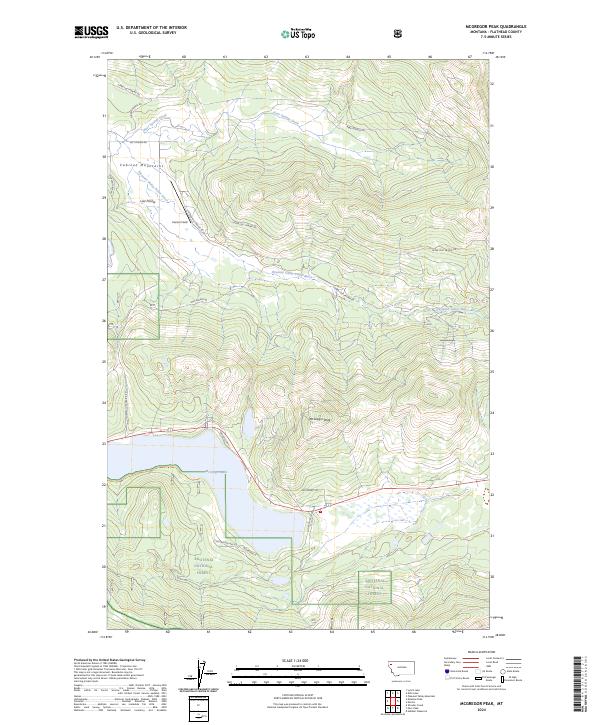
2024 McGregor Peak
Flathead County, MT
2024 Meadow Creek
Flathead County, MT
2024 Meadow Peak
Flathead County, MT
2024 Moose Peak
Flathead County, MT
2024 Mount Bradley
Flathead County, MT
2024 Mount Cannon
Flathead County, MT
2024 Mount Carter
Flathead County, MT
2024 Mount Geduhn
Flathead County, MT
2024 Mount Grant
Flathead County, MT
2024 Mount Hefty
Flathead County, MT
2024 Mount Hefty OE N
Flathead County, MT
2024 Mount Jackson
Flathead County, MT
2024 Mount Saint Nicholas
Flathead County, MT
2024 Mount Stimson
Flathead County, MT
2024 Murr Peak
Flathead County, MT
2024 Nimrod
Flathead County, MT
2024 Nyack
Flathead County, MT
2024 Nyack SW
Flathead County, MT
2024 Pagoda Mountain
Flathead County, MT
2024 Pentagon Mountain
Flathead County, MT
2024 Pioneer Ridge
Flathead County, MT
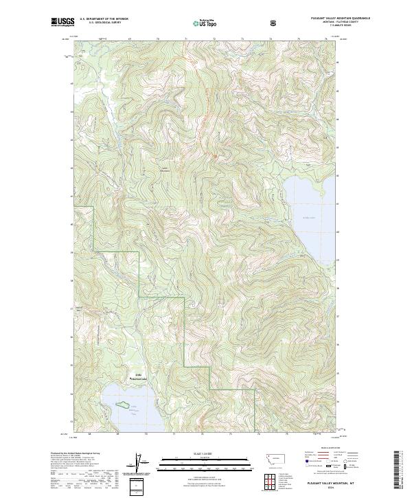
2024 Pleasant Valley Mountain
Flathead County, MT
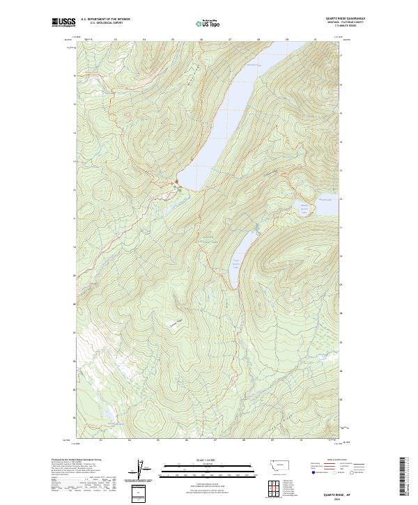
2024 Quartz Ridge
Flathead County, MT
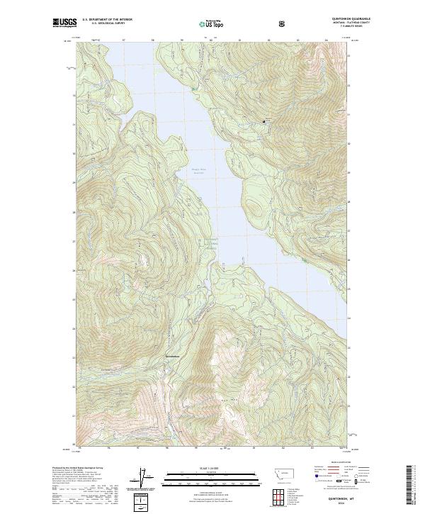
2024 Quintonkon
Flathead County, MT
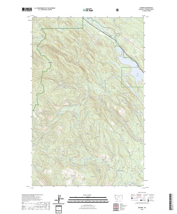
2024 Radnor
Flathead County, MT
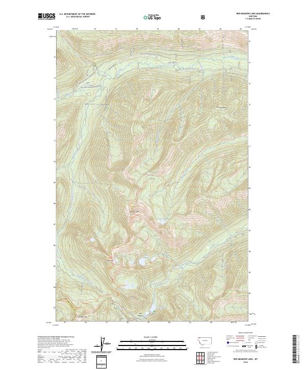
2024 Red Meadow Lake
Flathead County, MT
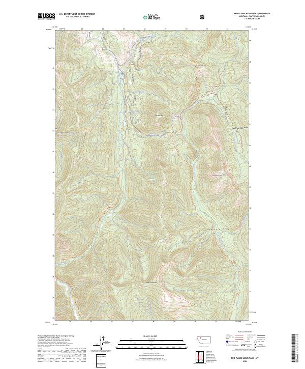
2024 Red Plume Mountain
Flathead County, MT
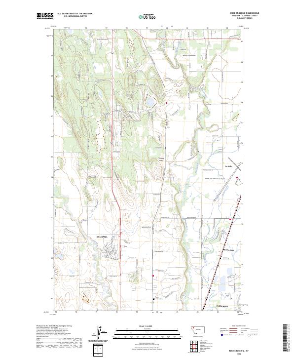
2024 Rose Crossing
Flathead County, MT
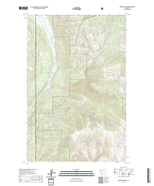
2024 Shroder Creek
Flathead County, MT
2024 Skookoleel Creek
Flathead County, MT
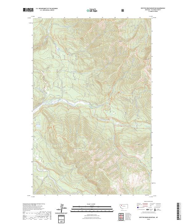
2024 Spotted Bear Mountain
Flathead County, MT
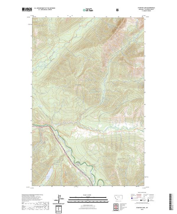
2024 Stanton Lake
Flathead County, MT
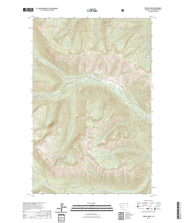
2024 String Creek
Flathead County, MT
2024 Sunburst Lake
Flathead County, MT
2024 Sunday Mountain
Flathead County, MT
2024 Sylvia Lake
Flathead County, MT
2024 Tally Lake
Flathead County, MT
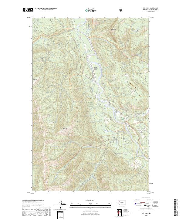
2024 Tin Creek
Flathead County, MT
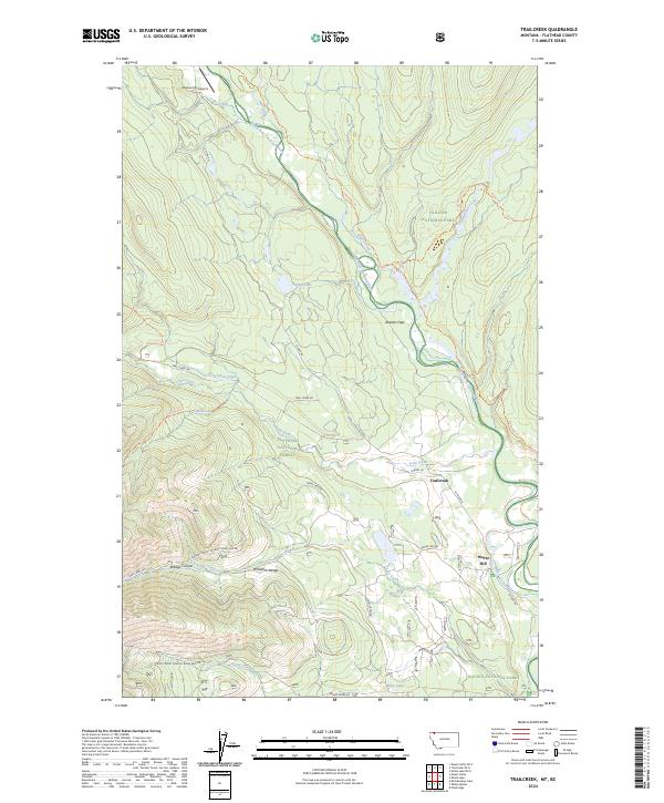
2024 Trailcreek
Flathead County, MT
2024 Trailcreek OE N
Flathead County, MT
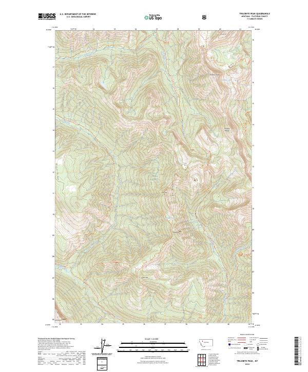
2024 Trilobite Peak
Flathead County, MT
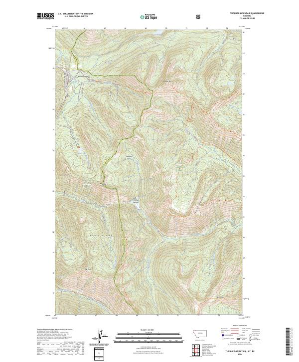
2024 Tuchuck Mountain
Flathead County, MT
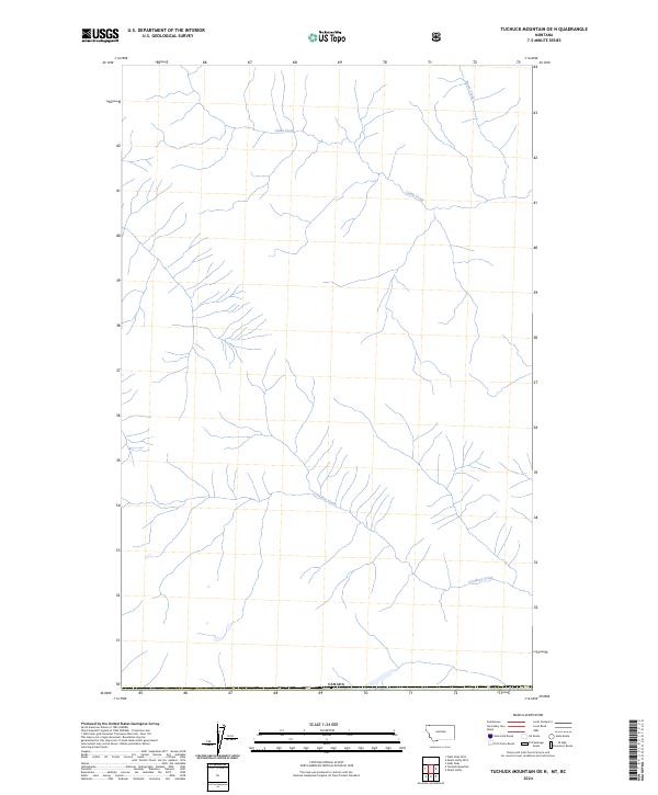
2024 Tuchuck Mountain OE N
Flathead County, MT
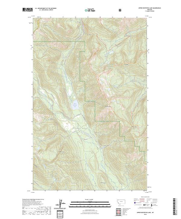
2024 Upper Whitefish Lake
Flathead County, MT
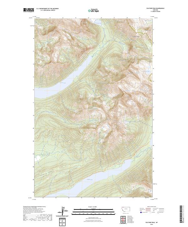
2024 Vulture Peak
Flathead County, MT
2024 Werner Peak
Flathead County, MT
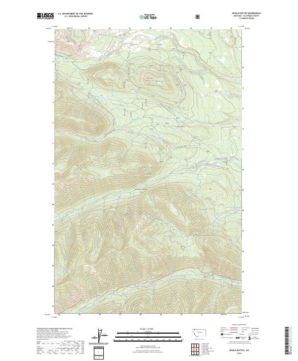
2024 Whale Buttes
Flathead County, MT
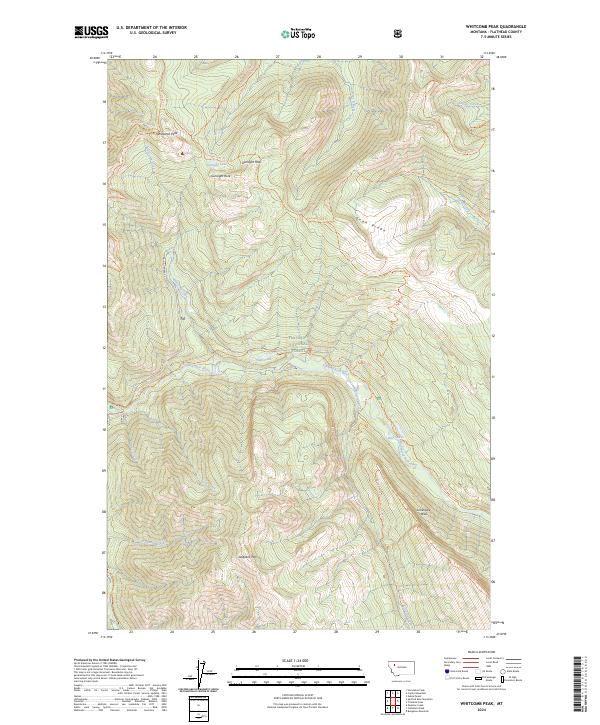
2024 Whitcomb Peak
Flathead County, MT