2022 Map of Dancyville
USGS Topo · Published 2022About this map
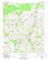
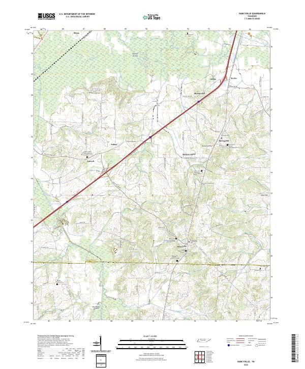
Dancyville serves as the focal point for this rural Tennessee landscape, which sits along the border of Haywood and Fayette Counties. The area is characterized by low-lying wetlands such as Hatchie Bottom in the north and Big Muddy Bottom to the south, separated by ridges where several small communities and many historic congregations were established. Genealogists will find a wealth of burial grounds, including the Dancyville Presbyterian Cem, Spring Hill United Methodist Cem, and the uniquely named Scratchunder Cem. These sites, along with churches like the Saint John Missionary Baptist Church, trace the social and spiritual fabric of the region. The map shows a clear pattern of settlement following higher ground between the river systems, with landmarks like Morton Hill and Richmond Hill providing elevation above the surrounding Big Muddy Canal and Prairie Cr.
Find a feature on this map
87 named features on this map. Tap any name to fly to it.
Don’t see what you’re looking for? This feature index may not catch every label — zoom into the map to look around manually.
Map Details
Editions of this 2022 Dancyville Map
This is the sole edition of this map. No revisions or reprints were ever made.