
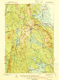
1941 Map of Danforth
USGS Topo · Published 1941About this map
Danforth serves as the focal point of this 1941 survey, situated at the junction where the Canadian Pacific and Maine Central railroads converge. The landscape is defined by the extensive Baskahegan Stream and the sprawling waters of Baskahegan Lake and Chiputneticook Lakes along the international border with New Brunswick. Settlement patterns in the late 1930s reveal a network of rural schoolhouses like Bonner Sch and Butterfield Sch, alongside localized communities such as Irish Settlement and Cranetown. The presence of numerous named camps, including Gillis Camp and Deadman Camp, highlights the region's reliance on timber and seasonal activities. Transportation is anchored by the rail lines and unique roadway landmarks like Properly Turn and the Two Mile Curve, while the terrain is marked by prominent heights such as Stetson Mountain and Snow Mountain.
Find a feature on this map
141 named features on this map. Tap any name to fly to it.
Don’t see what you’re looking for? This feature index may not catch every label — zoom into the map to look around manually.
Map Details
Editions of this 1941 Danforth Map
2 editions found
Other maps of this area

1931 · Springfield
USGS Topo · 1:48,000

1934 · Springfield
USGS Topo · 1:62,500

1940 · Danforth
USGS Topo · 1:62,500

1940 · Amity
USGS Topo · 1:62,500

1940 · Waite
USGS Topo · 1:62,500

1940 · Forest
USGS Topo · 1:62,500

1941 · Amity
USGS Topo · 1:62,500

1941 · Scraggly Lake
USGS Topo · 1:62,500

1941 · Mattawamkeag Lake
USGS Topo · 1:62,500

1941 · Wytopitlock
USGS Topo · 1:62,500