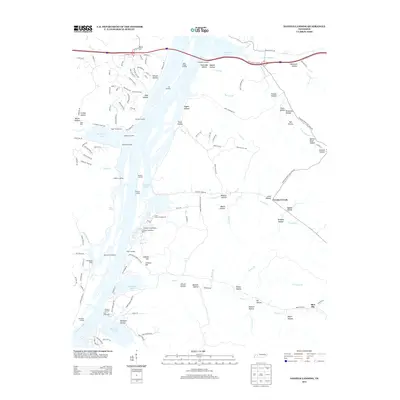
2013 Map of Daniels Landing
USGS Topo · Published 2013About this map
Kentucky Lake dominates the western half of this landscape, its shoreline dotted with various boat docks and landings that define the area's recreational and transit character. Points of access such as Daniels Landing, Walkers Landing, and Nix Landing serve as primary nodes for navigating the reservoir, while more developed sites like the Sugar Tree Marina and Ponderosa Dock cater to local boaters. The topography to the east is deeply incised by a network of drainage systems, most notably around Crooked Creek and Roan Cr. This region is characterized by dozens of named valleys, including Pigpen Hollow, McGruder Hollow, and Negro Hollow, reflecting a long history of local naming conventions for the various draws and ridges. Small settlements like Ward Hill and Blue Sky anchor the more level terrain, while the heights of Cotham Hill offer a vantage point over the southern reaches of the lake near Opossum Hollow.
Find a feature on this map
137 named features on this map. Tap any name to fly to it.
Don’t see what you’re looking for? This feature index may not catch every label — zoom into the map to look around manually.
Map Details
Editions of this 2013 Daniels Landing Map
This is the sole edition of this map. No revisions or reprints were ever made.
Other maps of this area

1936 · Hurricane Mills
USGS Topo · 1:24,000

1936 · Pine View
USGS Topo · 1:24,000

1936 · Daniels Landing
USGS Topo · 1:24,000

1936 · Chestnut Grove
USGS Topo · 1:24,000

1936 · Jeannette
USGS Topo · 1:24,000

1936 · Sugar Tree
USGS Topo · 1:24,000

1936 · Lobelville
USGS Topo · 1:24,000

1936 · Rockport
USGS Topo · 1:24,000

1936 · Hustburg
USGS Topo · 1:24,000

1949 · Daniels Landing
USGS Topo · 1:24,000