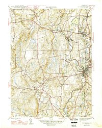
1946 Map of Danielson
USGS Topo · Published 1946About this map
The Quinebaug River corridor serves as the industrial and social backbone of this Windham County region shortly after World War II. Large concentrations of settlement are visible at Danielson and Dayville, where the New York New Haven and Hartford railroad parallels the river's path. The map reveals a landscape transitioning from rural agricultural hubs like Brooklyn and Pomfret Landing to industrial pockets such as Attawaugan and Goodyear.
Find a feature on this map
59 named features on this map. Tap any name to fly to it.
Don’t see what you’re looking for? This feature index may not catch every label — zoom into the map to look around manually.
Map Details
Editions of this 1946 Danielson Map
2 editions found
Other maps of this area

1889 · Putnam
USGS Topo · 1:62,500

1889 · Moosup
USGS Topo · 1:62,500

1892 · Woodstock
USGS Topo · 1:62,500

1892 · Norwich
USGS Topo · 1:62,500

1893 · Putnam
USGS Topo · 1:62,500

1893 · Moosup
USGS Topo · 1:62,500

1919 · Putnam
USGS Topo · 1:62,500

1920 · Moosup
USGS Topo · 1:62,500

1921 · Woodstock
USGS Topo · 1:62,500

1943 · Plainfield
USGS Topo · 1:31,680