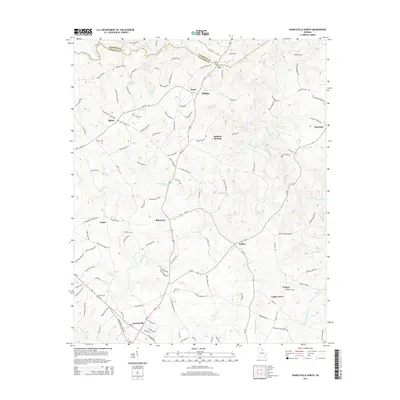
2014 Map of Danielsville North
USGS Topo · Published 2014About this map
The Broad River and its numerous tributaries, including Scull Shoal Cr and Bluestone Cr, carve through this section of the Georgia Piedmont. The northern outskirts of Danielsville are visible at the bottom of the map, while the historic area of Madison Springs sits centrally, reflecting the region's long-standing connection to local water sources. Small rural communities like Bluestone, Bond, and Phillips are linked by a network of winding roads, many bearing local family names such as Jim Grizzle Rd and Elridge Crowe Rd. Family history is anchored by several burial sites, including Ware Cem and Adams Cem. The map illustrates a landscape where agricultural land is shaped by the complex drainage patterns of the Hudson River and Nails Creek, maintaining a pattern of dispersed settlement and river-valley orientation common to this part of the state.
Find a feature on this map
131 named features on this map. Tap any name to fly to it.
Don’t see what you’re looking for? This feature index may not catch every label — zoom into the map to look around manually.
Map Details
Editions of this 2014 Danielsville North Map
This is the sole edition of this map. No revisions or reprints were ever made.
Other maps of this area

1891 · Carnesville
USGS Topo · 1:125,000

1954 · Greenville
USGS Topo · 1:250,000

1958 · Greenville
USGS Topo · 1:250,000

1958 · Danielsville
USGS Topo · 1:62,500

1959 · Carnesville
USGS Topo · 1:24,000

1959 · Royston
USGS Topo · 1:24,000

1964 · Ila
USGS Topo · 1:24,000

1964 · Ashland
USGS Topo · 1:24,000

1964 · Hull
USGS Topo · 1:24,000
1972 · Danielsville South
USGS Topo · 1:24,000