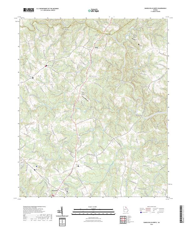
2024 Map of Danielsville North
USGS Topo · Published 2024About this map
The Broad River and its numerous tributaries, including Scull Shoal Creek, Bluestone Creek, and Masons Mill Creek, define the landscape of northern Madison County. This survey illustrates the rural connectivity between the northern reaches of Danielsville and the smaller community of Bond, showing a network of family-named roads like Mullins Creek Rd and Holloway Rd. Historic river crossings are noted at Bragg Ferry and Daniels Ferry, indicating old transportation patterns that predate modern bridges along the Broad River. Local history is deeply embedded in the land through several burial grounds such as Shiloh Cem, Ware Cem, and Hannahs Creek Cem. The transition from agriculture to small-scale aviation is also evident with the presence of Hannah Creek Airport and Papas Place Airport, marking modern utility within this traditional Piedmont setting.
Find a feature on this map
121 named features on this map. Tap any name to fly to it.
Don’t see what you’re looking for? This feature index may not catch every label — zoom into the map to look around manually.
Map Details
Editions of this 2024 Danielsville North Map
This is the sole edition of this map. No revisions or reprints were ever made.
Other maps of this area

1891 · Carnesville
USGS Topo · 1:125,000

1954 · Greenville
USGS Topo · 1:250,000

1958 · Greenville
USGS Topo · 1:250,000

1958 · Danielsville
USGS Topo · 1:62,500

1959 · Carnesville
USGS Topo · 1:24,000

1959 · Royston
USGS Topo · 1:24,000

1964 · Ila
USGS Topo · 1:24,000

1964 · Ashland
USGS Topo · 1:24,000

1964 · Hull
USGS Topo · 1:24,000
1972 · Danielsville South
USGS Topo · 1:24,000