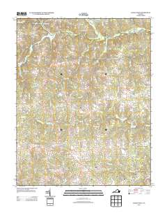
2013 Map of Danieltown
USGS Topo · Published 2013About this map
Danieltown serves as a central point in this part of Brunswick County, where the landscape is defined by small crossroads settlements and the headwaters of numerous creeks. The area is characterized by traditional gathering places like Barrows Store, Edmunds Store, and the curiously named Tobacco and Vote. To the north, the Fort Pickett Military Reserve occupies a significant portion of the terrain, influenced by the proximity of the Nottoway River.
Find a feature on this map
65 named features on this map. Tap any name to fly to it.
Don’t see what you’re looking for? This feature index may not catch every label — zoom into the map to look around manually.
Map Details
Editions of this 2013 Danieltown Map
This is the sole edition of this map. No revisions or reprints were ever made.
Other maps of this area

1891 · Farmville
USGS Topo · 1:125,000

1893 · Farmville
USGS Topo · 1:125,000

1897 · Amelia
USGS Topo · 1:125,000

1918 · Lawrenceville
USGS Topo · 1:62,500

1920 · Lawrenceville
USGS Topo · 1:48,000

1921 · Lawrenceville
USGS Topo · 1:62,500

1942 · Lawrenceville
USGS Topo · 1:62,500

1943 · Richmond
USGS Topo · 1:250,000

1947 · Roanoke
USGS Topo · 1:250,000

1949 · Richmond
USGS Topo · 1:250,000