
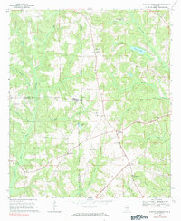
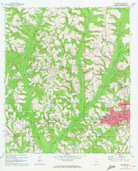
1968 Map of Danleys Crossroads
USGS Topo · Published 1970About this map
Danleys Crossroads serves as a central point in this rural Southeast Alabama landscape, where the borders of Coffee, Crenshaw, and Covington Counties converge. The area is defined by a dense network of small communities and country churches that anchored social life in the late 1960s, including Friendship, Curtis, and Pine Level. These settlements are linked by winding roads that traverse a terrain cut by numerous waterways like Pigeon Creek, Knot Creek, and Moores Creek.
Find a feature on this map
35 named features on this map. Tap any name to fly to it.
Don’t see what you’re looking for? This feature index may not catch every label — zoom into the map to look around manually.
Map Details
Editions of this 1968 Danleys Crossroads Map
2 editions found
Other maps of this area

1953 · Andalusia
USGS Topo · 1:250,000

1957 · Andalusia
USGS Topo · 1:250,000
1968 · Ino
USGS Topo · 1:24,000
1968 · Bluff Springs
USGS Topo · 1:24,000

1968 · Opp East
USGS Topo · 1:24,000
1968 · Elba
USGS Topo · 1:24,000

1968 · Bullock
USGS Topo · 1:24,000

1971 · Dozier
USGS Topo · 1:24,000

1971 · Brantley
USGS Topo · 1:24,000
1971 · Opp West
USGS Topo · 1:24,000