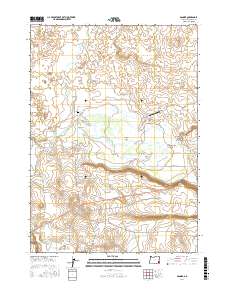
2017 Map of Danner
USGS Topo · Published 2017About this map
The Jean Baptiste Charbonneau Grave marks a site of significant historical weight near the small settlement of Danner. This landscape in Malheur County is defined by a sophisticated network of water management, including the S Antelope Canal and N Antelope Canal, which feed into the expansive Antelope Reservoir. These features, along with Rock Creek Reservoir, illustrate the critical role of irrigation in sustaining ranching and habitation in this corner of Oregon.
Find a feature on this map
35 named features on this map. Tap any name to fly to it.
Don’t see what you’re looking for? This feature index may not catch every label — zoom into the map to look around manually.
Map Details
Editions of this 2017 Danner Map
This is the sole edition of this map. No revisions or reprints were ever made.
Other maps of this area

1955 · Jordan Valley
USGS Topo · 1:250,000

1955 · Boise
USGS Topo · 1:250,000

1957 · Jordan Valley
USGS Topo · 1:250,000

1958 · Boise
USGS Topo · 1:250,000

1958 · Jordan Valley
USGS Topo · 1:250,000

1962 · Boise
USGS Topo · 1:250,000
1969 · Little Grassy Mountain
USGS Topo · 1:24,000

1969 · Jordan Craters South
USGS Topo · 1:24,000
1969 · Juniper Ridge
USGS Topo · 1:24,000

1969 · Cow Lakes
USGS Topo · 1:24,000