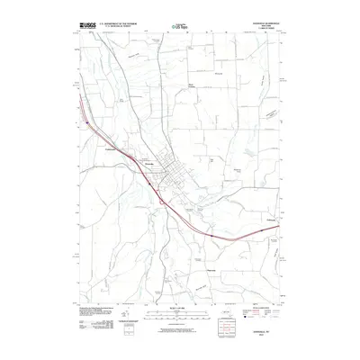
2010 Map of Dansville
USGS Topo · Published 2010About this map
Dansville sits at the confluence of several glacial valleys and waterways, anchored by the winding course of Canaseraga Creek and Stony Brook. The landscape is defined by deep geological features like Patterson Gully, Sponable Gully, and Whiteman Gully, which cut through the elevated terrain of East Hill and Strong Hill. This area is particularly noteworthy for its concentration of burial grounds, from the Dutch Cemetery in the north to the Bluff Point Cemetery overlooking the southern creek bends, providing a rich spatial record for genealogical research.
Find a feature on this map
77 named features on this map. Tap any name to fly to it.
Don’t see what you’re looking for? This feature index may not catch every label — zoom into the map to look around manually.
Map Details
Editions of this 2010 Dansville Map
This is the sole edition of this map. No revisions or reprints were ever made.
Other maps of this area

1902 · Wayland
USGS Topo · 1:62,500

1904 · Wayland
USGS Topo · 1:62,500

1905 · Nunda
USGS Topo · 1:62,500

1915 · Hornell
USGS Topo · 1:62,500

1916 · Canaseraga
USGS Topo · 1:62,500

1918 · Hornell
USGS Topo · 1:62,500

1940 · Canaseraga
USGS Topo · 1:62,500

1942 · Springwater
USGS Topo · 1:31,680

1942 · Wayland
USGS Topo · 1:31,680

1942 · Dansville
USGS Topo · 1:31,680