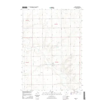
2015 Map of Dante
USGS Topo · Published 2015About this map
Dante sits at the center of this 2015 survey, serving as a primary point of reference in a landscape shaped by structured townships and section lines. The topography is defined by the winding course of Choteau Creek, which meanders through the southern and western portions of the quadrangle. North of the settlement, Lake Dante provides a prominent water feature, situated near the intersection of Dante Lake Rd and local agricultural thoroughfares. This area, divided among t96n r62w and adjacent townships, maintains a distinct rural character typical of the Charles Mix County plains. Genealogists and local historians can locate United Cem in the northern section of the map, a key landmark for tracing family history in this portion of South Dakota.
Find a feature on this map
11 named features on this map. Tap any name to fly to it.
Don’t see what you’re looking for? This feature index may not catch every label — zoom into the map to look around manually.
Map Details
Editions of this 2015 Dante Map
This is the sole edition of this map. No revisions or reprints were ever made.
Other maps of this area

1955 · Mitchell
USGS Topo · 1:250,000

1955 · O'Neill
USGS Topo · 1:250,000

1959 · O'Neill
USGS Topo · 1:250,000

1959 · Mitchell
USGS Topo · 1:250,000

1964 · Wagner NE
USGS Topo · 1:24,000

1964 · Wagner
USGS Topo · 1:24,000

1964 · Lynch NE
USGS Topo · 1:24,000

1969 · O'Neill
USGS Topo · 1:250,000
1972 · Niobrara NW
USGS Topo · 1:24,000
1972 · Dante
USGS Topo · 1:24,000