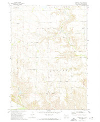
1972 Map of Niobrara NW
USGS Topo · Published 1974About this map
The Old Indian Treaty Boundary carves a diagonal line across this landscape, marking a legacy of land division within the Yankton Indian Reservation. Situated in the townships of Lawrence, Lone Tree, and Rouse, the area is defined by its rural infrastructure and water sources. These include several artesian Flowing Wells and the drainage of Choteau Creek, Spring Creek, and Bull Creek.
Find a feature on this map
17 named features on this map. Tap any name to fly to it.
Don’t see what you’re looking for? This feature index may not catch every label — zoom into the map to look around manually.
Map Details
Editions of this 1972 Niobrara NW Map
This is the sole edition of this map. No revisions or reprints were ever made.
Other maps of this area

1950 · Niobrara
USGS Topo · 1:24,000

1950 · Verdel
USGS Topo · 1:24,000

1950 · Monowi
USGS Topo · 1:24,000

1952 · Monowi
USGS Topo · 1:24,000

1955 · Mitchell
USGS Topo · 1:250,000

1955 · O'Neill
USGS Topo · 1:250,000

1959 · O'Neill
USGS Topo · 1:250,000

1959 · Mitchell
USGS Topo · 1:250,000

1964 · Wagner
USGS Topo · 1:24,000

1964 · Lynch NE
USGS Topo · 1:24,000