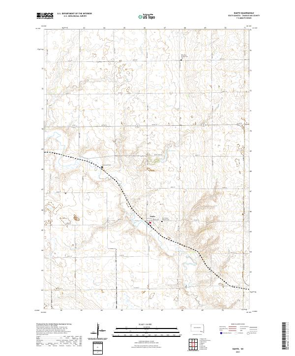
2021 Map of Dante
USGS Topo · Published 2021About this map
Dante sits at the heart of this prairie landscape, serving as a focal point for the surrounding agricultural community in Charles Mix County. The settlement is anchored by local landmarks such as Saint Mary's Catholic Cem and the nearby Bohemian Presbyterian Cem, which reflect the European heritage of the early settlers who established these rural parishes. The meandering path of Choteau Creek and its smaller branch, Choteau Cr, define the drainage of the region, winding past Lake Dante and through a grid of section-line roads like Dante Lake Rd. This network of local thoroughfares, including Warren Ave and Pearl St, connects the town to outlying farms and older burial grounds like Greenwood Cem, illustrating a persistent pattern of rural life and land use that has endured for generations.
Find a feature on this map
34 named features on this map. Tap any name to fly to it.
Don’t see what you’re looking for? This feature index may not catch every label — zoom into the map to look around manually.
Map Details
Editions of this 2021 Dante Map
This is the sole edition of this map. No revisions or reprints were ever made.
Other maps of this area

1955 · Mitchell
USGS Topo · 1:250,000

1955 · O'Neill
USGS Topo · 1:250,000

1959 · O'Neill
USGS Topo · 1:250,000

1959 · Mitchell
USGS Topo · 1:250,000

1964 · Wagner NE
USGS Topo · 1:24,000

1964 · Wagner
USGS Topo · 1:24,000

1964 · Lynch NE
USGS Topo · 1:24,000

1969 · O'Neill
USGS Topo · 1:250,000
1972 · Niobrara NW
USGS Topo · 1:24,000
1972 · Dante
USGS Topo · 1:24,000