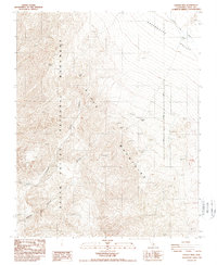
1988 Map of Dantes View
USGS Topo · Published 1988About this map
Dantes View provides a high-altitude vantage point over the steep western escarpment of the Black Mountains in Inyo County. This 1980s topographical record captures the arid complexity of the Death Valley National Monument, where dramatic elevation drops lead into deep drainage features like Coffin Canyon and Copper Canyon. The landscape is defined by the sharp contrast between the mountain peaks and the broad expanse of the Greenwater Valley to the east.
Find a feature on this map
11 named features on this map. Tap any name to fly to it.
Don’t see what you’re looking for? This feature index may not catch every label — zoom into the map to look around manually.
Map Details
Editions of this 1988 Dantes View Map
2 editions found
Other maps of this area

1908 · Furnace Creek
USGS Topo · 1:250,000

1910 · Furnace Creek
USGS Topo · 1:250,000

1948 · Death Valley
USGS Topo · 1:250,000

1951 · Funeral Peak
USGS Topo · 1:62,500

1952 · Furnace Creek
USGS Topo · 1:62,500

1952 · Ryan
USGS Topo · 1:62,500

1952 · Bennetts Well
USGS Topo · 1:62,500

1954 · Death Valley
USGS Topo · 1:250,000

1956 · Death Valley
USGS Topo · 1:250,000

1957 · Death Valley
USGS Topo · 1:250,000