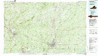
1984 Map of Danville
USGS Topo · Published 1984About this map
Danville and Martinsville serve as the primary urban anchors in this 1984 survey, which spans the rolling borderlands of south-central Virginia and north-central North Carolina. The landscape is defined by the winding course of the Dan River, which connects several industrial and textile centers including Eden and Fieldale. The region's educational and civic infrastructure is prominently mapped, featuring institutions such as Danville Community College and Averett College, alongside the Patrick Henry Monument near the southern border.
Find a feature on this map
203 named features on this map. Tap any name to fly to it.
Don’t see what you’re looking for? This feature index may not catch every label — zoom into the map to look around manually.
Map Details
Editions of this 1984 Danville Map
This is the sole edition of this map. No revisions or reprints were ever made.
Other maps of this area

1890 · Roanoke
USGS Topo · 1:125,000

1890 · Christiansburg
USGS Topo · 1:125,000

1891 · Roanoke
USGS Topo · 1:125,000

1892 · Lynchburg
USGS Topo · 1:125,000

1892 · Appomattox
USGS Topo · 1:125,000

1921 · Chatham
USGS Topo · 1:48,000

1922 · Callands
USGS Topo · 1:48,000

1923 · Danville
USGS Topo · 1:48,000

1923 · Chatham
USGS Topo · 1:62,500

1924 · Martinsville
USGS Topo · 1:48,000