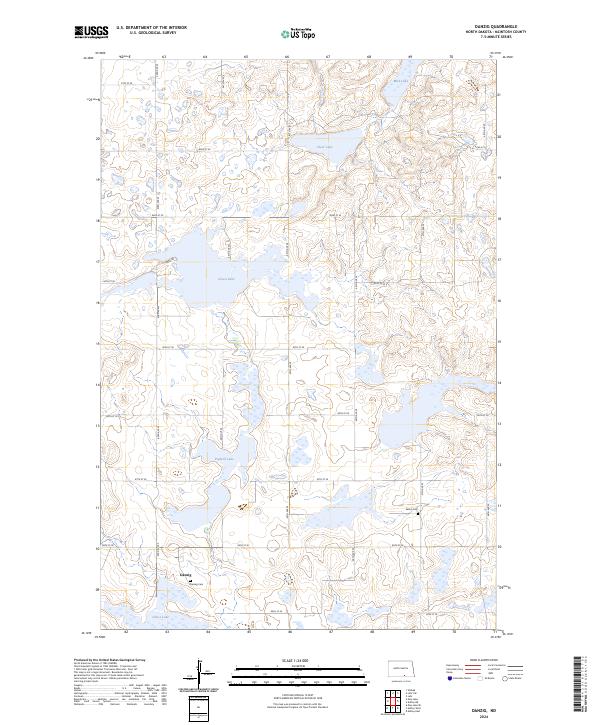
2024 Map of Danzig
USGS Topo · Published 2024About this map
Danzig anchors this pocket of the North Dakota prairie, where the landscape is defined by the numerous glacial basins of the McIntosh County Waterfowl Production Area. This environment is a patchwork of wetlands and lakes, including the prominent Green Lake, Clear Lake, and Pudwill Lake. The grid of section lines is marked by rural infrastructure such as Salem Cem and the Danzig Cem, which serve as quiet markers of the community's early settlement history. The terrain is characterized by these depressions and rises, creating a complex hydrology where smaller water bodies like Mud Lake and Goose Lake dot the countryside. The road network, composed of numerical designations like 45th Ave SE and 84th St SE, illustrates the systematic organization of this agricultural and conservation-focused region.
Find a feature on this map
29 named features on this map. Tap any name to fly to it.
Don’t see what you’re looking for? This feature index may not catch every label — zoom into the map to look around manually.
Map Details
Editions of this 2024 Danzig Map
This is the sole edition of this map. No revisions or reprints were ever made.
Other maps of this area

1953 · Jamestown
USGS Topo · 1:250,000

1956 · Jamestown
USGS Topo · 1:250,000

1982 · Danzig
USGS Topo · 1:24,000

1982 · Ashley East
USGS Topo · 1:24,000

1982 · May Lake
USGS Topo · 1:24,000
1982 · May Lake SE
USGS Topo · 1:24,000

1982 · Ashley NE
USGS Topo · 1:24,000

1982 · Lehr SW
USGS Topo · 1:24,000
1982 · Ashley West
USGS Topo · 1:24,000

1982 · Wishek
USGS Topo · 1:24,000