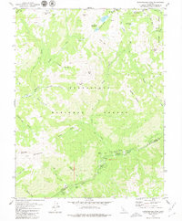
1979 Map of Dardanelles Cone
USGS Topo · Published 1979About this map
Stanislaus National Forest defines this high-elevation landscape along the border of Alpine and Tuolumne counties. The dramatic volcanic formations of The Dardanelles and the prominent Dardanelles Cone anchor the southwest, while a network of peaks like Airola Peak, Iceberg Peak, and Folger Peak create a jagged skyline to the north. This 1970s survey captures the region's recreational infrastructure, featuring sites such as Liahona Camp, Sand Flat Campground, and the Peaceful Pines Amphitheater. The era's focus on wilderness preservation and access is evident through the path of the Pacific Crest National Scenic Trail and various pack trails including the Marshall Canyon Trail and Gardner Meadow Trail. High alpine water sources including Highland Lakes, Half Moon Lake, and the winding Clark Fork suggest a landscape primarily used for seasonal grazing and outdoor tourism before the late 20th-century shifts in forest management.
Find a feature on this map
39 named features on this map. Tap any name to fly to it.
Don’t see what you’re looking for? This feature index may not catch every label — zoom into the map to look around manually.
Map Details
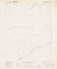
Editions of this 1979 Dardanelles Cone Map
2 editions found
Other maps of this area

1889 · Markleeville
USGS Topo · 1:125,000

1891 · Markleeville
USGS Topo · 1:125,000

1893 · Markleeville
USGS Topo · 1:125,000

1896 · Dardanelles
USGS Topo · 1:125,000

1898 · Dardanelles
USGS Topo · 1:125,000

1948 · Walker Lake
USGS Topo · 1:250,000

1956 · Topaz Lake
USGS Topo · 1:62,500

1956 · Markleeville
USGS Topo · 1:62,500

1956 · Dardanelles Cone
USGS Topo · 1:62,500

1956 · Sonora Pass
USGS Topo · 1:62,500