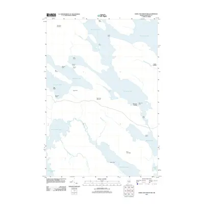
2011 Map of Dark Cove Mountain
USGS Topo · Published 2011About this map
West Grand Lake and Sysladobsis Lake dominate this portion of the Downeast interior, where a complex network of waterways facilitated early transport and timber movement. The presence of Dobsis Dam and Dennison Portage between the major lakes highlights the importance of controlling and navigating these waters, while seasonal settlements like The Birches and The Pines suggest the area's long-standing role as a destination for outdoor recreation and logging operations.
Find a feature on this map
32 named features on this map. Tap any name to fly to it.
Don’t see what you’re looking for? This feature index may not catch every label — zoom into the map to look around manually.
Map Details
Editions of this 2011 Dark Cove Mountain Map
This is the sole edition of this map. No revisions or reprints were ever made.
Other maps of this area

1931 · Springfield
USGS Topo · 1:48,000

1932 · Nicatous Lake
USGS Topo · 1:48,000

1934 · Nicatous Lake
USGS Topo · 1:62,500

1934 · Springfield
USGS Topo · 1:62,500

1941 · Scraggly Lake
USGS Topo · 1:62,500

1941 · Wabassus Lake
USGS Topo · 1:62,500

1943 · Wabassus Lake
USGS Topo · 1:62,500

1944 · Scraggly Lake
USGS Topo · 1:62,500

1953 · Wabassus Lake
USGS Topo · 1:62,500

1954 · Millinocket
USGS Topo · 1:250,000