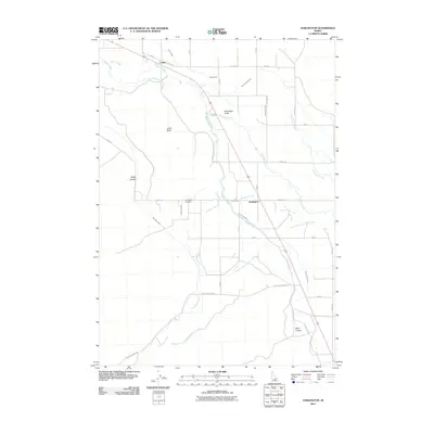
2011 Map of Darlington
USGS Topo · Published 2011About this map
The small settlements of Leslie and Darlington anchor this Custer County valley, where the agricultural landscape is defined by an intricate network of irrigation systems. The Big Lost River meanders through the northern section, feeding into the Darlington Sinks, while the human-engineered Blaine Canal and various waterways like the Three in One Ditch and Angelo Ditch distribute water across the valley floor. This reliance on water management is essential for the farms and ranches situated between the rising terrain of Leslie Butte and the deep recesses of Sheep Canyon and Berry Canyon. Genealogists and local historians will find the Darlington Cemetery clearly marked along Smith Rd, serving as a central landmark for the community. The map illustrates the transition from the riparian corridors of Antelope Creek to the surrounding canyons, reflecting the traditional livestock and farming heritage of this Idaho region.
Find a feature on this map
24 named features on this map. Tap any name to fly to it.
Don’t see what you’re looking for? This feature index may not catch every label — zoom into the map to look around manually.
Map Details
Editions of this 2011 Darlington Map
This is the sole edition of this map. No revisions or reprints were ever made.
Other maps of this area

1935 · MacKay
USGS Topo · 1:96,000

1940 · Mackay
USGS Topo · 1:62,500

1955 · Idaho Falls
USGS Topo · 1:250,000

1958 · Idaho Falls
USGS Topo · 1:250,000

1960 · Grouse
USGS Topo · 1:62,500

1960 · Mackay
USGS Topo · 1:62,500

1969 · Darlington
USGS Topo · 1:24,000

1969 · Ramshorn Canyon
USGS Topo · 1:24,000

1969 · Sunset Peak
USGS Topo · 1:24,000
1969 · Methodist Creek
USGS Topo · 1:24,000