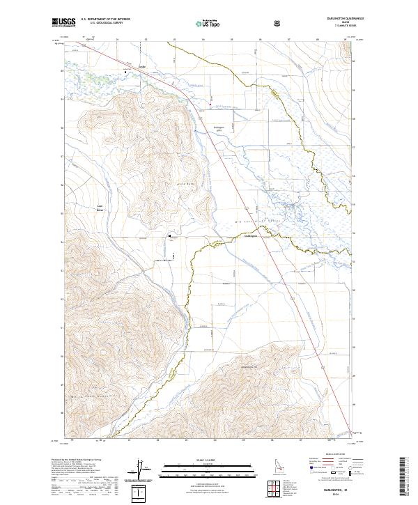
2024 Map of Darlington
USGS Topo · Published 2024About this map
The Big Lost River Valley forms the heart of this Idaho landscape, where the communities of Leslie and Darlington sit at the intersection of a complex agricultural irrigation system. This 2024 survey captures the intricate network of water management features necessary for life in the high desert, including the Blaine Canal, the Three in One Ditch, and the Beck and Evan Ditch. The presence of the Leslie Cem and Darlington Cem provides valuable reference points for genealogists and local historians tracking early settlement patterns near the Lost River.
Find a feature on this map
32 named features on this map. Tap any name to fly to it.
Don’t see what you’re looking for? This feature index may not catch every label — zoom into the map to look around manually.
Map Details
Editions of this 2024 Darlington Map
This is the sole edition of this map. No revisions or reprints were ever made.
Other maps of this area

1935 · MacKay
USGS Topo · 1:96,000

1940 · Mackay
USGS Topo · 1:62,500

1955 · Idaho Falls
USGS Topo · 1:250,000

1958 · Idaho Falls
USGS Topo · 1:250,000

1960 · Grouse
USGS Topo · 1:62,500

1960 · Mackay
USGS Topo · 1:62,500

1969 · Darlington
USGS Topo · 1:24,000

1969 · Ramshorn Canyon
USGS Topo · 1:24,000

1969 · Sunset Peak
USGS Topo · 1:24,000
1969 · Methodist Creek
USGS Topo · 1:24,000