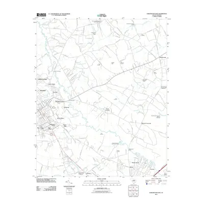
2011 Map of Darlington East
USGS Topo · Published 2011About this map
Black Creek and its many winding tributaries, including Hurricane Branch and Alligator Creek, define the topography of this Darlington County landscape. The drainage basin is dotted with early 21st-century water management features such as the Atkinson Invst Pond Dam and Cribbs Pond Dam. Residential growth is evident in a ring of established neighborhoods and subdivisions surrounding the western urban core, including Liberty Heights, Woodland Gardens, and Washington Terrace.
Find a feature on this map
135 named features on this map. Tap any name to fly to it.
Don’t see what you’re looking for? This feature index may not catch every label — zoom into the map to look around manually.
Map Details
Editions of this 2011 Darlington East Map
This is the sole edition of this map. No revisions or reprints were ever made.
Other maps of this area

1940 · Florence West
USGS Topo · 1:62,500

1940 · Florence East
USGS Topo · 1:62,500

1943 · Gum Swamp
USGS Topo · 1:62,500

1945 · Florence East
USGS Topo · 1:62,500

1945 · Florence West
USGS Topo · 1:62,500

1953 · Florence
USGS Topo · 1:250,000

1954 · Florence
USGS Topo · 1:250,000

1963 · Dovesville
USGS Topo · 1:24,000

1963 · Mont Clare
USGS Topo · 1:24,000

1963 · Darlington East
USGS Topo · 1:24,000