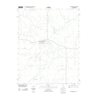
2012 Map of Darrouzett
USGS Topo · Published 2012About this map
Darrouzett serves as the central hub of this northern Panhandle landscape, where the grid of the town site meets the sprawling ranch lands of Lipscomb County. The street plan reflects a history tied to transportation, featuring names like Santa Fe Ave and Oklahoma Ave that hint at the regional connections of this borderland community. To the west, the label Old Darrouzett marks a previous location or historic focal point of the settlement along the open plains. Drainage for the cattle country is provided by a network of intermittent streams, including the winding paths of Kiowa Cr, White Woman Cr, and Coyote Cr. Further south, the Duke Ranch Airport and Ranch Road 2172 highlight the modern infrastructure necessary for managing large-scale agricultural operations in this corner of Texas.
Find a feature on this map
23 named features on this map. Tap any name to fly to it.
Don’t see what you’re looking for? This feature index may not catch every label — zoom into the map to look around manually.
Map Details
Editions of this 2012 Darrouzett Map
This is the sole edition of this map. No revisions or reprints were ever made.
Other maps of this area

1954 · Perryton
USGS Topo · 1:250,000

1958 · Perryton
USGS Topo · 1:250,000

1971 · Clear Lake SW
USGS Topo · 1:24,000

1971 · Clear Lake SE
USGS Topo · 1:24,000

1971 · Logan
USGS Topo · 1:24,000

1972 · Dugout Creek
USGS Topo · 1:24,000

1972 · Skunk Creek
USGS Topo · 1:24,000

1972 · Follett
USGS Topo · 1:24,000

1972 · Darrouzett
USGS Topo · 1:24,000

1972 · Gaylord
USGS Topo · 1:24,000