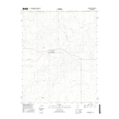
2016 Map of Darrouzett
USGS Topo · Published 2016About this map
Darrouzett serves as the focal point of this Panhandle landscape, where the town's grid is defined by streets such as Kansas Ave and Texas Ave. This 2016 survey illustrates the intersection of rural Texas life and aviation at the Duke Ranch Airport, located south of the main settlement. The topography is dominated by a complex network of drainage systems, including Kiowa Creek and White Woman Creek, which carve through the plains. Local history and genealogy are anchored at the Darrouzett Cemetery just northwest of town. The transition from older transit routes, like the Old Darrouzett Hwy, to modern farm-to-market roads like FM 2172 reflects the enduring reliance on these corridors for agricultural and ranching commerce in Lipscomb County.
Find a feature on this map
24 named features on this map. Tap any name to fly to it.
Don’t see what you’re looking for? This feature index may not catch every label — zoom into the map to look around manually.
Map Details
Editions of this 2016 Darrouzett Map
This is the sole edition of this map. No revisions or reprints were ever made.
Other maps of this area

1954 · Perryton
USGS Topo · 1:250,000

1958 · Perryton
USGS Topo · 1:250,000

1971 · Clear Lake SW
USGS Topo · 1:24,000

1971 · Clear Lake SE
USGS Topo · 1:24,000

1971 · Logan
USGS Topo · 1:24,000

1972 · Dugout Creek
USGS Topo · 1:24,000

1972 · Skunk Creek
USGS Topo · 1:24,000

1972 · Follett
USGS Topo · 1:24,000

1972 · Darrouzett
USGS Topo · 1:24,000

1972 · Gaylord
USGS Topo · 1:24,000