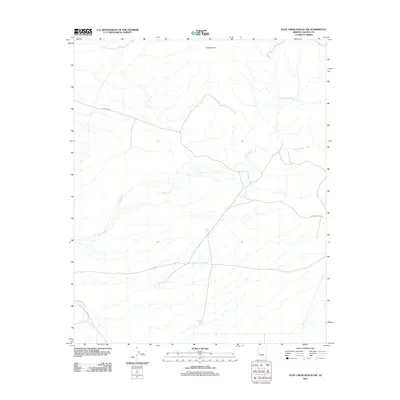
2011 Map of Date Creek Ranch NW
USGS Topo · Published 2011About this map
Date Creek winds through this arid landscape of western Yavapai County, defining the drainage patterns and historical movement across the region. The high desert terrain is punctuated by significant water sources such as Tres Alamos Spring and several constructed water catchments including Myers Tank and North Tank. These features suggest the area's continued reliance on seasonal and subterranean water for ranching operations in a dry environment. The transportation network is anchored by several rural thoroughfares, notably Alamo Rd and Palmerita Rd, which traverse the open country toward the Tres Alamos area. This 2011 survey records the modern state of the land, showing how legacy ranching infrastructure and remote access roads continue to shape the character of the Arizona backcountry.
Find a feature on this map
9 named features on this map. Tap any name to fly to it.
Don’t see what you’re looking for? This feature index may not catch every label — zoom into the map to look around manually.
Map Details
Editions of this 2011 Date Creek Ranch NW Map
This is the sole edition of this map. No revisions or reprints were ever made.
Other maps of this area

1923 · Signal
USGS Topo · 1:250,000

1942 · Signal
USGS Topo · 1:250,000

1950 · Prescott
USGS Topo · 1:250,000

1954 · Prescott
USGS Topo · 1:250,000

1958 · Prescott
USGS Topo · 1:250,000

1959 · Prescott
USGS Topo · 1:250,000

1960 · Prescott
USGS Topo · 1:250,000

1965 · Prescott
USGS Topo · 1:250,000
1967 · Smith Peak
USGS Topo · 1:24,000
1967 · Date Creek Ranch NW
USGS Topo · 1:24,000