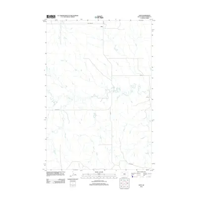
2012 Map of Date
USGS Topo · Published 2012About this map
Date represents a small settlement node in the wide-open landscape of Perkins County, centered at the intersection of Date Rd and Peggy Creek Rd. The community’s presence is anchored by the Date Cem, located to the southeast near the meandering banks of Antelope Cr. The map reveals a land defined by its drainage systems, where small tributaries like Dog Cr and Brushy Cr carve through the high plains. A sparse network of section-line roads, including Antelope Rd and Ridgeview Rd, provides the primary structure for this ranching and agricultural region. This survey captures the remote character of northwestern South Dakota, showing how names like Date persist as geographic markers even as the landscape remains largely dedicated to open range and creek-fed draws.
Find a feature on this map
10 named features on this map. Tap any name to fly to it.
Don’t see what you’re looking for? This feature index may not catch every label — zoom into the map to look around manually.
Map Details
Editions of this 2012 Date Map
This is the sole edition of this map. No revisions or reprints were ever made.
Other maps of this area

1951 · Imogene
USGS Topo · 1:24,000

1951 · Bixby
USGS Topo · 1:24,000

1954 · Lemmon
USGS Topo · 1:250,000

1957 · Lemmon
USGS Topo · 1:250,000

1980 · Zeona
USGS Topo · 1:25,000

1983 · Rabbit Butte
USGS Topo · 1:24,000

1983 · Sorum NE
USGS Topo · 1:24,000

1983 · Date NE
USGS Topo · 1:24,000

1983 · Date
USGS Topo · 1:24,000

1983 · Sorum SE
USGS Topo · 1:24,000