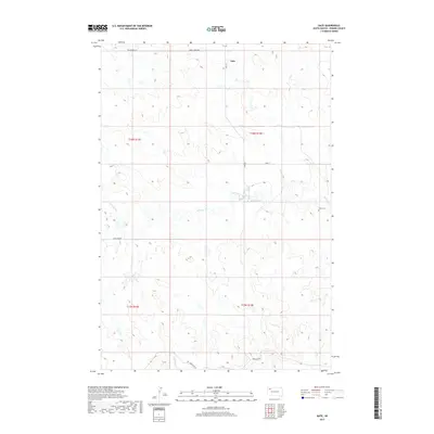
2017 Map of Date
USGS Topo · Published 2017About this map
Date remains a central point of reference in this corner of Perkins County, where the plains are defined by intermittent watercourses and scattered ranch infrastructure. The map documents a landscape oriented around the drainage of Antelope Creek and its tributaries, including Dog Cr and Brushy Cr. These seasonal streams dictate the placement of the sparse road network, with routes like Peggy Creek Rd and Ridgeview Rd skirting the higher ground between basins.
Find a feature on this map
15 named features on this map. Tap any name to fly to it.
Don’t see what you’re looking for? This feature index may not catch every label — zoom into the map to look around manually.
Map Details
Editions of this 2017 Date Map
This is the sole edition of this map. No revisions or reprints were ever made.
Other maps of this area

1951 · Imogene
USGS Topo · 1:24,000

1951 · Bixby
USGS Topo · 1:24,000

1954 · Lemmon
USGS Topo · 1:250,000

1957 · Lemmon
USGS Topo · 1:250,000

1980 · Zeona
USGS Topo · 1:25,000

1983 · Rabbit Butte
USGS Topo · 1:24,000

1983 · Sorum NE
USGS Topo · 1:24,000

1983 · Date NE
USGS Topo · 1:24,000

1983 · Date
USGS Topo · 1:24,000

1983 · Sorum SE
USGS Topo · 1:24,000