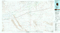
1980 Map of Dateland
USGS Topo · Published 1996About this map
Dateland and the surrounding Sonoran Desert landscape are defined by the critical infrastructure corridors of the Southern Pacific railroad and Interstate 8, which parallel the ancient course of the Gila River. This 1980 edition reveals a region dominated by vast military reserves, including the Barry M. Goldwater Air Force Range and the Yuma Proving Ground, which border the agricultural and transit strip. Small trackside settlements like Aztec, Stoval, and Sentinel mark the historical path of travel through the Mohawk Valley. The map detail reaches from the Mohawk Mountains across the Hyder Plain, capturing a period where remote mining operations like the Sheep Mine and Betty Lee Mine persisted alongside aviation landmarks such as the Dateland Airfield and Colfred Airport.
Find a feature on this map
47 named features on this map. Tap any name to fly to it.
Don’t see what you’re looking for? This feature index may not catch every label — zoom into the map to look around manually.
Map Details
Editions of this 1980 Dateland Map
This is the sole edition of this map. No revisions or reprints were ever made.
Other maps of this area

1926 · Wellton
USGS Topo · 1:62,500

1926 · Mohawk
USGS Topo · 1:62,500

1927 · Aguila Mountains
USGS Topo · 1:48,000

1927 · Kim
USGS Topo · 1:62,500

1927 · Hyder
USGS Topo · 1:62,500

1928 · Mohawk
USGS Topo · 1:62,500

1928 · Norton
USGS Topo · 1:62,500

1929 · Wellton
USGS Topo · 1:62,500

1929 · Aztec
USGS Topo · 1:62,500

1929 · Norton
USGS Topo · 1:62,500