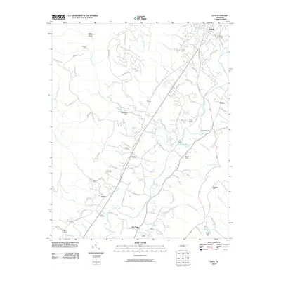
2010 Map of Daus
USGS Topo · Published 2010About this map
The Sequatchie River meanders through the heart of this valley, serving as a central geographic anchor for the rural communities of Liberty and New Hope. This landscape is defined by its numerous small burial grounds and family plots, including the Dunlap Cemetery, Cookston Cemetery, and Rogers Cemetery, which reflect the deep-rooted genealogical history of the region. The terrain transitions from the river valley into several distinctive landforms, such as Woodcock Gulf and Barker Cove, while managed water features like Glen Barker Lake and Ernest Taylor Lake dot the eastern and central reaches. The infrastructure is characterized by local routes such as Slaughter House Rd and Condra Switch Rd, alongside prominent natural springs like Stone Cave Spring and Boynton Spring. This survey highlights a traditional Tennessee settlement pattern where small towns and isolated homesteads are closely tied to the drainage basins of the Johnson Mill Creek and Hicks Creek systems.
Find a feature on this map
103 named features on this map. Tap any name to fly to it.
Don’t see what you’re looking for? This feature index may not catch every label — zoom into the map to look around manually.
Map Details
Editions of this 2010 Daus Map
This is the sole edition of this map. No revisions or reprints were ever made.
Other maps of this area

1888 · Chattanooga
USGS Topo · 1:125,000

1893 · Chattanooga
USGS Topo · 1:125,000

1895 · Sewanee
USGS Topo · 1:125,000

1935 · Mount Airy
USGS Topo · 1:24,000

1936 · Palmer
USGS Topo · 1:24,000

1936 · Daus
USGS Topo · 1:24,000

1936 · Henson Gap
USGS Topo · 1:24,000

1936 · Whitwell
USGS Topo · 1:24,000

1936 · Ketner Gap
USGS Topo · 1:24,000

1936 · Fairmount
USGS Topo · 1:24,000