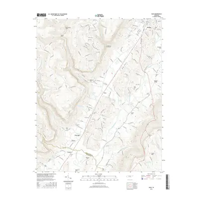
2016 Map of Daus
USGS Topo · Published 2016About this map
The Sequatchie River carves a deep path through the Sequatchie Valley, flanked by the steep rise of the Cumberland Escarpment to the west and Walden Ridge to the east. This landscape is defined by its dramatic relief, where settlements like Dunlap and Daus are situated along the valley floor, while features such as Mosley Gulf and Poplar Spring Hollow cut into the surrounding highlands. The map provides a detailed view of the local transport and burial history, showing the Cordell Lane Br railroad and numerous family and community burial grounds, including Pickett Cem and Thans Chapel Cem. The transition from the more developed valley around Center Point to the rugged terrain of Woodcock Gulf illustrates the geographical constraints that have historically shaped settlement patterns in this part of Tennessee.
Find a feature on this map
175 named features on this map. Tap any name to fly to it.
Don’t see what you’re looking for? This feature index may not catch every label — zoom into the map to look around manually.
Map Details
Editions of this 2016 Daus Map
This is the sole edition of this map. No revisions or reprints were ever made.
Other maps of this area

1888 · Chattanooga
USGS Topo · 1:125,000

1893 · Chattanooga
USGS Topo · 1:125,000

1895 · Sewanee
USGS Topo · 1:125,000

1935 · Mount Airy
USGS Topo · 1:24,000

1936 · Palmer
USGS Topo · 1:24,000

1936 · Daus
USGS Topo · 1:24,000

1936 · Henson Gap
USGS Topo · 1:24,000

1936 · Whitwell
USGS Topo · 1:24,000

1936 · Ketner Gap
USGS Topo · 1:24,000

1936 · Fairmount
USGS Topo · 1:24,000