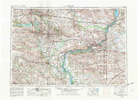
1958 Map of Davenport
USGS Topo · Published 1982About this map
The Mississippi River serves as the central artery of this mid-century landscape, threading together the industrial powerhouses of Davenport, Rock Island, and Moline. At the heart of this river junction lies the Rock Island Arsenal, a key landmark reflecting the region's manufacturing and military significance. The confluence of the Iowa River and Cedar River further west defines the drainage patterns of the fertile plains, where established rail networks like the Chicago and North Western and Rock Island Lines connect smaller agricultural hubs such as Tipton, Durant, and Stanwood.
Find a feature on this map
114 named features on this map. Tap any name to fly to it.
Don’t see what you’re looking for? This feature index may not catch every label — zoom into the map to look around manually.
Map Details
Editions of this 1958 Davenport Map
2 editions found

Other maps of this area

1887 · Cedar Rapids
USGS Topo · 1:62,500

1888 · Shellsburg
USGS Topo · 1:62,500

1888 · Marion
USGS Topo · 1:62,500

1888 · Amana
USGS Topo · 1:62,500

1889 · Tipton
USGS Topo · 1:62,500

1889 · Marion
USGS Topo · 1:62,500

1889 · Amana
USGS Topo · 1:62,500

1889 · Shellsburg
USGS Topo · 1:62,500

1890 · Durant
USGS Topo · 1:62,500

1890 · Tipton
USGS Topo · 1:62,500