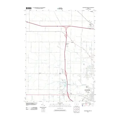
2010 Map of Davenport West
USGS Topo · Published 2010About this map
Davenport is shown here as a burgeoning urban center in Scott County, where the transition from dense city blocks to open rural sections is clearly visible. The landscape is defined by the winding paths of Duck Creek and Black Hawk Creek, which are supplemented by modern water management features like Northeast Lake and I-280 Lake. These waterways have long dictated the placement of local cemeteries and parks, such as the Fairmont Cemetery and the sprawling Emeis Golf Course located in the western portion of the city.
Find a feature on this map
51 named features on this map. Tap any name to fly to it.
Don’t see what you’re looking for? This feature index may not catch every label — zoom into the map to look around manually.
Map Details
Editions of this 2010 Davenport West Map
This is the sole edition of this map. No revisions or reprints were ever made.
Other maps of this area

1890 · Durant
USGS Topo · 1:62,500

1891 · Davenport
USGS Topo · 1:62,500

1894 · Durant
USGS Topo · 1:62,500

1894 · Davenport
USGS Topo · 1:62,500

1901 · Rock Island
USGS Topo · 1:125,000

1910 · Rock Island
USGS Topo · 1:125,000

1912 · Milan
USGS Topo · 1:62,500

1916 · Edgington
USGS Topo · 1:62,500

1938 · Edgington
USGS Topo · 1:62,500

1944 · Milan
USGS Topo · 1:62,500