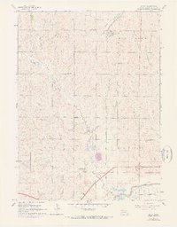
1964 Map of Davey
USGS Topo · Published 1973About this map
Davey stands as the primary settlement in this northern Lancaster County landscape, situated along the Chicago and North Western rail line. The terrain is defined by the winding course of Little Salt Creek and its tributaries, including Garr Creek, which carve through the North Bluff and Oak uplands. This 1964 survey, with updates from 1972, illustrates a rural society organized around a network of local institutions, evidenced by a high density of country schools including School No 132, School No 112, and School No 109.
Find a feature on this map
20 named features on this map. Tap any name to fly to it.
Don’t see what you’re looking for? This feature index may not catch every label — zoom into the map to look around manually.
Map Details
Editions of this 1964 Davey Map
2 editions found
Other maps of this area

1897 · Lincoln
USGS Topo · 1:125,000

1899 · Wahoo
USGS Topo · 1:125,000

1955 · Fremont
USGS Topo · 1:250,000

1955 · Lincoln
USGS Topo · 1:250,000

1957 · Fremont
USGS Topo · 1:250,000

1957 · Lincoln
USGS Topo · 1:250,000

1958 · Fremont
USGS Topo · 1:250,000

1958 · Lincoln
USGS Topo · 1:250,000

1964 · Waverly
USGS Topo · 1:24,000

1964 · Davey
USGS Topo · 1:24,000