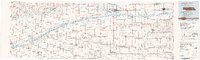
1985 Map of David City
USGS Topo · Published 1991About this map
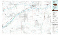
The Platte River and Loup River define the agricultural landscape of east-central Nebraska in the mid-1980s, creating a network of braided channels and named islands. The terrain is marked by significant riverine features like Karkaw Island and Hewitt Island, while the industrial heart of the region is anchored at Columbus. This map captures the intersection of major rail corridors, including the Union Pacific and Burlington Northern, which historically facilitated the growth of rural farming hubs such as David City, Schuyler, and Fullerton. Notable for genealogists are the smaller, often overlooked settlements like Swedehome, Millerton, and Arborville that populate the surrounding plains. The presence of the Whitetail State Wildlife Management Area and the reservoirs at Lake Babcock highlight the managed water resources essential to the Platte valley's development.
Find a feature on this map
72 named features on this map. Tap any name to fly to it.
Don’t see what you’re looking for? This feature index may not catch every label — zoom into the map to look around manually.
Map Details
Editions of this 1985 David City Map
2 editions found
Other maps of this area

1896 · Stromsburg
USGS Topo · 1:125,000

1897 · Lincoln
USGS Topo · 1:125,000

1898 · York
USGS Topo · 1:125,000

1898 · Grand Island
USGS Topo · 1:125,000

1899 · Wahoo
USGS Topo · 1:125,000

1899 · David City
USGS Topo · 1:125,000

1899 · St. Paul
USGS Topo · 1:125,000

1899 · York
USGS Topo · 1:125,000

1934 · Seward
USGS Topo · 1:48,000

1934 · Utica
USGS Topo · 1:62,500