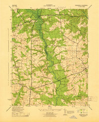
1944 Map of Davidsonville
USGS Topo · Published 1944About this map
The Patuxent River serves as the central dividing line on this 1944 survey, separating Anne Arundel Co and Prince Georges Co. This mid-century landscape is defined by its transition from rural agriculture to a more connected regional network, anchored by significant thoroughfares like the Defense Highway and Crain Highway. The map captures a detailed view of local community life through its well-distributed institutional landmarks, including White Marsh Church, Union Chapel, and the combined Nebo Ch and Sch.
Find a feature on this map
31 named features on this map. Tap any name to fly to it.
Don’t see what you’re looking for? This feature index may not catch every label — zoom into the map to look around manually.
Map Details
Editions of this 1944 Davidsonville Map
This is the sole edition of this map. No revisions or reprints were ever made.
Other maps of this area

1892 · Laurel
USGS Topo · 1:62,500

1892 · Owensville
USGS Topo · 1:62,500

1894 · Laurel
USGS Topo · 1:62,500

1894 · Relay
USGS Topo · 1:62,500

1895 · Owensville
USGS Topo · 1:62,500

1897 · Laurel
USGS Topo · 1:62,500

1899 · Patuxent
USGS Topo · 1:125,000

1900 · Washington
USGS Topo · 1:62,500

1905 · Owensville
USGS Topo · 1:62,500

1906 · Patuxent
USGS Topo · 1:125,000