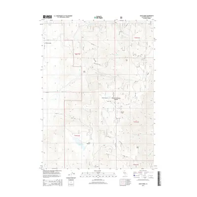
2015 Map of Davis Creek
USGS Topo · Published 2015About this map
Davis Creek serves as the primary settlement anchor within the northern expanse of the Modoc National Forest. The landscape is defined by a complex network of seasonal and permanent watercourses, including the various forks of Davis Creek and the high-altitude Halls Meadows Reservoir. The terrain transitions from the relatively flat Little Valley and Benton Meadow to the prominent heights of Buck Mtn and Little Baldy. Forest service roads like the Benton Meadow Spur and Lassen Creek Spur provide access through the timbered sections, while the crest is marked by Warner Summit. Local history is embedded in the nomenclature of features such as Harris Flat and the curious Betty Jean label, reflecting a history of land use ranging from livestock grazing in high-country meadows like Halls Meadows to early forest management.
Find a feature on this map
46 named features on this map. Tap any name to fly to it.
Don’t see what you’re looking for? This feature index may not catch every label — zoom into the map to look around manually.
Map Details
Editions of this 2015 Davis Creek Map
This is the sole edition of this map. No revisions or reprints were ever made.
Other maps of this area

1886 · Alturas
USGS Topo · 1:250,000

1892 · Alturas
USGS Topo · 1:250,000

1954 · Alturas
USGS Topo · 1:250,000

1958 · Alturas
USGS Topo · 1:250,000

1962 · Alturas
USGS Topo · 1:250,000

1962 · Davis Creek
USGS Topo · 1:62,500

1962 · Willow Ranch
USGS Topo · 1:62,500

1962 · Cedarville
USGS Topo · 1:62,500

1962 · Fort Bidwell
USGS Topo · 1:62,500

1965 · Alturas
USGS Topo · 1:250,000