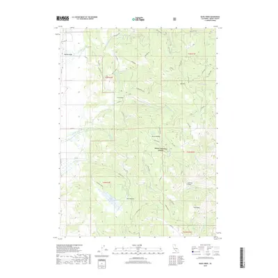
2018 Map of Davis Creek
USGS Topo · Published 2018About this map
Davis Creek and the surrounding high-altitude terrain of the Modoc National Forest define this corner of northeastern California. This survey captures the complex drainage systems that feed into the high desert landscape, featuring prominent water bodies such as Bishop Lake and the Halls Meadows Reservoir. The mapping of small settlements like Little Valley and Halls Meadows illustrates the sparse but persistent human presence in this region, which is primarily organized around timber and grazing lands. Significant mountain features, including Buck Mountain and Little Baldy, anchor the topography, while the intricate network of forest roads such as Plum Valley Rd and Benton Meadow reflect the modern infrastructure used for resource management and access to remote springs like Needle Grass Spring and Benton Meadow Spring.
Find a feature on this map
49 named features on this map. Tap any name to fly to it.
Don’t see what you’re looking for? This feature index may not catch every label — zoom into the map to look around manually.
Map Details
Editions of this 2018 Davis Creek Map
This is the sole edition of this map. No revisions or reprints were ever made.
Other maps of this area

1886 · Alturas
USGS Topo · 1:250,000

1892 · Alturas
USGS Topo · 1:250,000

1954 · Alturas
USGS Topo · 1:250,000

1958 · Alturas
USGS Topo · 1:250,000

1962 · Alturas
USGS Topo · 1:250,000

1962 · Davis Creek
USGS Topo · 1:62,500

1962 · Willow Ranch
USGS Topo · 1:62,500

1962 · Cedarville
USGS Topo · 1:62,500

1962 · Fort Bidwell
USGS Topo · 1:62,500

1965 · Alturas
USGS Topo · 1:250,000